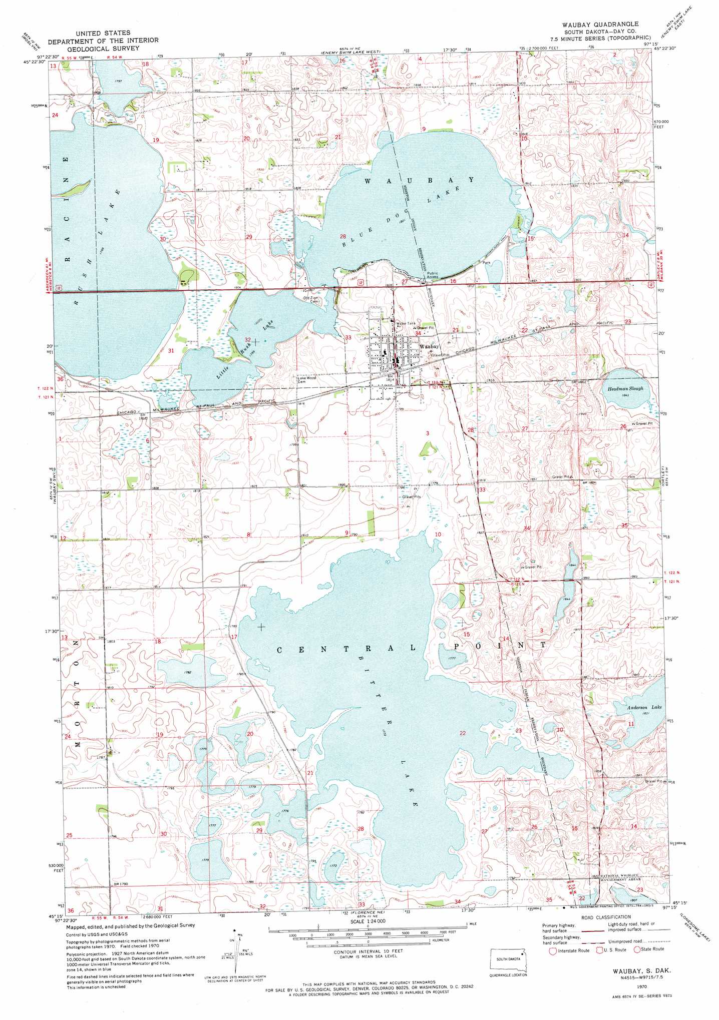
Waubay Topo Map South Dakota
To zoom in, hover over the map of Waubay
USGS Topo Quad 45097c3 - 1:24,000 scale
| Topo Map Name: | Waubay |
| USGS Topo Quad ID: | 45097c3 |
| Print Size: | ca. 21 1/4" wide x 27" high |
| Southeast Coordinates: | 45.25° N latitude / 97.25° W longitude |
| Map Center Coordinates: | 45.3125° N latitude / 97.3125° W longitude |
| U.S. State: | SD |
| Filename: | o45097c3.jpg |
| Download Map JPG Image: | Waubay topo map 1:24,000 scale |
| Map Type: | Topographic |
| Topo Series: | 7.5´ |
| Map Scale: | 1:24,000 |
| Source of Map Images: | United States Geological Survey (USGS) |
| Alternate Map Versions: |
Waubay SD 1970, updated 1973 Download PDF Buy paper map Waubay SD 2012 Download PDF Buy paper map Waubay SD 2015 Download PDF Buy paper map |
1:24,000 Topo Quads surrounding Waubay
Britton 4 Se |
Eden |
Piyas Lake |
Drywood Lakes |
Goodwill |
Webster Ne |
Roslyn |
Enemy Swim Lake West |
Enemy Swim Lake East |
Summit Ne |
Webster |
Waubay Sw |
Waubay |
Ortley |
Summit |
Swan Lake |
Florence Nw |
Florence Ne |
Lonesome Lake |
Still Lake Ne |
Heggs Lake |
Wallace |
Florence |
Still Lake |
Still Lake Se |
> Back to 45097a1 at 1:100,000 scale
> Back to 45096a1 at 1:250,000 scale
> Back to U.S. Topo Maps home
Waubay topo map: Gazetteer
Waubay: Lakes
Anderson Lake elevation 557m 1827′Bitter Lake elevation 540m 1771′
Blue Dog Lake elevation 549m 1801′
Headman Slough elevation 562m 1843′
Little Rush Lake elevation 548m 1797′
Rush Lake elevation 548m 1797′
Waubay: Populated Places
Waubay elevation 554m 1817′Waubay digital topo map on disk
Buy this Waubay topo map showing relief, roads, GPS coordinates and other geographical features, as a high-resolution digital map file on DVD:
Eastern North Dakota & Eastern South Dakota
Buy digital topo maps: Eastern North Dakota & Eastern South Dakota