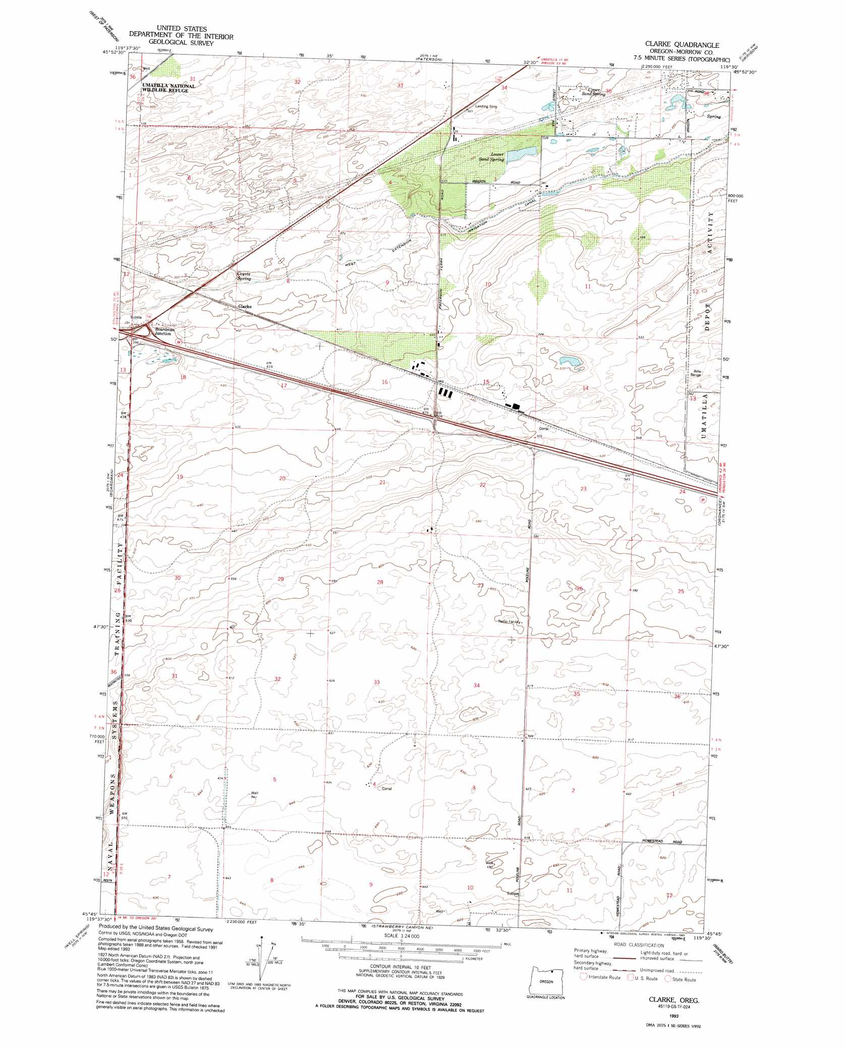
Clarke Topo Map Oregon
To zoom in, hover over the map of Clarke
USGS Topo Quad 45119g5 - 1:24,000 scale
| Topo Map Name: | Clarke |
| USGS Topo Quad ID: | 45119g5 |
| Print Size: | ca. 21 1/4" wide x 27" high |
| Southeast Coordinates: | 45.75° N latitude / 119.5° W longitude |
| Map Center Coordinates: | 45.8125° N latitude / 119.5625° W longitude |
| U.S. State: | OR |
| Filename: | o45119g5.jpg |
| Download Map JPG Image: | Clarke topo map 1:24,000 scale |
| Map Type: | Topographic |
| Topo Series: | 7.5´ |
| Map Scale: | 1:24,000 |
| Source of Map Images: | United States Geological Survey (USGS) |
| Alternate Map Versions: |
Clarke OR 1962, updated 1963 Download PDF Buy paper map Clarke OR 1962, updated 1971 Download PDF Buy paper map Clarke OR 1962, updated 1980 Download PDF Buy paper map Clarke OR 1993, updated 1993 Download PDF Buy paper map Clarke OR 2011 Download PDF Buy paper map Clarke OR 2014 Download PDF Buy paper map |
1:24,000 Topo Quads surrounding Clarke
Prosser Se |
Lenzie Ranch |
Whitstran Se |
Prior Ranch |
Taylor Canyon |
Canoe Ridge |
Blalock Island |
Paterson |
Irrigon |
Umatilla |
Crow Butte |
Boardman |
Clarke |
Ordnance |
Hermiston |
Ella |
Well Spring |
Strawberry Canyon Ne |
Ward Butte |
Service Buttes |
Ione North |
Strawberry Canyon Sw |
Strawberry Canyon Se |
Butter Creek Junction |
Vey Ranch |
> Back to 45119e1 at 1:100,000 scale
> Back to 45118a1 at 1:250,000 scale
> Back to U.S. Topo Maps home
Clarke topo map: Gazetteer
Clarke: Populated Places
Clarke elevation 123m 403′Clarke: Springs
Coyote Spring elevation 113m 370′Lower Sand Spring elevation 98m 321′
Upper Sand Spring elevation 96m 314′
Clarke digital topo map on disk
Buy this Clarke topo map showing relief, roads, GPS coordinates and other geographical features, as a high-resolution digital map file on DVD: