Hermiston Topo Map Oregon
To zoom in, hover over the map of Hermiston
USGS Topo Map 45119e1 - 1:100,000 scale
| Topo Map Name: | Hermiston |
| USGS Topo Quad ID: | 45119e1 |
| Print Size: | ca. 39" wide x 24" high |
| Southeast Coordinates: | 45.5° N latitude / 119° W longitude |
| Map Center Coordinates: | 45.75° N latitude / 119.5° W longitude |
| U.S. States: | OR, WA |
| Filename: | 45119e1.jpg |
| Download Map JPG Image: | Hermiston topo map 1:100,000 scale |
| Map Type: | Topographic |
| Topo Series: | 30´x60´ |
| Map Scale: | 1:100,000 |
| Source of Map Images: | United States Geological Survey (USGS) |
| Alternate Map Versions: |
Hermiston OR 1984, updated 1984 Download PDF Buy paper map Hermiston OR 1984, updated 1984 Download PDF Buy paper map |
1:100,000 Topos surrounding Hermiston
Toppenish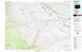 |
Richland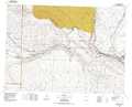 |
Walla Walla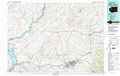 |
Goldendale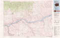 |
Hermiston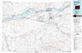 |
Pendleton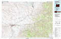 |
Condon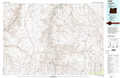 |
Heppner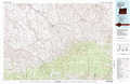 |
La Grande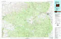 |
> Back to 45118a1 at 1:250,000 scale
> Back to U.S. Topo Maps home
1:24,000 Topo Quads covered by the spatial extent of this 100k map (Hermiston)
|
Phinny Hill 
|
Canoe Ridge 
|
Blalock Island 
|
Paterson 
|
Irrigon 
|
Umatilla 
|
Hat Rock 
|
Juniper 
|
|
Alderdale 
|
Crow Butte 
|
Boardman 
|
Clarke 
|
Ordnance 
|
Hermiston 
|
Stanfield 
|
Stanfield Se 
|
|
Dalreed Butte 
|
Ella 
|
Well Spring 
|
Strawberry Canyon Ne 
|
Ward Butte 
|
Service Buttes 
|
Echo 
|
Nolin 
|
|
Cecil 
|
Ione North 
|
Strawberry Canyon Sw 
|
Strawberry Canyon Se 
|
Butter Creek Junction 
|
Vey Ranch 
|
Echo Sw 
|
Echo Se 
|
