Island Falls Topo Map Maine
To zoom in, hover over the map of Island Falls
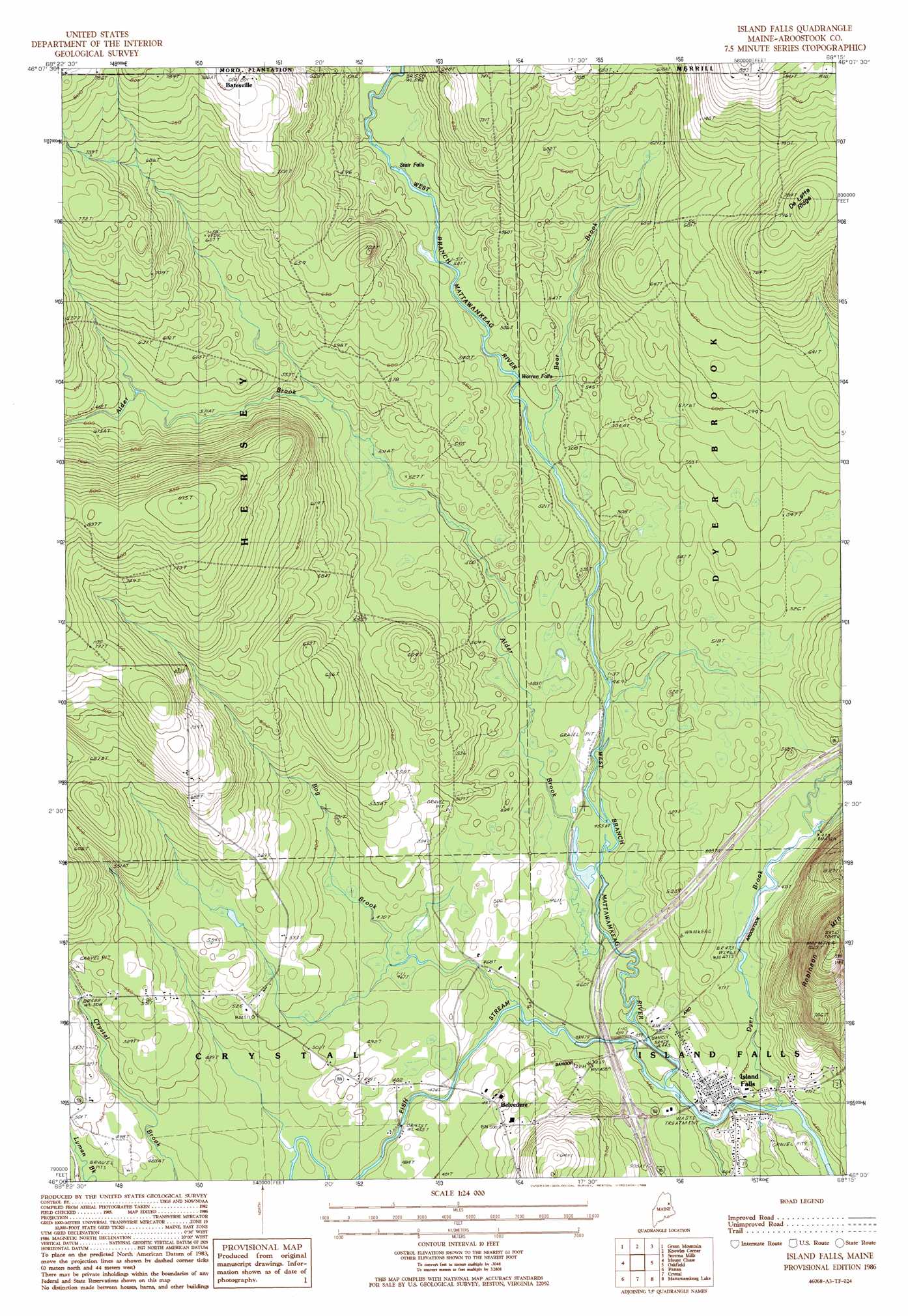
USGS Topo Quad 46068a3 - 1:24,000 scale
| Topo Map Name: | Island Falls |
| USGS Topo Quad ID: | 46068a3 |
| Print Size: | ca. 21 1/4" wide x 27" high |
| Southeast Coordinates: | 46° N latitude / 68.25° W longitude |
| Map Center Coordinates: | 46.0625° N latitude / 68.3125° W longitude |
| U.S. State: | ME |
| Filename: | o46068a3.jpg |
| Download Map JPG Image: | Island Falls topo map 1:24,000 scale |
| Map Type: | Topographic |
| Topo Series: | 7.5´ |
| Map Scale: | 1:24,000 |
| Source of Map Images: | United States Geological Survey (USGS) |
| Alternate Map Versions: |
Island Falls SE ME 1975, updated 1980 Download PDF Buy paper map Island Falls ME 1986, updated 1986 Download PDF Buy paper map Island Falls ME 2011 Download PDF Buy paper map Island Falls ME 2014 Download PDF Buy paper map |
1:24,000 Topo Quads surrounding Island Falls
La Pomkeag Lake |
Umcolcus Lake |
Mcnally Ridge |
Saint Croix Lake |
North Brook Ridge |
Hay Brook Mountain |
Green Mountain |
Knowles Corner |
Smyrna Mills |
Ludlow |
Shin Pond |
Mount Chase |
Island Falls |
Oakfield |
Meduxnekeag Lake |
Lookout Mountain |
Patten |
Crystal |
Mattawamkeag Lake |
Monument Brook |
Stacyville |
Benedicta |
Monarda |
Wytopitlock Lake |
Alder Brook |
> Back to 46068a1 at 1:100,000 scale
> Back to 46068a1 at 1:250,000 scale
> Back to U.S. Topo Maps home
Island Falls topo map: Gazetteer
Island Falls: Crossings
Interchange 59 elevation 149m 488′Island Falls: Falls
Stair Falls elevation 168m 551′Warren Falls elevation 156m 511′
Island Falls: Populated Places
Island Falls elevation 143m 469′Island Falls: Post Offices
Island Falls Post Office elevation 143m 469′Island Falls: Streams
Alder Brook elevation 137m 449′Bear Brook elevation 149m 488′
Bog Brook elevation 140m 459′
Dyer Brook elevation 134m 439′
Fish Stream elevation 136m 446′
Sly Brook elevation 135m 442′
Island Falls: Summits
Robinson Mountain elevation 311m 1020′Island Falls digital topo map on disk
Buy this Island Falls topo map showing relief, roads, GPS coordinates and other geographical features, as a high-resolution digital map file on DVD:
Maine, New Hampshire, Rhode Island & Eastern Massachusetts
Buy digital topo maps: Maine, New Hampshire, Rhode Island & Eastern Massachusetts