Betsy Lake North Topo Map Michigan
To zoom in, hover over the map of Betsy Lake North
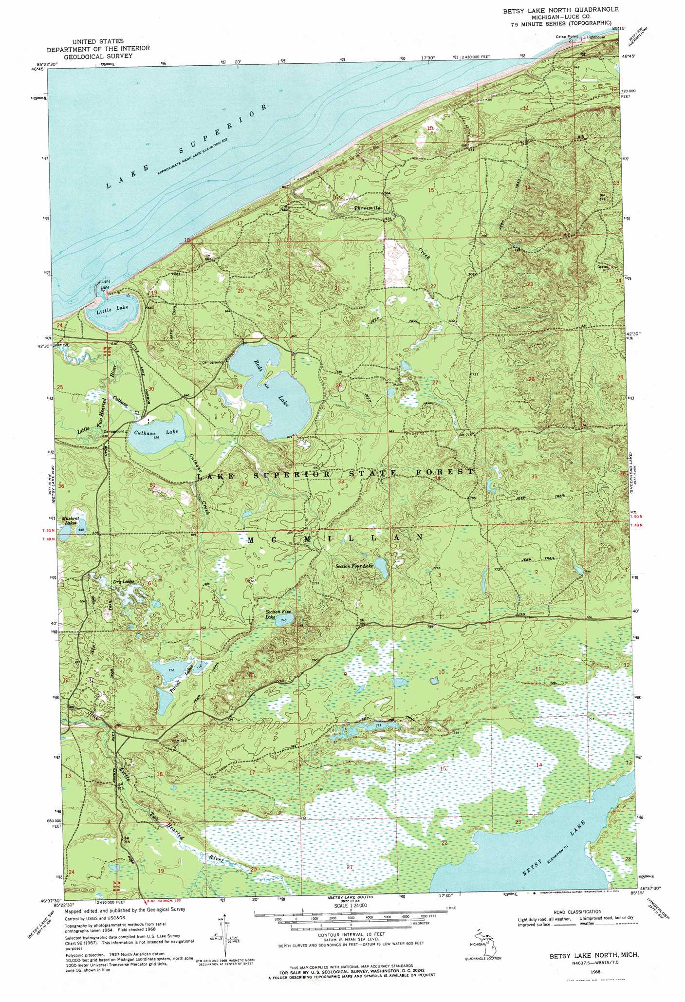
USGS Topo Quad 46085f3 - 1:24,000 scale
| Topo Map Name: | Betsy Lake North |
| USGS Topo Quad ID: | 46085f3 |
| Print Size: | ca. 21 1/4" wide x 27" high |
| Southeast Coordinates: | 46.625° N latitude / 85.25° W longitude |
| Map Center Coordinates: | 46.6875° N latitude / 85.3125° W longitude |
| U.S. State: | MI |
| Filename: | o46085f3.jpg |
| Download Map JPG Image: | Betsy Lake North topo map 1:24,000 scale |
| Map Type: | Topographic |
| Topo Series: | 7.5´ |
| Map Scale: | 1:24,000 |
| Source of Map Images: | United States Geological Survey (USGS) |
| Alternate Map Versions: |
Betsy Lake North MI 2011 Download PDF Buy paper map Betsy Lake North MI 2014 Download PDF Buy paper map Betsy Lake North MI 2017 Download PDF Buy paper map |
1:24,000 Topo Quads surrounding Betsy Lake North
Vermilion |
Vermilion Se |
|||
Muskallonge Lake East |
Betsy Lake Nw |
Betsy Lake North |
Sheephead Lake |
Shelldrake |
Muskallonge Lake Se |
Betsy Lake Sw |
Betsy Lake South |
Timberlost |
Emerson |
Auger Lake |
Roy Lake |
Gimlet Creek |
Big Beaver Creek |
Piatt Lake |
> Back to 46085e1 at 1:100,000 scale
> Back to 46084a1 at 1:250,000 scale
> Back to U.S. Topo Maps home
Betsy Lake North topo map: Gazetteer
Betsy Lake North: Bays
Little Lake Harbor elevation 184m 603′Betsy Lake North: Lakes
Bodi Lake elevation 195m 639′Culhane Lake elevation 191m 626′
Dry Lakes elevation 210m 688′
Little Lake elevation 184m 603′
Muskrat Lakes elevation 201m 659′
Parcell Lakes elevation 217m 711′
Section Five Lake elevation 216m 708′
Section Four Lake elevation 222m 728′
Betsy Lake North: Streams
Carp River elevation 186m 610′Culhane Creek elevation 192m 629′
Threemile Creek elevation 184m 603′
Betsy Lake North digital topo map on disk
Buy this Betsy Lake North topo map showing relief, roads, GPS coordinates and other geographical features, as a high-resolution digital map file on DVD: