Sand Island Topo Map Wisconsin
To zoom in, hover over the map of Sand Island
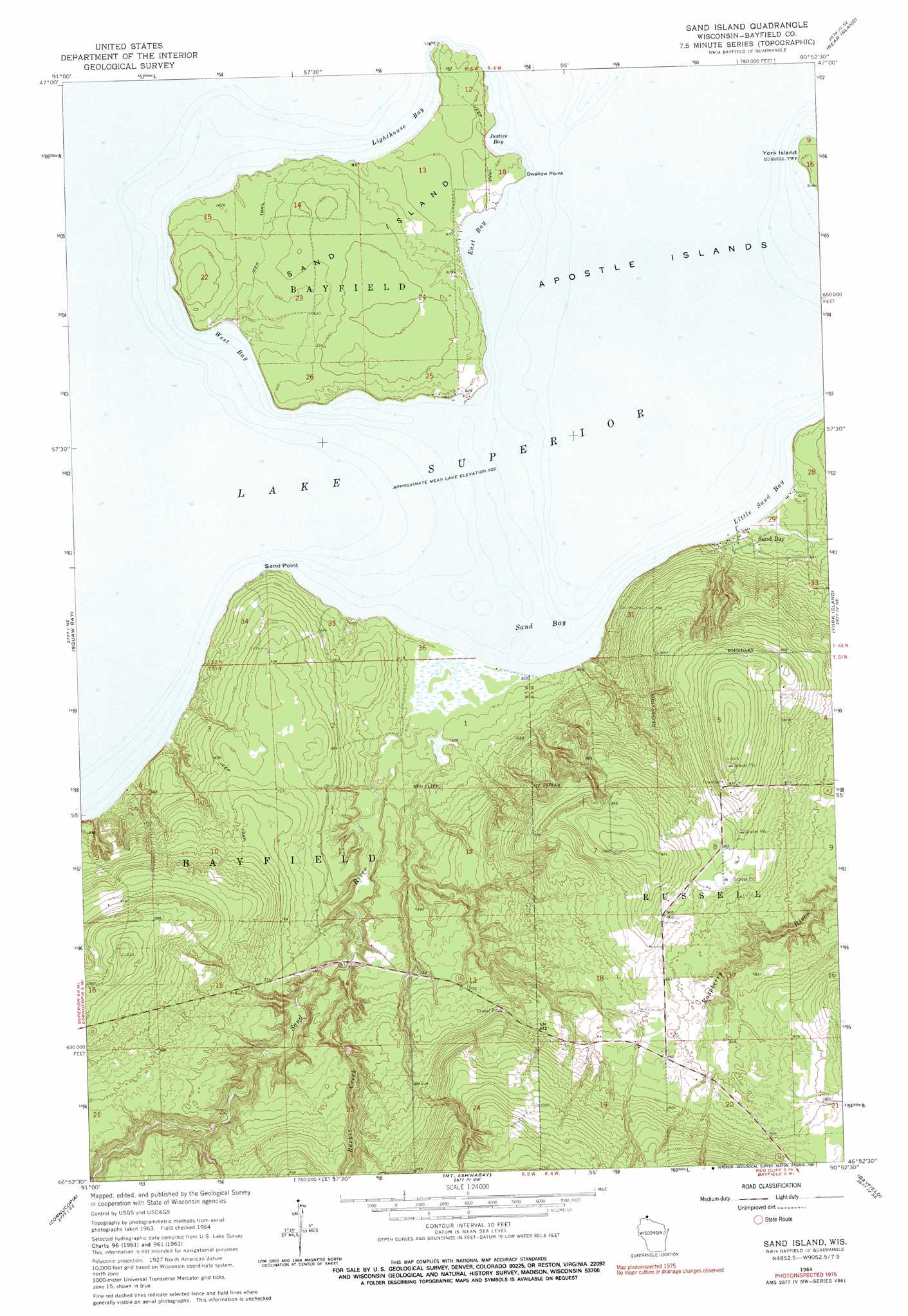
USGS Topo Quad 46090h8 - 1:24,000 scale
| Topo Map Name: | Sand Island |
| USGS Topo Quad ID: | 46090h8 |
| Print Size: | ca. 21 1/4" wide x 27" high |
| Southeast Coordinates: | 46.875° N latitude / 90.875° W longitude |
| Map Center Coordinates: | 46.9375° N latitude / 90.9375° W longitude |
| U.S. State: | WI |
| Filename: | o46090h8.jpg |
| Download Map JPG Image: | Sand Island topo map 1:24,000 scale |
| Map Type: | Topographic |
| Topo Series: | 7.5´ |
| Map Scale: | 1:24,000 |
| Source of Map Images: | United States Geological Survey (USGS) |
| Alternate Map Versions: |
Sand Island WI 1964, updated 1965 Download PDF Buy paper map Sand Island WI 1964, updated 1991 Download PDF Buy paper map Sand Island WI 2010 Download PDF Buy paper map Sand Island WI 2013 Download PDF Buy paper map Sand Island WI 2015 Download PDF Buy paper map |
1:24,000 Topo Quads surrounding Sand Island
Bear Island |
Rocky Island |
|||
Squaw Bay |
Sand Island |
York Island |
Oak Island |
|
Bark Bay |
Cornucopia |
Mount Ashwabay |
Bayfield |
Madeline Island |
Moquah Nw |
Mount Valhalla |
Washburn |
Long Island |
Chequamegon Point |
> Back to 46090e1 at 1:100,000 scale
> Back to 46090a1 at 1:250,000 scale
> Back to U.S. Topo Maps home
Sand Island topo map: Gazetteer
Sand Island: Bays
East Bay elevation 184m 603′Justice Bay elevation 184m 603′
Lighthouse Bay elevation 184m 603′
Little Sand Bay elevation 184m 603′
Sand Bay elevation 184m 603′
West Bay elevation 184m 603′
Sand Island: Capes
Sand Point elevation 195m 639′Swallow Point elevation 191m 626′
Sand Island: Islands
Sand Island elevation 199m 652′Sand Island: Parks
Apostle Islands National Lakeshore elevation 184m 603′Sand Island: Populated Places
Sand Bay elevation 192m 629′Sand Island: Streams
Racket Creek elevation 195m 639′Sand River elevation 184m 603′
Sand Island digital topo map on disk
Buy this Sand Island topo map showing relief, roads, GPS coordinates and other geographical features, as a high-resolution digital map file on DVD: