Big Wall Nw Topo Map Montana
To zoom in, hover over the map of Big Wall Nw
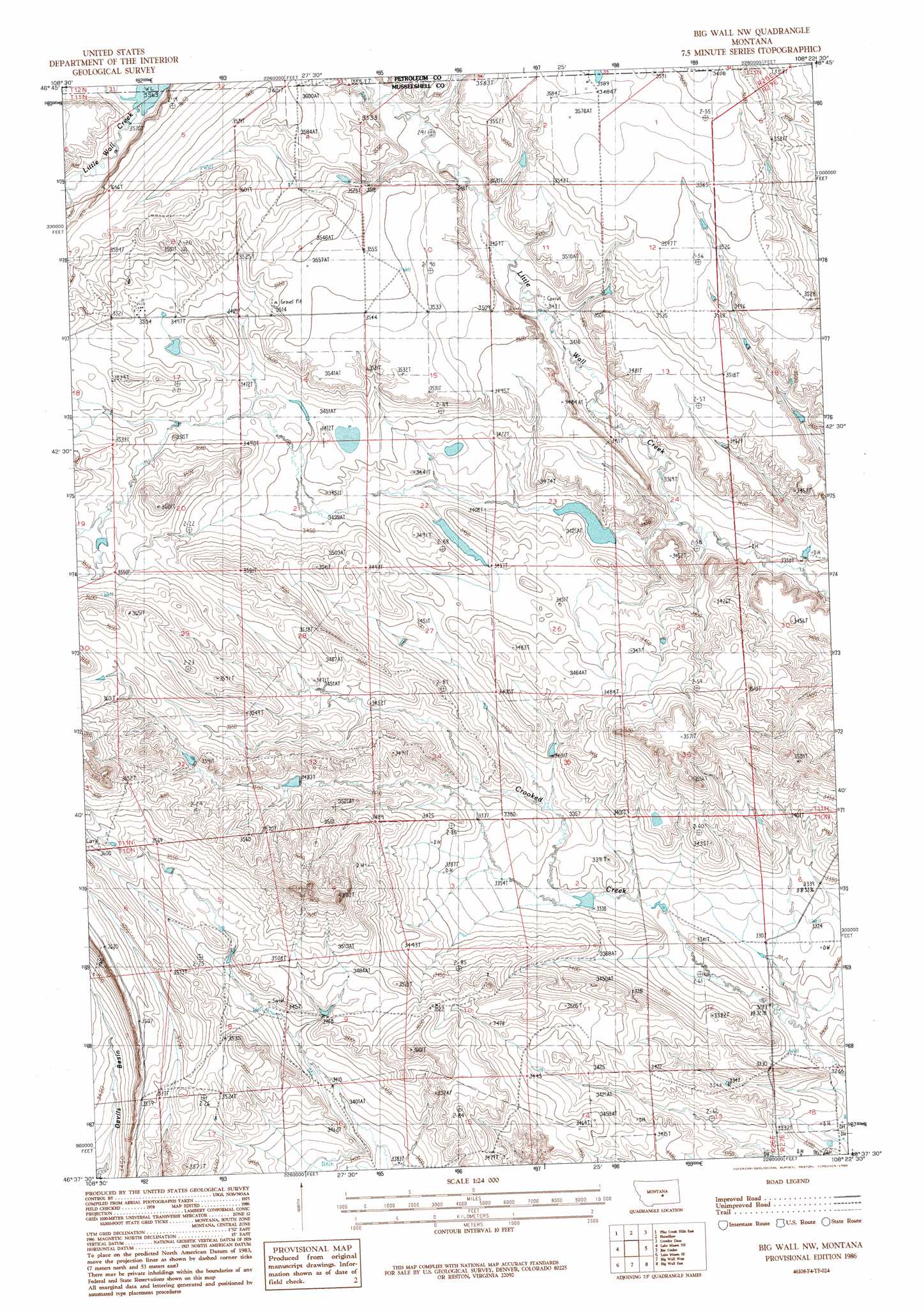
USGS Topo Quad 46108f4 - 1:24,000 scale
| Topo Map Name: | Big Wall Nw |
| USGS Topo Quad ID: | 46108f4 |
| Print Size: | ca. 21 1/4" wide x 27" high |
| Southeast Coordinates: | 46.625° N latitude / 108.375° W longitude |
| Map Center Coordinates: | 46.6875° N latitude / 108.4375° W longitude |
| U.S. State: | MT |
| Filename: | o46108f4.jpg |
| Download Map JPG Image: | Big Wall Nw topo map 1:24,000 scale |
| Map Type: | Topographic |
| Topo Series: | 7.5´ |
| Map Scale: | 1:24,000 |
| Source of Map Images: | United States Geological Survey (USGS) |
| Alternate Map Versions: |
Big Wall NW MT 1986, updated 1986 Download PDF Buy paper map Big Wall NW MT 2011 Download PDF Buy paper map Big Wall NW MT 2014 Download PDF Buy paper map |
1:24,000 Topo Quads surrounding Big Wall Nw
Milk Springs |
Snoose Creek |
Yellow Water Res. |
Winnett South |
Petrolia Lake |
Pike Creek Hills W. |
Pike Creek Hills E. |
Flatwillow |
Crowley Dam |
Kelley |
Lake Mason Nw |
Lake Mason Ne |
Big Wall Nw |
Jim Coulee |
Musselshell Nw |
Lake Mason |
Lake Mason Se |
Big Wall West |
Big Wall East |
Delphia |
Horse Thief Creek |
Roundup |
Gage |
Gage Ne |
Chimney Butte |
> Back to 46108e1 at 1:100,000 scale
> Back to 46108a1 at 1:250,000 scale
> Back to U.S. Topo Maps home
Big Wall Nw topo map: Gazetteer
Big Wall Nw: Dams
Ivy Dam elevation 1034m 3392′Big Wall Nw: Populated Places
Flatwillow Colony elevation 1070m 3510′Big Wall Nw: Wells
10N26E16B___01 Well elevation 1051m 3448′Big Wall Nw digital topo map on disk
Buy this Big Wall Nw topo map showing relief, roads, GPS coordinates and other geographical features, as a high-resolution digital map file on DVD: