Jim Coulee Topo Map Montana
To zoom in, hover over the map of Jim Coulee
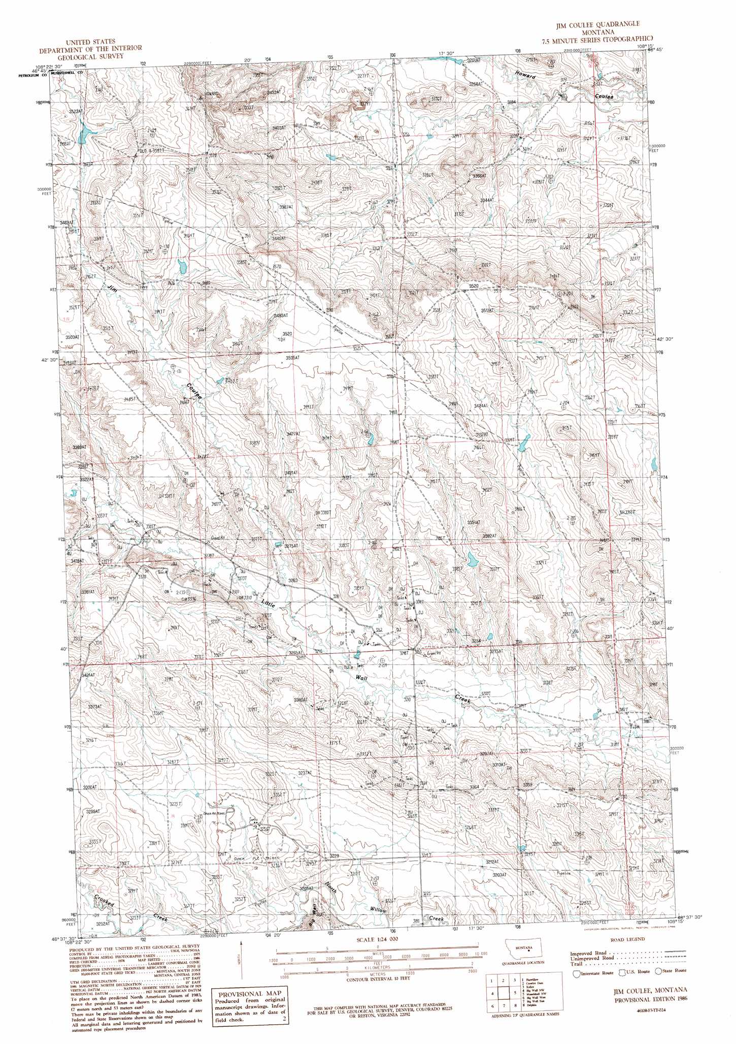
USGS Topo Quad 46108f3 - 1:24,000 scale
| Topo Map Name: | Jim Coulee |
| USGS Topo Quad ID: | 46108f3 |
| Print Size: | ca. 21 1/4" wide x 27" high |
| Southeast Coordinates: | 46.625° N latitude / 108.25° W longitude |
| Map Center Coordinates: | 46.6875° N latitude / 108.3125° W longitude |
| U.S. State: | MT |
| Filename: | o46108f3.jpg |
| Download Map JPG Image: | Jim Coulee topo map 1:24,000 scale |
| Map Type: | Topographic |
| Topo Series: | 7.5´ |
| Map Scale: | 1:24,000 |
| Source of Map Images: | United States Geological Survey (USGS) |
| Alternate Map Versions: |
Jim Coulee MT 1986, updated 1986 Download PDF Buy paper map Jim Coulee MT 2011 Download PDF Buy paper map Jim Coulee MT 2014 Download PDF Buy paper map |
1:24,000 Topo Quads surrounding Jim Coulee
Snoose Creek |
Yellow Water Res. |
Winnett South |
Petrolia Lake |
Breed Spring |
Pike Creek Hills E. |
Flatwillow |
Crowley Dam |
Kelley |
Mud Spring |
Lake Mason Ne |
Big Wall Nw |
Jim Coulee |
Musselshell Nw |
Akers Ranch |
Lake Mason Se |
Big Wall West |
Big Wall East |
Delphia |
Musselshell |
Roundup |
Gage |
Gage Ne |
Chimney Butte |
Corey Flat |
> Back to 46108e1 at 1:100,000 scale
> Back to 46108a1 at 1:250,000 scale
> Back to U.S. Topo Maps home
Jim Coulee topo map: Gazetteer
Jim Coulee: Dams
Little Wall Dam elevation 1064m 3490′Willow Dam elevation 1049m 3441′
Jim Coulee: Post Offices
Verneil Post Office (historical) elevation 986m 3234′Jim Coulee: Valleys
Jim Coulee elevation 991m 3251′Jim Coulee digital topo map on disk
Buy this Jim Coulee topo map showing relief, roads, GPS coordinates and other geographical features, as a high-resolution digital map file on DVD: