Cushman Nw Topo Map Montana
To zoom in, hover over the map of Cushman Nw
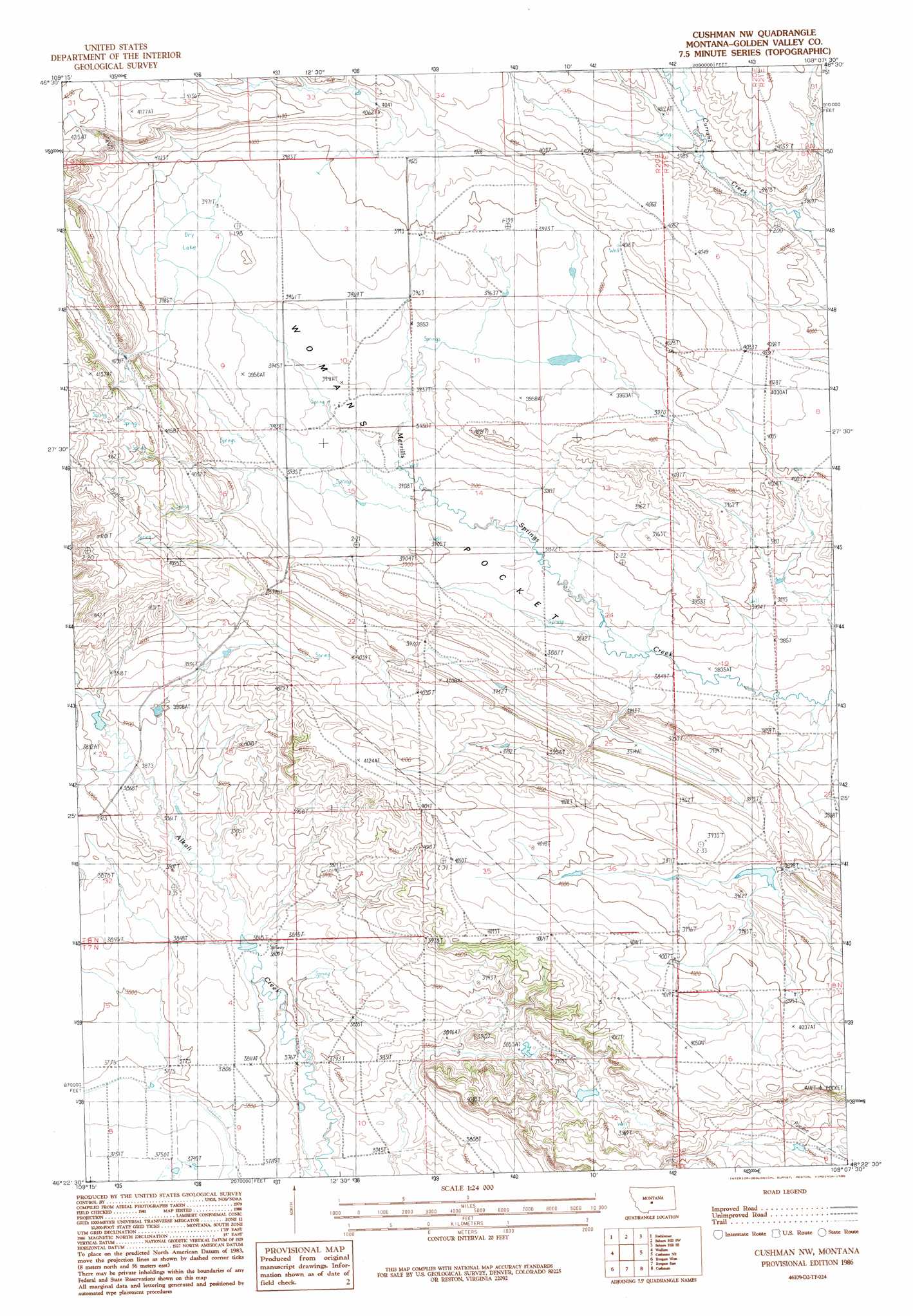
USGS Topo Quad 46109d2 - 1:24,000 scale
| Topo Map Name: | Cushman Nw |
| USGS Topo Quad ID: | 46109d2 |
| Print Size: | ca. 21 1/4" wide x 27" high |
| Southeast Coordinates: | 46.375° N latitude / 109.125° W longitude |
| Map Center Coordinates: | 46.4375° N latitude / 109.1875° W longitude |
| U.S. State: | MT |
| Filename: | o46109d2.jpg |
| Download Map JPG Image: | Cushman Nw topo map 1:24,000 scale |
| Map Type: | Topographic |
| Topo Series: | 7.5´ |
| Map Scale: | 1:24,000 |
| Source of Map Images: | United States Geological Survey (USGS) |
| Alternate Map Versions: |
Cushman NW MT 1986, updated 1986 Download PDF Buy paper map Cushman NW MT 2011 Download PDF Buy paper map Cushman NW MT 2014 Download PDF Buy paper map |
1:24,000 Topo Quads surrounding Cushman Nw
Snow Saucer Coulee |
Green Ashly Gulch |
Patterson Canyon |
Sahara Hill |
Devils Hole Lake |
Halbert Creek North |
Rothiemay |
Sahara Hill Sw |
Sahara Hill Se |
Emory School |
Halbert Creek South |
Vallum |
Cushman Nw |
Cushman Ne |
Lavina Nw |
Deadman Basin Res. |
Ryegate West |
Ryegate East |
Cushman |
Lavina |
O'Brien Hill |
Locomotive Butte |
Mount Sinai |
Eagle Point |
Belmont |
> Back to 46109a1 at 1:100,000 scale
> Back to 46108a1 at 1:250,000 scale
> Back to U.S. Topo Maps home
Cushman Nw topo map: Gazetteer
Cushman Nw: Dams
Babbit Dam elevation 1217m 3992′George Rath Number 3 Dam elevation 1205m 3953′
Hammer Number 1 Dam elevation 1188m 3897′
Cushman Nw: Wells
07N21E05BBC_01 Well elevation 1226m 4022′08N21E30BBD_01 Well elevation 1194m 3917′
Cushman Nw digital topo map on disk
Buy this Cushman Nw topo map showing relief, roads, GPS coordinates and other geographical features, as a high-resolution digital map file on DVD: