Lavina Nw Topo Map Montana
To zoom in, hover over the map of Lavina Nw
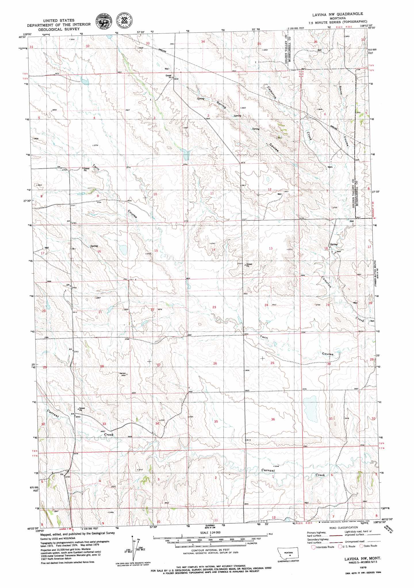
USGS Topo Quad 46108d8 - 1:24,000 scale
| Topo Map Name: | Lavina Nw |
| USGS Topo Quad ID: | 46108d8 |
| Print Size: | ca. 21 1/4" wide x 27" high |
| Southeast Coordinates: | 46.375° N latitude / 108.875° W longitude |
| Map Center Coordinates: | 46.4375° N latitude / 108.9375° W longitude |
| U.S. State: | MT |
| Filename: | o46108d8.jpg |
| Download Map JPG Image: | Lavina Nw topo map 1:24,000 scale |
| Map Type: | Topographic |
| Topo Series: | 7.5´ |
| Map Scale: | 1:24,000 |
| Source of Map Images: | United States Geological Survey (USGS) |
| Alternate Map Versions: |
Lavina NW MT 1979, updated 1979 Download PDF Buy paper map Lavina NW MT 2011 Download PDF Buy paper map Lavina NW MT 2014 Download PDF Buy paper map |
1:24,000 Topo Quads surrounding Lavina Nw
Patterson Canyon |
Sahara Hill |
Devils Hole Lake |
Pender Coulee |
Lake Mason Nw |
Sahara Hill Sw |
Sahara Hill Se |
Emory School |
Timber Buttes North |
Lake Mason |
Cushman Nw |
Cushman Ne |
Lavina Nw |
Timber Buttes South |
Horse Thief Creek |
Ryegate East |
Cushman |
Lavina |
Bundy |
Elso |
Mount Sinai |
Eagle Point |
Belmont |
Broadview Ne |
Hay Basin North |
> Back to 46108a1 at 1:100,000 scale
> Back to 46108a1 at 1:250,000 scale
> Back to U.S. Topo Maps home
Lavina Nw topo map: Gazetteer
Lavina Nw: Valleys
Smith Coulee elevation 1112m 3648′Spring Coulee elevation 1108m 3635′
Lavina Nw: Wells
08N23E30D___01 Well elevation 1101m 3612′08N23E32C___01 Well elevation 1089m 3572′
08N30E22ACCD01 Well elevation 1115m 3658′
Lavina Nw digital topo map on disk
Buy this Lavina Nw topo map showing relief, roads, GPS coordinates and other geographical features, as a high-resolution digital map file on DVD: