Hedgesville Topo Map Montana
To zoom in, hover over the map of Hedgesville
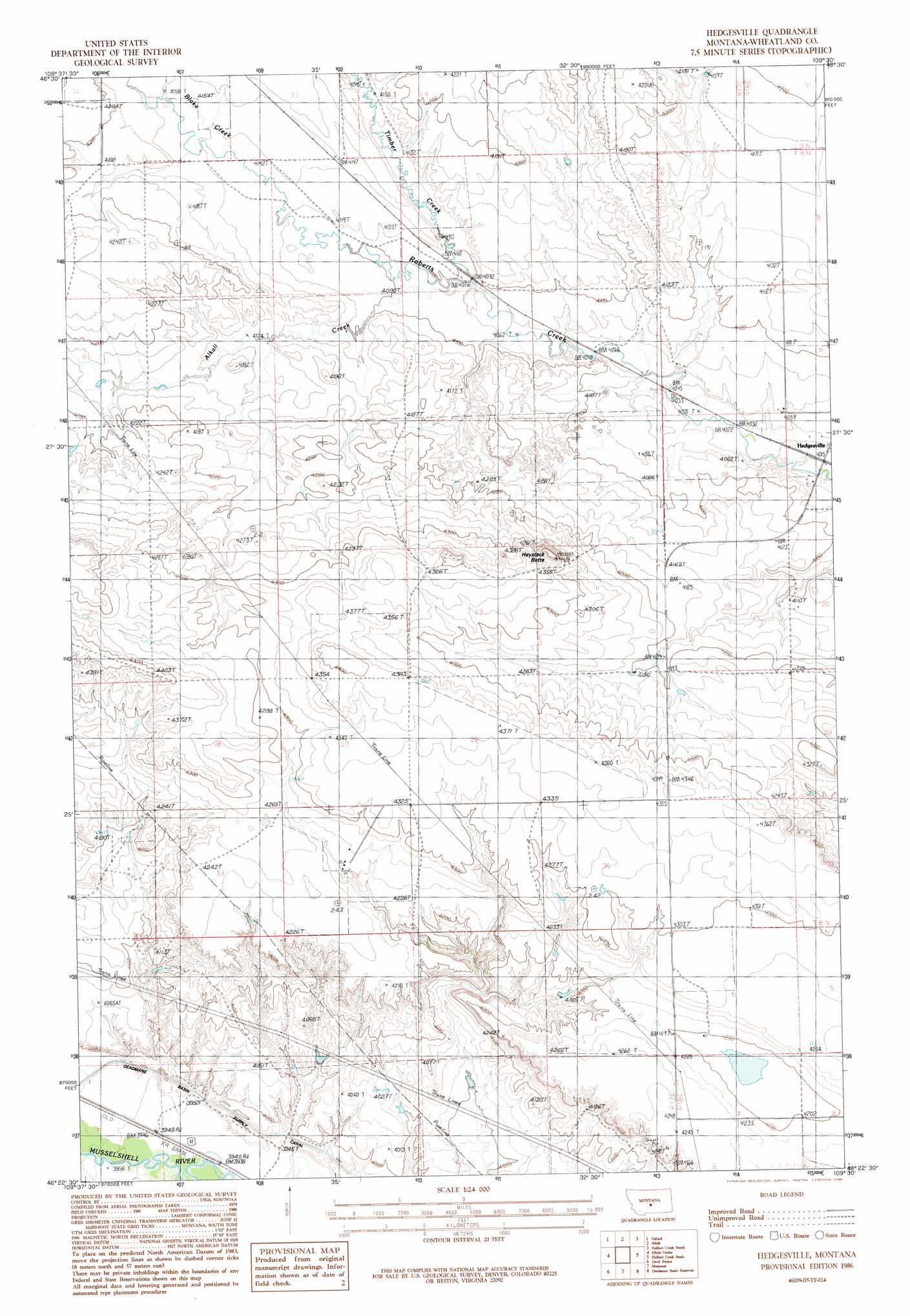
USGS Topo Quad 46109d5 - 1:24,000 scale
| Topo Map Name: | Hedgesville |
| USGS Topo Quad ID: | 46109d5 |
| Print Size: | ca. 21 1/4" wide x 27" high |
| Southeast Coordinates: | 46.375° N latitude / 109.5° W longitude |
| Map Center Coordinates: | 46.4375° N latitude / 109.5625° W longitude |
| U.S. State: | MT |
| Filename: | o46109d5.jpg |
| Download Map JPG Image: | Hedgesville topo map 1:24,000 scale |
| Map Type: | Topographic |
| Topo Series: | 7.5´ |
| Map Scale: | 1:24,000 |
| Source of Map Images: | United States Geological Survey (USGS) |
| Alternate Map Versions: |
Hedgesville MT 1986, updated 1986 Download PDF Buy paper map Hedgesville MT 2011 Download PDF Buy paper map Hedgesville MT 2014 Download PDF Buy paper map |
1:24,000 Topo Quads surrounding Hedgesville
Judith Gap |
Elephant Rocks |
Yaple Bench |
Snow Saucer Coulee |
Green Ashly Gulch |
Oka |
Oxford |
Nihill |
Halbert Creek North |
Rothiemay |
Harlowton |
Ethels Coulee |
Hedgesville |
Halbert Creek South |
Vallum |
Ten O'Clock Gate |
Devils Pocket |
Shawmut |
Deadman Basin Res. |
Ryegate West |
Gougley Creek |
Jim Creek |
Progress |
O'Brien Hill |
Locomotive Butte |
> Back to 46109a1 at 1:100,000 scale
> Back to 46108a1 at 1:250,000 scale
> Back to U.S. Topo Maps home
Hedgesville topo map: Gazetteer
Hedgesville: Dams
Ernie Hudson Dam elevation 1254m 4114′Hedgesville: Populated Places
Hedgesville elevation 1225m 4019′Hedgesville: Post Offices
Hedgesville Post Office (historical) elevation 1225m 4019′Hedgesville: Streams
Alkali Creek elevation 1244m 4081′Blake Creek elevation 1262m 4140′
Elk Creek elevation 1245m 4084′
Hedgesville: Summits
Haystack Butte elevation 1349m 4425′Hedgesville: Wells
08N17E29BBB_01 Well elevation 1339m 4393′Hedgesville digital topo map on disk
Buy this Hedgesville topo map showing relief, roads, GPS coordinates and other geographical features, as a high-resolution digital map file on DVD: