Baggs Creek Topo Map Montana
To zoom in, hover over the map of Baggs Creek
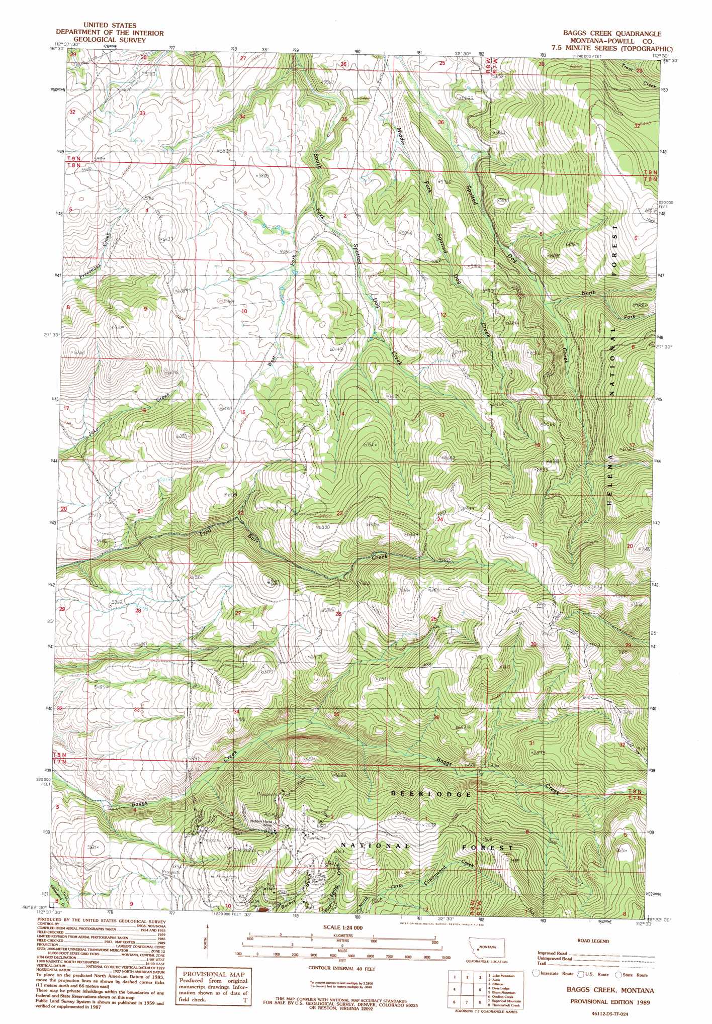
USGS Topo Quad 46112d5 - 1:24,000 scale
| Topo Map Name: | Baggs Creek |
| USGS Topo Quad ID: | 46112d5 |
| Print Size: | ca. 21 1/4" wide x 27" high |
| Southeast Coordinates: | 46.375° N latitude / 112.5° W longitude |
| Map Center Coordinates: | 46.4375° N latitude / 112.5625° W longitude |
| U.S. State: | MT |
| Filename: | o46112d5.jpg |
| Download Map JPG Image: | Baggs Creek topo map 1:24,000 scale |
| Map Type: | Topographic |
| Topo Series: | 7.5´ |
| Map Scale: | 1:24,000 |
| Source of Map Images: | United States Geological Survey (USGS) |
| Alternate Map Versions: |
Baggs Creek MT 1989, updated 1989 Download PDF Buy paper map Baggs Creek MT 1996, updated 1998 Download PDF Buy paper map Baggs Creek MT 2011 Download PDF Buy paper map Baggs Creek MT 2014 Download PDF Buy paper map |
| FStopo: | US Forest Service topo Baggs Creek is available: Download FStopo PDF Download FStopo TIF |
1:24,000 Topo Quads surrounding Baggs Creek
Windy Rock |
Gravely Mountain |
Ophir Creek |
Esmeralda Hill |
Greenhorn Mountain |
Garrison |
Luke Mountain |
Avon |
Elliston |
Macdonald Pass |
Conleys Lake |
Deer Lodge |
Baggs Creek |
Bison Mountain |
Three Brothers |
Racetrack |
Orofino Creek |
Sugarloaf Mountain |
Thunderbolt Creek |
Basin |
Warm Springs |
Orofino Mountain |
Lockhart Meadows |
Sheepshead Mountain |
Bison Canyon |
> Back to 46112a1 at 1:100,000 scale
> Back to 46112a1 at 1:250,000 scale
> Back to U.S. Topo Maps home
Baggs Creek topo map: Gazetteer
Baggs Creek: Mines
Emery Mine elevation 1924m 6312′Hidden Hand Mine elevation 1891m 6204′
Baggs Creek: Populated Places
Emery (historical) elevation 1924m 6312′Baggs Creek: Post Offices
Emery Post Office (historical) elevation 1924m 6312′Baggs Creek: Streams
North Fork Spotted Dog Creek elevation 1738m 5702′West Fork Spotted Dog Creek elevation 1709m 5606′
Baggs Creek digital topo map on disk
Buy this Baggs Creek topo map showing relief, roads, GPS coordinates and other geographical features, as a high-resolution digital map file on DVD: