Lind Sw Topo Map Washington
To zoom in, hover over the map of Lind Sw
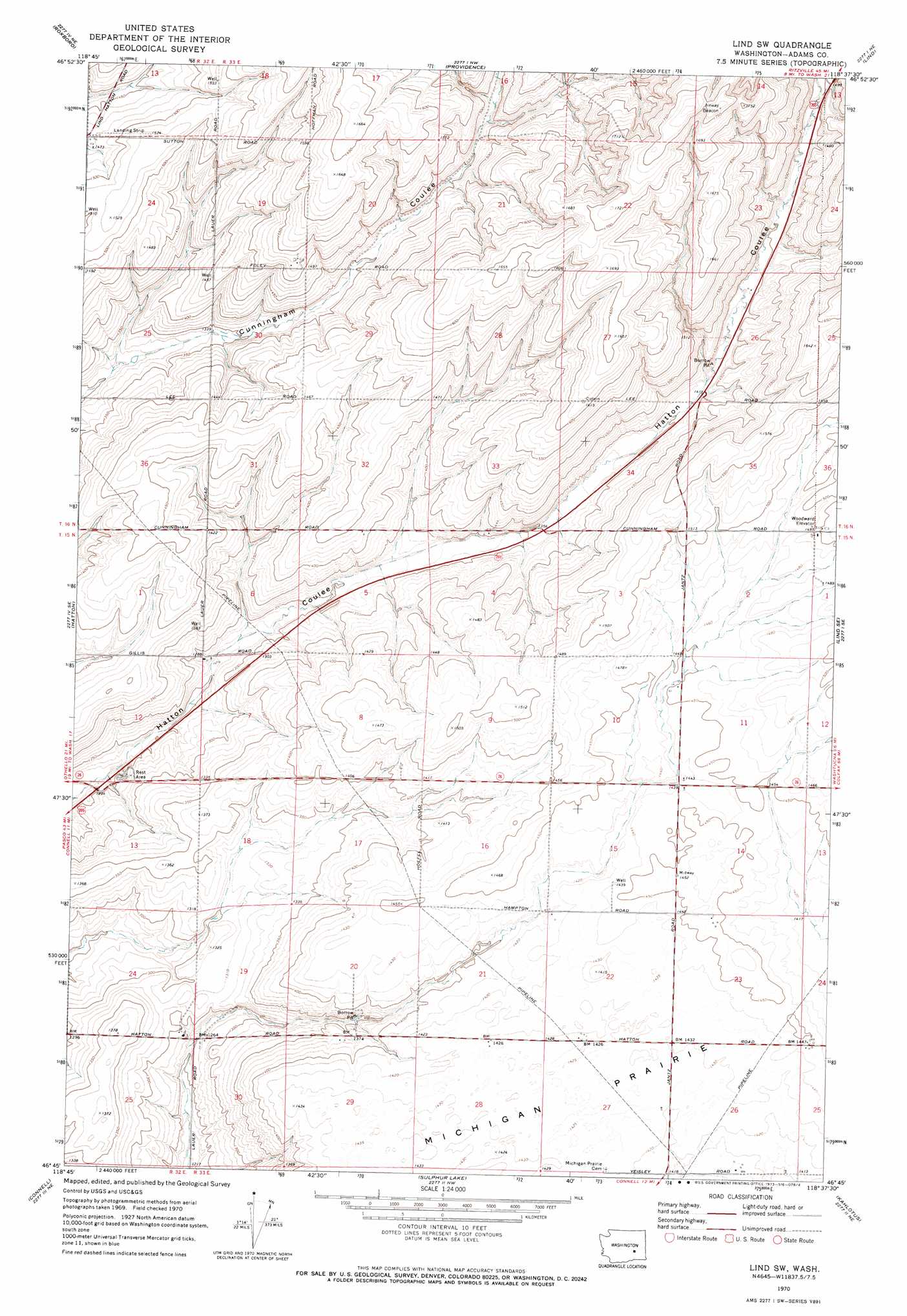
USGS Topo Quad 46118g6 - 1:24,000 scale
| Topo Map Name: | Lind Sw |
| USGS Topo Quad ID: | 46118g6 |
| Print Size: | ca. 21 1/4" wide x 27" high |
| Southeast Coordinates: | 46.75° N latitude / 118.625° W longitude |
| Map Center Coordinates: | 46.8125° N latitude / 118.6875° W longitude |
| U.S. State: | WA |
| Filename: | o46118g6.jpg |
| Download Map JPG Image: | Lind Sw topo map 1:24,000 scale |
| Map Type: | Topographic |
| Topo Series: | 7.5´ |
| Map Scale: | 1:24,000 |
| Source of Map Images: | United States Geological Survey (USGS) |
| Alternate Map Versions: |
Lind SW WA 1970, updated 1973 Download PDF Buy paper map Lind SW WA 2011 Download PDF Buy paper map Lind SW WA 2013 Download PDF Buy paper map |
1:24,000 Topo Quads surrounding Lind Sw
Weber |
Schrag |
Reiman Sw |
Reiman Se |
Ritzville Sw |
Hatton Nw |
Roxboro |
Providence |
Lind |
Pizarro |
Shano |
Hatton |
Lind Sw |
Lind Se |
West Of Washtucna |
Frischknecht |
Connell |
Sulphur Lake |
Kahlotus |
Sperry |
Mesa East |
Connell Se |
Burr Canyon |
Lower Monumental Dam |
Monumental Rock |
> Back to 46118e1 at 1:100,000 scale
> Back to 46118a1 at 1:250,000 scale
> Back to U.S. Topo Maps home
Lind Sw topo map: Gazetteer
Lind Sw: Airports
Phillips Landing Strip elevation 461m 1512′Lind Sw: Flats
Michigan Prairie elevation 438m 1437′Lind Sw digital topo map on disk
Buy this Lind Sw topo map showing relief, roads, GPS coordinates and other geographical features, as a high-resolution digital map file on DVD: