Balfour Nw Topo Map North Dakota
To zoom in, hover over the map of Balfour Nw
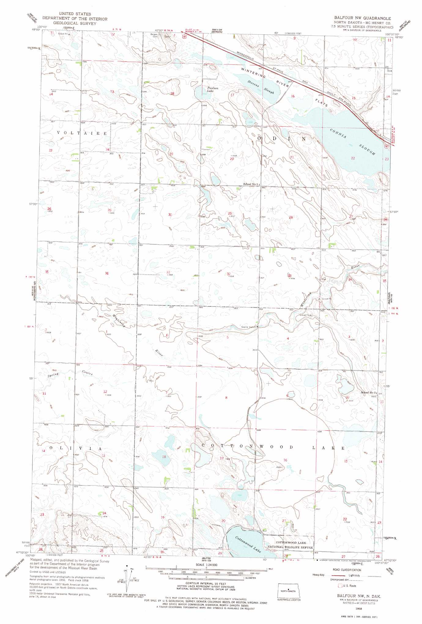
USGS Topo Quad 47100h6 - 1:24,000 scale
| Topo Map Name: | Balfour Nw |
| USGS Topo Quad ID: | 47100h6 |
| Print Size: | ca. 21 1/4" wide x 27" high |
| Southeast Coordinates: | 47.875° N latitude / 100.625° W longitude |
| Map Center Coordinates: | 47.9375° N latitude / 100.6875° W longitude |
| U.S. State: | ND |
| Filename: | O47100H6.jpg |
| Download Map JPG Image: | Balfour Nw topo map 1:24,000 scale |
| Map Type: | Topographic |
| Topo Series: | 7.5´ |
| Map Scale: | 1:24,000 |
| Source of Map Images: | United States Geological Survey (USGS) |
| Alternate Map Versions: |
Balfour NW ND 1958, updated 1959 Download PDF Buy paper map Balfour NW ND 1958, updated 1978 Download PDF Buy paper map Balfour NW ND 2011 Download PDF Buy paper map Balfour NW ND 2014 Download PDF Buy paper map |
1:24,000 Topo Quads surrounding Balfour Nw
Norwich |
Simcoe |
Karlsruhe Nw |
Karlsruhe Ne |
Rangeley Nw |
Velva |
Voltaire |
Bergen |
Karlsruhe |
Rangeley |
Blacktail Coulee |
Kongsberg Ne |
Balfour Nw |
Balfour |
Drake Nw |
Ruso |
Kongsberg |
Butte |
Kief |
Drake Sw |
Horseshoe Valley |
Long Lake |
Alkali Lake |
Siebold Lake |
Lincoln Valley Nw |
> Back to 47100e1 at 1:100,000 scale
> Back to 47100a1 at 1:250,000 scale
> Back to U.S. Topo Maps home
Balfour Nw topo map: Gazetteer
Balfour Nw: Lakes
Connia Slough elevation 477m 1564′Cottonwood Lake elevation 490m 1607′
Paulson Lake elevation 483m 1584′
Stevens Slough elevation 477m 1564′
Balfour Nw: Streams
Spring Coulee elevation 488m 1601′Balfour Nw digital topo map on disk
Buy this Balfour Nw topo map showing relief, roads, GPS coordinates and other geographical features, as a high-resolution digital map file on DVD:
Eastern North Dakota & Eastern South Dakota
Buy digital topo maps: Eastern North Dakota & Eastern South Dakota