Lewis Reservoir Topo Map Montana
To zoom in, hover over the map of Lewis Reservoir
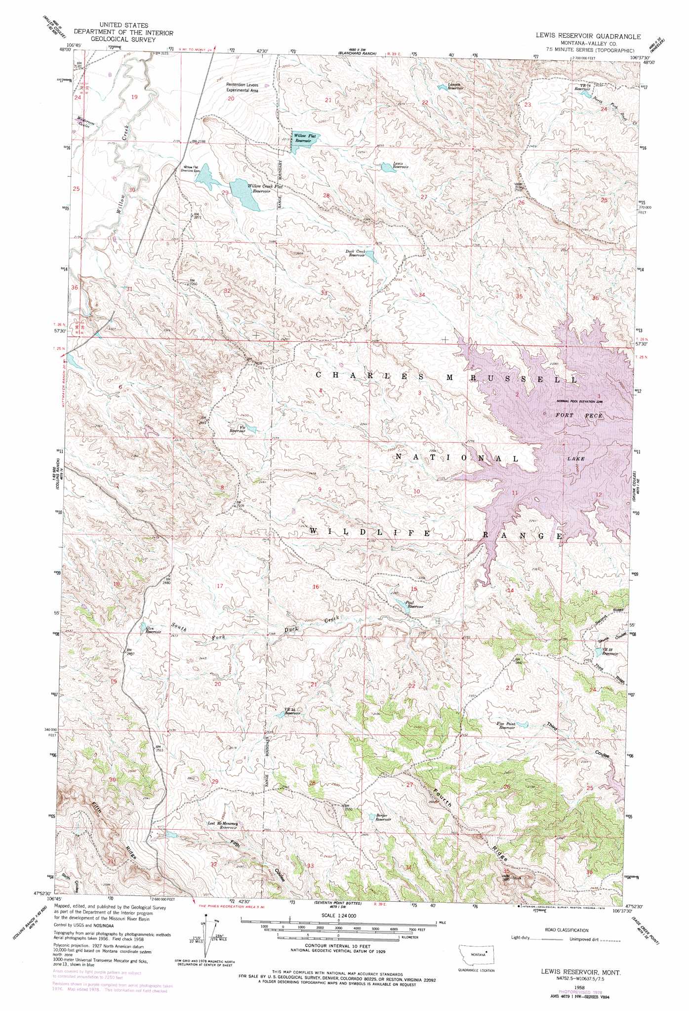
USGS Topo Quad 47106h6 - 1:24,000 scale
| Topo Map Name: | Lewis Reservoir |
| USGS Topo Quad ID: | 47106h6 |
| Print Size: | ca. 21 1/4" wide x 27" high |
| Southeast Coordinates: | 47.875° N latitude / 106.625° W longitude |
| Map Center Coordinates: | 47.9375° N latitude / 106.6875° W longitude |
| U.S. State: | MT |
| Filename: | o47106h6.jpg |
| Download Map JPG Image: | Lewis Reservoir topo map 1:24,000 scale |
| Map Type: | Topographic |
| Topo Series: | 7.5´ |
| Map Scale: | 1:24,000 |
| Source of Map Images: | United States Geological Survey (USGS) |
| Alternate Map Versions: |
Lewis Reservoir MT 1958, updated 1960 Download PDF Buy paper map Lewis Reservoir MT 1958, updated 1975 Download PDF Buy paper map Lewis Reservoir MT 1958, updated 1978 Download PDF Buy paper map Lewis Reservoir MT 2011 Download PDF Buy paper map Lewis Reservoir MT 2014 Download PDF Buy paper map |
1:24,000 Topo Quads surrounding Lewis Reservoir
Billick Coulee |
Engstrom Ranch |
Glasgow |
Whately |
Lindeke Coulee |
Miller Coulee West |
Miller Coulee East |
Blanchard Ranch |
Wheeler |
Fort Peck |
Collins Reservoir |
Bomber Coulee |
Lewis Reservoir |
Skunk Coulee |
York Island |
Brown Pass |
Middle Eighth Coulee |
Seventh Point Buttes |
Sage Creek Point |
Norville Creek |
Peterson Point |
Little Buffalo Hill |
Signal Butte |
Gilbert Creek |
Ash Creek West |
> Back to 47106e1 at 1:100,000 scale
> Back to 47106a1 at 1:250,000 scale
> Back to U.S. Topo Maps home
Lewis Reservoir topo map: Gazetteer
Lewis Reservoir: Dams
Bob Number 1 Dam elevation 694m 2276′Paul Reservoir Dam elevation 712m 2335′
Whatsitsname Dam elevation 711m 2332′
Willow Creek Flat Dam elevation 676m 2217′
Willow Flat Diversion Dam elevation 670m 2198′
Willow Flat Number 2 Dam elevation 669m 2194′
Willow Flat Reservoir Dam elevation 672m 2204′
Lewis Reservoir: Reservoirs
Berger Reservoir elevation 757m 2483′Duck Creek Reservoir elevation 692m 2270′
Five Point Reservoir elevation 706m 2316′
Glen Reservoir elevation 744m 2440′
Langen Reservoir elevation 690m 2263′
Lewis Reservoir elevation 687m 2253′
Lost McMenomey Reservoir elevation 750m 2460′
Paul Reservoir elevation 710m 2329′
Vic Reservoir elevation 725m 2378′
VR 33 Reservoir elevation 750m 2460′
VR 44 Reservoir elevation 737m 2417′
VR 78 Reservoir elevation 728m 2388′
Willow Creek Flat Reservoir elevation 673m 2208′
Willow Flat Reservoir elevation 669m 2194′
Lewis Reservoir: Valleys
Wilderness Coulee elevation 662m 2171′Lewis Reservoir: Wells
25N39E08ACDC01 Well elevation 763m 2503′26N39E29ADAB01 Well elevation 692m 2270′
Lewis Reservoir digital topo map on disk
Buy this Lewis Reservoir topo map showing relief, roads, GPS coordinates and other geographical features, as a high-resolution digital map file on DVD:
Eastern Montana & Western North Dakota
Buy digital topo maps: Eastern Montana & Western North Dakota