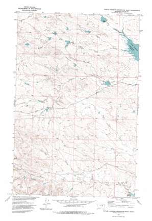
Triple Crossing Res. West Topo Map Montana
To zoom in, hover over the map of Triple Crossing Res. West
USGS Topo Quad 47107h2 - 1:24,000 scale
| Topo Map Name: | Triple Crossing Res. West |
| USGS Topo Quad ID: | 47107h2 |
| Print Size: | ca. 21 1/4" wide x 27" high |
| Southeast Coordinates: | 47.875° N latitude / 107.125° W longitude |
| Map Center Coordinates: | 47.9375° N latitude / 107.1875° W longitude |
| U.S. State: | MT |
| Filename: | o47107h2.jpg |
| Download Map JPG Image: | Triple Crossing Res. West topo map 1:24,000 scale |
| Map Type: | Topographic |
| Topo Series: | 7.5´ |
| Map Scale: | 1:24,000 |
| Source of Map Images: | United States Geological Survey (USGS) |
| Alternate Map Versions: |
Triple Crossing Reservoir West MT 1973, updated 1976 Download PDF Buy paper map Triple Crossing Reservoir West MT 2011 Download PDF Buy paper map Triple Crossing Reservoir West MT 2014 Download PDF Buy paper map |
1:24,000 Topo Quads surrounding Triple Crossing Res. West
> Back to 47107e1 at 1:100,000 scale
> Back to 47106a1 at 1:250,000 scale
> Back to U.S. Topo Maps home
Triple Crossing Res. West topo map: Gazetteer
Triple Crossing Res. West: Dams
Finn Reservoir Dam elevation 786m 2578′Foulweather Dam elevation 778m 2552′
Hard Rock Dam elevation 744m 2440′
Horny Dam elevation 768m 2519′
Long Horn Number 1 Dam elevation 781m 2562′
Nod Dam elevation 775m 2542′
Nod Dam elevation 763m 2503′
One Fork Dam elevation 750m 2460′
Ruins Dam elevation 810m 2657′
Shag Dam elevation 818m 2683′
Sheep Shed Dam elevation 799m 2621′
Sob Dam elevation 778m 2552′
Tin Roof Dam elevation 774m 2539′
Toprail Dam elevation 781m 2562′
Ult Dam elevation 754m 2473′
Winkum Dam elevation 813m 2667′
Triple Crossing Res. West: Reservoirs
Finn Reservoir elevation 804m 2637′Ruins Reservoir elevation 805m 2641′
ULT Reservoir elevation 756m 2480′
Triple Crossing Res. West: Streams
North Fork Willow Creek elevation 846m 2775′South Fork Willow Creek elevation 846m 2775′
Triple Crossing Res. West: Valleys
Long Coulee elevation 737m 2417′Short Coulee elevation 745m 2444′
Tony Coulee elevation 787m 2582′
Triple Crossing Res. West digital topo map on disk
Buy this Triple Crossing Res. West topo map showing relief, roads, GPS coordinates and other geographical features, as a high-resolution digital map file on DVD:
Eastern Montana & Western North Dakota
Buy digital topo maps: Eastern Montana & Western North Dakota


