Eagleton Nw Topo Map Montana
To zoom in, hover over the map of Eagleton Nw
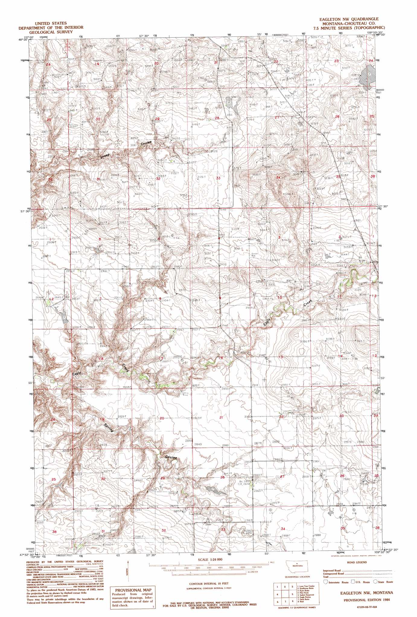
USGS Topo Quad 47109h8 - 1:24,000 scale
| Topo Map Name: | Eagleton Nw |
| USGS Topo Quad ID: | 47109h8 |
| Print Size: | ca. 21 1/4" wide x 27" high |
| Southeast Coordinates: | 47.875° N latitude / 109.875° W longitude |
| Map Center Coordinates: | 47.9375° N latitude / 109.9375° W longitude |
| U.S. State: | MT |
| Filename: | o47109h8.jpg |
| Download Map JPG Image: | Eagleton Nw topo map 1:24,000 scale |
| Map Type: | Topographic |
| Topo Series: | 7.5´ |
| Map Scale: | 1:24,000 |
| Source of Map Images: | United States Geological Survey (USGS) |
| Alternate Map Versions: |
Eagleton NW MT 1984, updated 1984 Download PDF Buy paper map Eagleton NW MT 2011 Download PDF Buy paper map Eagleton NW MT 2014 Download PDF Buy paper map |
1:24,000 Topo Quads surrounding Eagleton Nw
Ihmsen Well |
Big Sandy |
Table Butte |
Centennial Mountain |
Bowery Peak |
Verona |
Lonetree Coulee |
Studhorse Butte |
Ryan Butte |
Tiger Butte |
Big Bend School |
Pilot Rock |
Eagleton Nw |
Seifort Reservoir |
Eskay Nw |
Eagle Buttes Sw |
Eagle Buttes |
Dark Butte |
Iliad |
Pigtail Coulee |
Dammel Reservoir |
Square Butte Ne |
Last Chance Bench |
Starve Out Flat |
P N Ranch |
> Back to 47109e1 at 1:100,000 scale
> Back to 47108a1 at 1:250,000 scale
> Back to U.S. Topo Maps home
Eagleton Nw topo map: Gazetteer
Eagleton Nw: Dams
Baba Blacksheep Dam elevation 953m 3126′Eagleton Nw: Populated Places
Hopp (historical) elevation 911m 2988′Eagleton Nw: Post Offices
Fiedler Post Office (historical) elevation 976m 3202′Hopp Post Office (historical) elevation 911m 2988′
Melz Post Office (historical) elevation 903m 2962′
Eagleton Nw digital topo map on disk
Buy this Eagleton Nw topo map showing relief, roads, GPS coordinates and other geographical features, as a high-resolution digital map file on DVD: