Collins Topo Map Montana
To zoom in, hover over the map of Collins
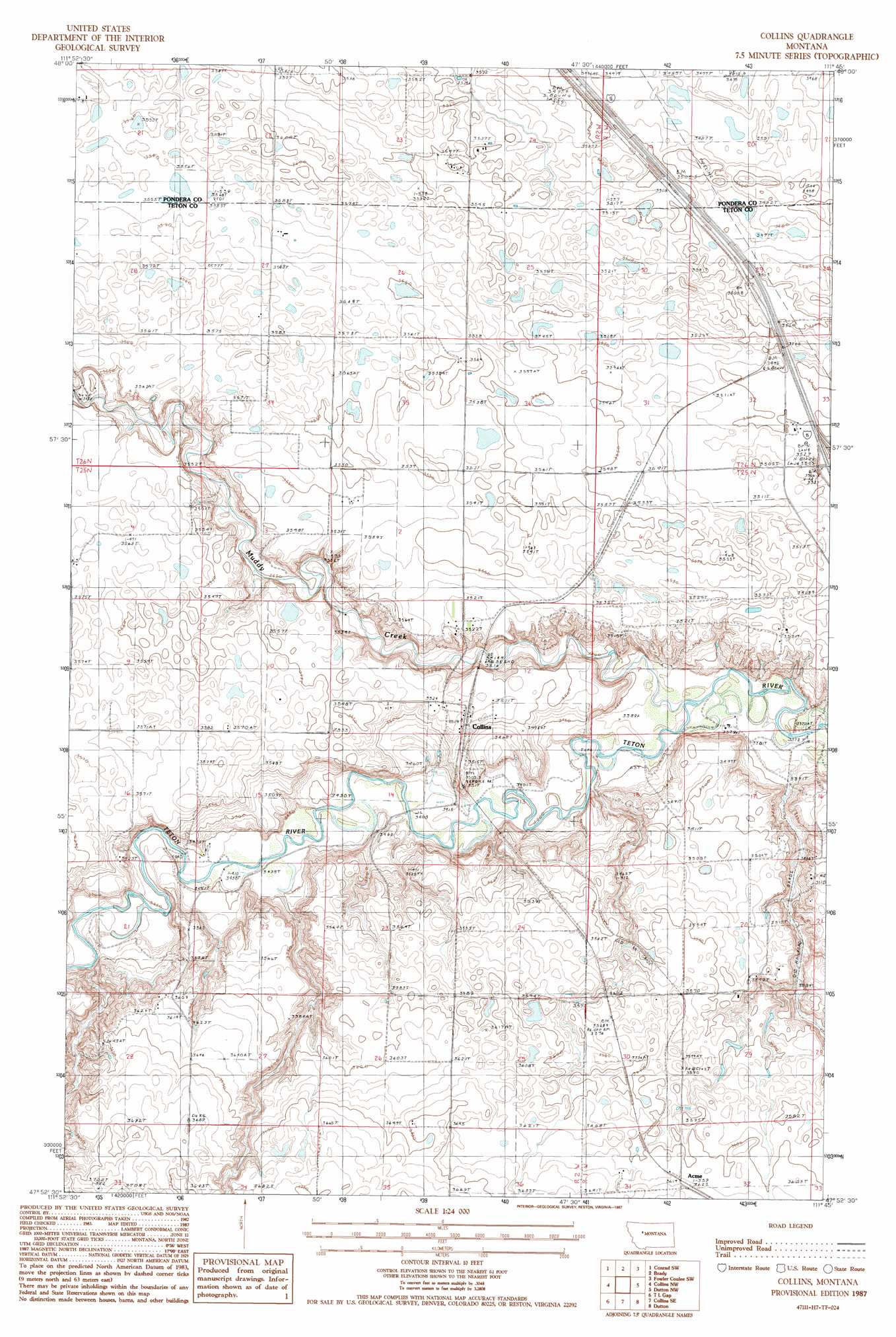
USGS Topo Quad 47111h7 - 1:24,000 scale
| Topo Map Name: | Collins |
| USGS Topo Quad ID: | 47111h7 |
| Print Size: | ca. 21 1/4" wide x 27" high |
| Southeast Coordinates: | 47.875° N latitude / 111.75° W longitude |
| Map Center Coordinates: | 47.9375° N latitude / 111.8125° W longitude |
| U.S. State: | MT |
| Filename: | o47111h7.jpg |
| Download Map JPG Image: | Collins topo map 1:24,000 scale |
| Map Type: | Topographic |
| Topo Series: | 7.5´ |
| Map Scale: | 1:24,000 |
| Source of Map Images: | United States Geological Survey (USGS) |
| Alternate Map Versions: |
Collins MT 1987, updated 1987 Download PDF Buy paper map Collins MT 2011 Download PDF Buy paper map Collins MT 2014 Download PDF Buy paper map |
1:24,000 Topo Quads surrounding Collins
Sam George Hill |
Conrad |
Letz Lake |
Fowler Coulee Nw |
Fowler Coulee Ne |
Gallup City |
Conrad Sw |
Brady |
Fowler Coulee Sw |
Fowler Coulee Se |
Eyraud Lakes |
Collins Nw |
Collins |
Dutton Nw |
Dutton Ne |
Choteau Se |
T L Gap |
Collins Se |
Dutton |
Dutton Se |
Freezeout Lake |
Cleiv |
Greenfield |
Power |
Vaughn Ne |
> Back to 47111e1 at 1:100,000 scale
> Back to 47110a1 at 1:250,000 scale
> Back to U.S. Topo Maps home
Collins topo map: Gazetteer
Collins: Crossings
Interchange 321 elevation 1070m 3510′Collins: Populated Places
Collins elevation 1072m 3517′Collins: Post Offices
Collins Post Office (historical) elevation 1072m 3517′Collins: Streams
Muddy Creek elevation 1031m 3382′Collins: Valleys
Government Coulee elevation 1074m 3523′Railroad Coulee elevation 1036m 3398′
Trail Coulee elevation 1051m 3448′
Collins digital topo map on disk
Buy this Collins topo map showing relief, roads, GPS coordinates and other geographical features, as a high-resolution digital map file on DVD: