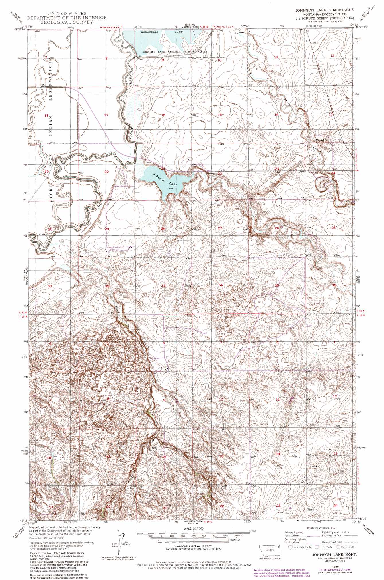
Johnson Lake Topo Map Montana
To zoom in, hover over the map of Johnson Lake
USGS Topo Quad 48104c5 - 1:24,000 scale
| Topo Map Name: | Johnson Lake |
| USGS Topo Quad ID: | 48104c5 |
| Print Size: | ca. 21 1/4" wide x 27" high |
| Southeast Coordinates: | 48.25° N latitude / 104.5° W longitude |
| Map Center Coordinates: | 48.3125° N latitude / 104.5625° W longitude |
| U.S. State: | MT |
| Filename: | o48104c5.jpg |
| Download Map JPG Image: | Johnson Lake topo map 1:24,000 scale |
| Map Type: | Topographic |
| Topo Series: | 7.5´ |
| Map Scale: | 1:24,000 |
| Source of Map Images: | United States Geological Survey (USGS) |
| Alternate Map Versions: |
Johnson Lake MT 1949, updated 1977 Download PDF Buy paper map Johnson Lake MT 1949, updated 1989 Download PDF Buy paper map Johnson Lake MT 1950 Download PDF Buy paper map Johnson Lake MT 2011 Download PDF Buy paper map Johnson Lake MT 2014 Download PDF Buy paper map |
1:24,000 Topo Quads surrounding Johnson Lake
Thornwood Ranch |
Flagstaff Hill |
Alkali Coulee |
Reserve |
Reserve Se |
Smoke Creek Ne |
Homestead Nw |
Homestead |
Medicine Lake |
Capeneys Lake |
Coyote Coulee |
Rocky Point |
Johnson Lake |
Froid |
Froid Se |
Calais |
Fort Kipp |
Culbertson |
Mccabe West |
Mccabe East |
Frog Coulee |
Twomile Creek |
Dugout Creek |
Three Buttes |
Cedar Coulee |
> Back to 48104a1 at 1:100,000 scale
> Back to 48104a1 at 1:250,000 scale
> Back to U.S. Topo Maps home
Johnson Lake topo map: Gazetteer
Johnson Lake: Lakes
Johnson Lake elevation 588m 1929′Johnson Lake: Reservoirs
Homestead Lake elevation 590m 1935′Johnson Lake: Streams
Sand Creek elevation 585m 1919′Sheep Creek elevation 590m 1935′
Johnson Lake: Wells
29N55E18DABC01 Well elevation 660m 2165′30N55E10DDDD01 Well elevation 602m 1975′
30N55E16BBBA01 Well elevation 590m 1935′
30N55E23DBAB01 Well elevation 600m 1968′
30N55E32ACA_01 Well elevation 602m 1975′
30N55E36DADD01 Well elevation 629m 2063′
Johnson Lake digital topo map on disk
Buy this Johnson Lake topo map showing relief, roads, GPS coordinates and other geographical features, as a high-resolution digital map file on DVD:
Eastern Montana & Western North Dakota
Buy digital topo maps: Eastern Montana & Western North Dakota