Rocky Point Topo Map Montana
To zoom in, hover over the map of Rocky Point
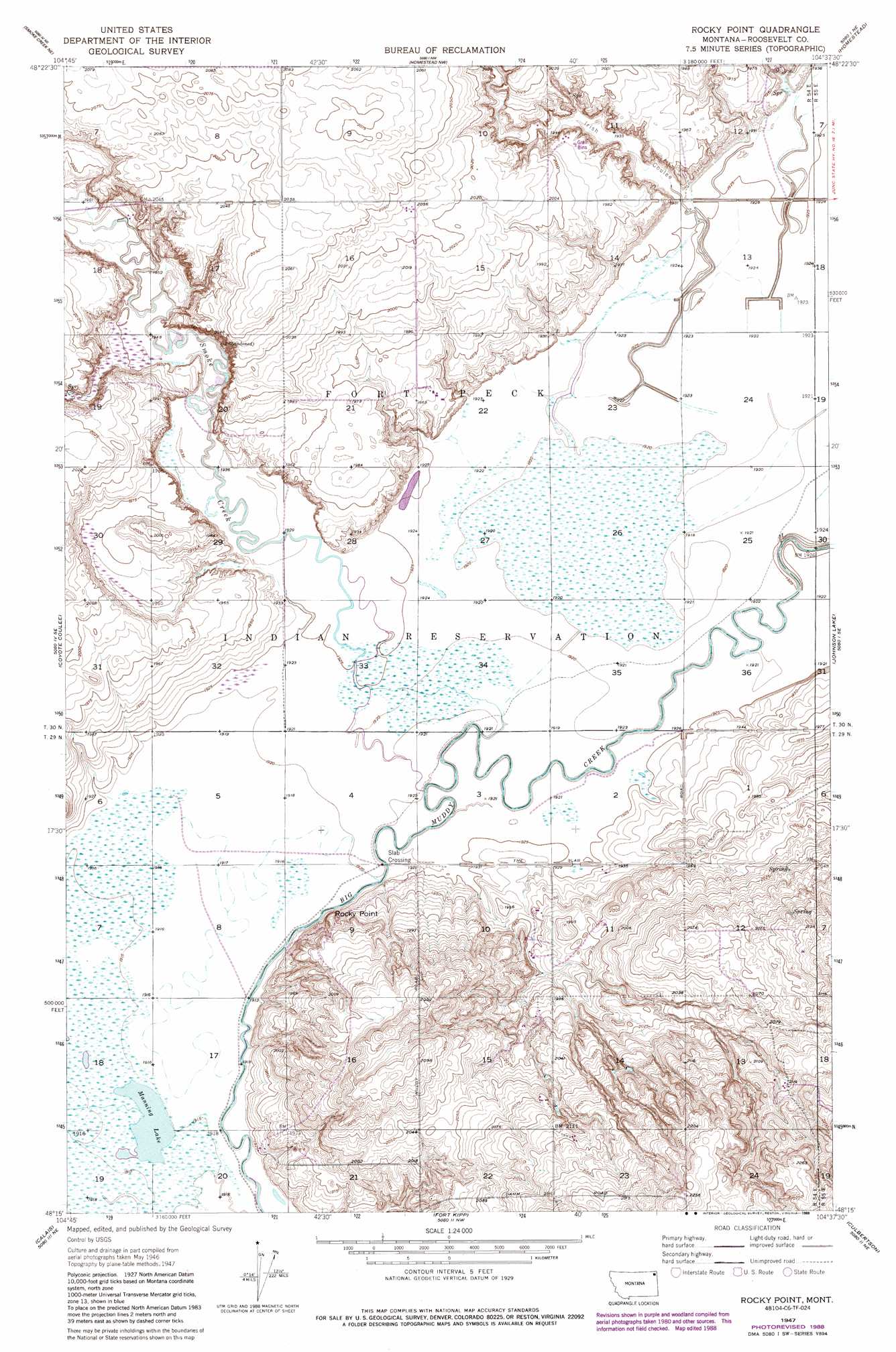
USGS Topo Quad 48104c6 - 1:24,000 scale
| Topo Map Name: | Rocky Point |
| USGS Topo Quad ID: | 48104c6 |
| Print Size: | ca. 21 1/4" wide x 27" high |
| Southeast Coordinates: | 48.25° N latitude / 104.625° W longitude |
| Map Center Coordinates: | 48.3125° N latitude / 104.6875° W longitude |
| U.S. State: | MT |
| Filename: | o48104c6.jpg |
| Download Map JPG Image: | Rocky Point topo map 1:24,000 scale |
| Map Type: | Topographic |
| Topo Series: | 7.5´ |
| Map Scale: | 1:24,000 |
| Source of Map Images: | United States Geological Survey (USGS) |
| Alternate Map Versions: |
Rocky Point MT 1947, updated 1976 Download PDF Buy paper map Rocky Point MT 1947, updated 1989 Download PDF Buy paper map Rocky Point MT 1948 Download PDF Buy paper map Rocky Point MT 2011 Download PDF Buy paper map Rocky Point MT 2014 Download PDF Buy paper map |
1:24,000 Topo Quads surrounding Rocky Point
Soo |
Thornwood Ranch |
Flagstaff Hill |
Alkali Coulee |
Reserve |
Beam School |
Smoke Creek Ne |
Homestead Nw |
Homestead |
Medicine Lake |
Smoke Creek Sw |
Coyote Coulee |
Rocky Point |
Johnson Lake |
Froid |
Brockton |
Calais |
Fort Kipp |
Culbertson |
Mccabe West |
Mortarstone Bluff |
Frog Coulee |
Twomile Creek |
Dugout Creek |
Three Buttes |
> Back to 48104a1 at 1:100,000 scale
> Back to 48104a1 at 1:250,000 scale
> Back to U.S. Topo Maps home
Rocky Point topo map: Gazetteer
Rocky Point: Cliffs
Rocky Point elevation 606m 1988′Rocky Point: Lakes
Manning Lake elevation 584m 1916′Rocky Point: Populated Places
Slab Crossing elevation 584m 1916′Rocky Point: Streams
Lake Creek elevation 584m 1916′Smoke Creek elevation 584m 1916′
Rocky Point: Valleys
Irish Coulee elevation 587m 1925′Rocky Point digital topo map on disk
Buy this Rocky Point topo map showing relief, roads, GPS coordinates and other geographical features, as a high-resolution digital map file on DVD:
Eastern Montana & Western North Dakota
Buy digital topo maps: Eastern Montana & Western North Dakota