Glentana West Topo Map Montana
To zoom in, hover over the map of Glentana West
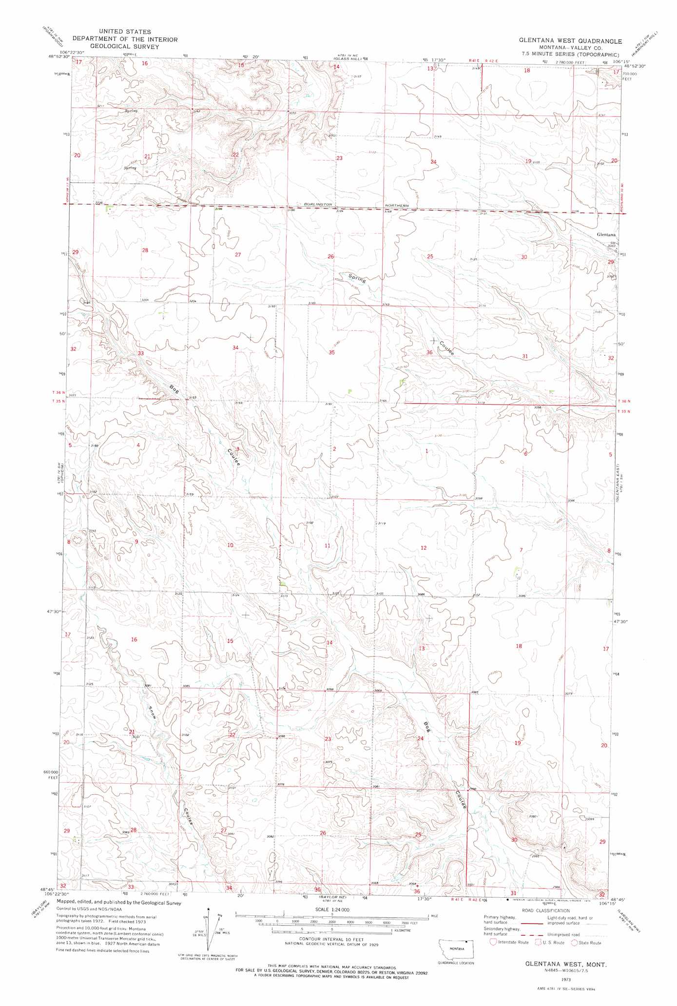
USGS Topo Quad 48106g3 - 1:24,000 scale
| Topo Map Name: | Glentana West |
| USGS Topo Quad ID: | 48106g3 |
| Print Size: | ca. 21 1/4" wide x 27" high |
| Southeast Coordinates: | 48.75° N latitude / 106.25° W longitude |
| Map Center Coordinates: | 48.8125° N latitude / 106.3125° W longitude |
| U.S. State: | MT |
| Filename: | o48106g3.jpg |
| Download Map JPG Image: | Glentana West topo map 1:24,000 scale |
| Map Type: | Topographic |
| Topo Series: | 7.5´ |
| Map Scale: | 1:24,000 |
| Source of Map Images: | United States Geological Survey (USGS) |
| Alternate Map Versions: |
Glentana West MT 1973, updated 1976 Download PDF Buy paper map Glentana West MT 2011 Download PDF Buy paper map Glentana West MT 2014 Download PDF Buy paper map |
1:24,000 Topo Quads surrounding Glentana West
Coal Mine Creek East |
Roanwood |
Glass Hill |
Kaminski Hill |
Brockway Spring |
O'Juel Lake |
Opheim |
Glentana West |
Glentana East |
Richland |
Wards Dam |
Baylor |
Baylor Ne |
Larslan Nw |
Johnnys Hill |
Dry Fork Creek |
Cameron Point |
Baylor Se |
Larslan |
Blink Springs |
> Back to 48106e1 at 1:100,000 scale
> Back to 48106a1 at 1:250,000 scale
> Back to U.S. Topo Maps home
Glentana West topo map: Gazetteer
Glentana West: Airports
Redfield Ag Strip elevation 950m 3116′Glentana West: Wells
36N42E30CA__01 Well elevation 954m 3129′Glentana West digital topo map on disk
Buy this Glentana West topo map showing relief, roads, GPS coordinates and other geographical features, as a high-resolution digital map file on DVD:
Eastern Montana & Western North Dakota
Buy digital topo maps: Eastern Montana & Western North Dakota