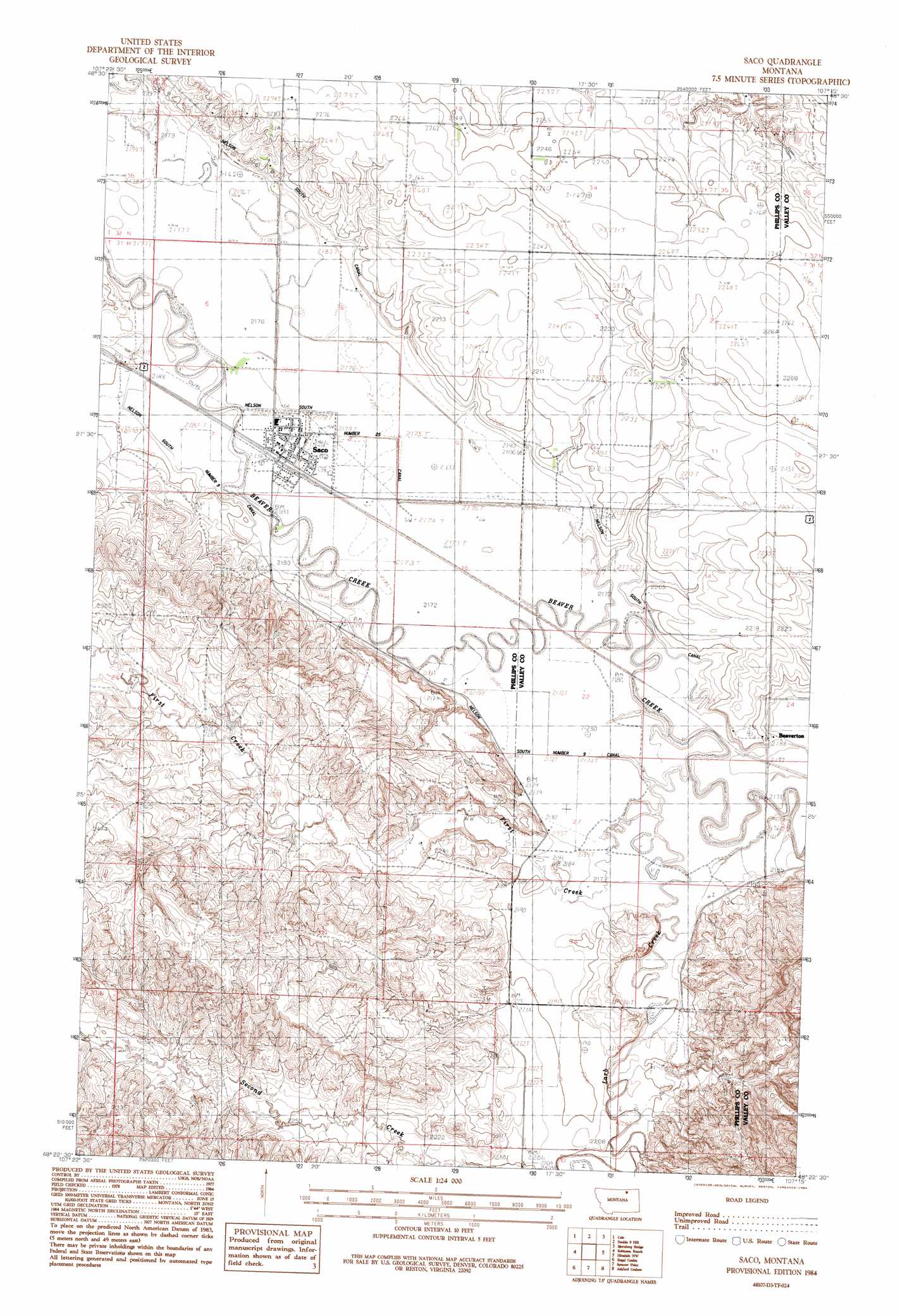
Saco Topo Map Montana
To zoom in, hover over the map of Saco
USGS Topo Quad 48107d3 - 1:24,000 scale
| Topo Map Name: | Saco |
| USGS Topo Quad ID: | 48107d3 |
| Print Size: | ca. 21 1/4" wide x 27" high |
| Southeast Coordinates: | 48.375° N latitude / 107.25° W longitude |
| Map Center Coordinates: | 48.4375° N latitude / 107.3125° W longitude |
| U.S. State: | MT |
| Filename: | o48107d3.jpg |
| Download Map JPG Image: | Saco topo map 1:24,000 scale |
| Map Type: | Topographic |
| Topo Series: | 7.5´ |
| Map Scale: | 1:24,000 |
| Source of Map Images: | United States Geological Survey (USGS) |
| Alternate Map Versions: |
Saco MT 1984, updated 1984 Download PDF Buy paper map Saco MT 2011 Download PDF Buy paper map Saco MT 2014 Download PDF Buy paper map |
1:24,000 Topo Quads surrounding Saco
Tattnall |
Forks |
Porcupine Coulee |
Genevieve |
Papoose Hills |
Hewitt Lake |
Cole |
Double S Hill |
Bjornberg Bridge |
Jones Coulee |
Bowdoin |
Robinson Ranch |
Saco |
Hinsdale Nw |
Hinsdale |
Pinks |
Regal Coulee |
Spencer Point |
Ashford Coulee |
Hinsdale Se |
Johnson Dam |
Harb |
Flat Coulee |
Christmas Reservoir |
Hardpan Coulee |
> Back to 48107a1 at 1:100,000 scale
> Back to 48106a1 at 1:250,000 scale
> Back to U.S. Topo Maps home
Saco topo map: Gazetteer
Saco: Bridges
Beaver Creek Bridge elevation 662m 2171′Saco: Populated Places
Beaverton elevation 662m 2171′Saco elevation 665m 2181′
Saco: Post Offices
Beaverton Post Office (historical) elevation 669m 2194′Saco Post Office elevation 665m 2181′
Saco: Streams
First Creek elevation 662m 2171′Larb Creek elevation 661m 2168′
Second Creek elevation 673m 2208′
Saco: Wells
31N34E08CA__01 Well elevation 665m 2181′32N34E29CCC_01 Well elevation 694m 2276′
32N34E29CCCD01 Well elevation 693m 2273′
32N34E33BAA_01 Well elevation 686m 2250′
Saco digital topo map on disk
Buy this Saco topo map showing relief, roads, GPS coordinates and other geographical features, as a high-resolution digital map file on DVD:
Eastern Montana & Western North Dakota
Buy digital topo maps: Eastern Montana & Western North Dakota