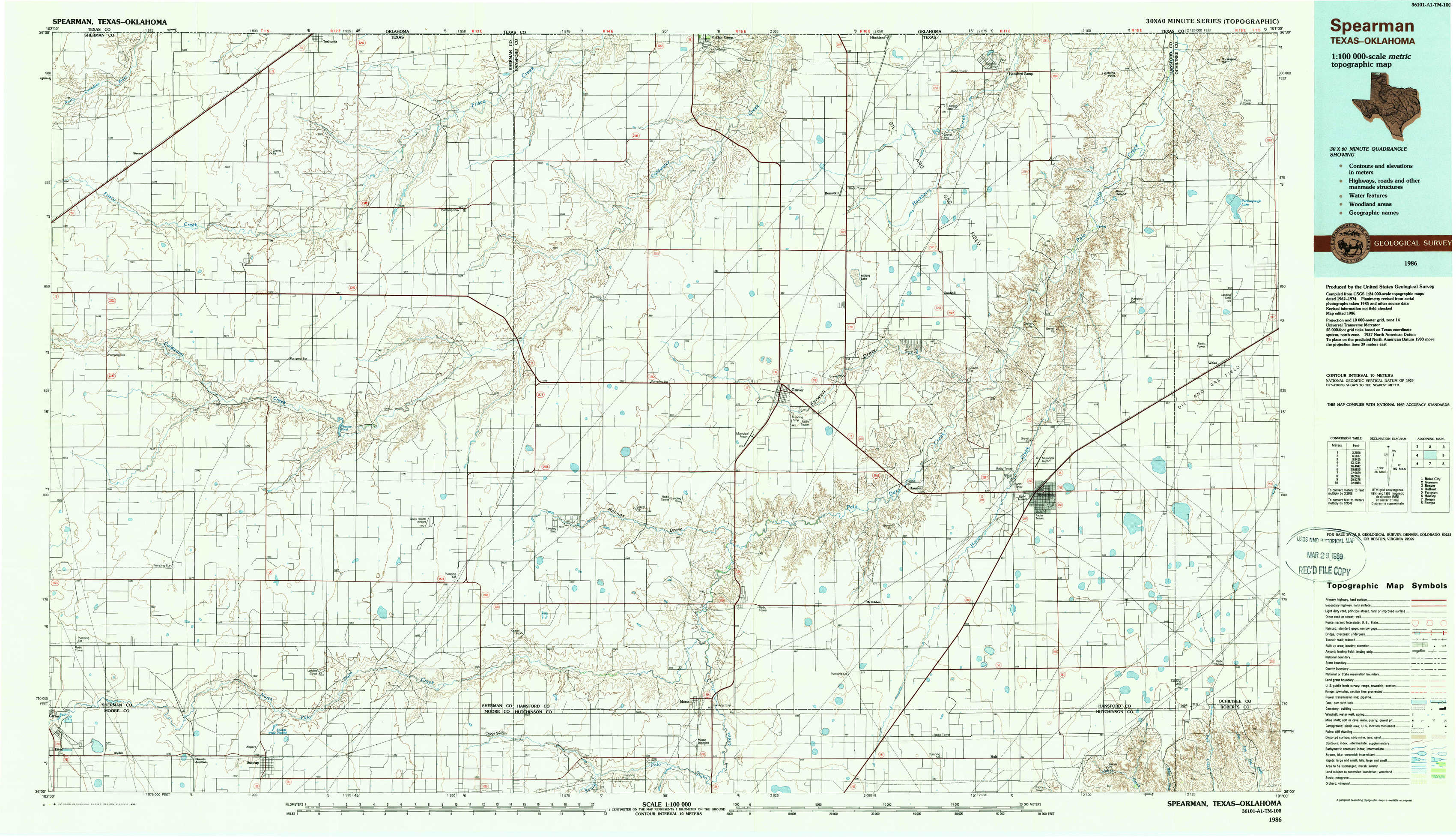
Spearman Topo Map Texas

To zoom in, hover over the map of Spearman

USGS Topo Map 36101a1 - 1:100,000 scale

Topo Map Name: Spearman
USGS Topo Quad ID: 36101a1
Print Size: ca. 39" wide x 24" high
Southeast Coordinates: 36° N latitude / 101° W longitude
Map Center Coordinates: 36.25° N latitude / 101.5° W longitude
U.S. States: TX, OK
Filename: 36101a1.jpg
Download Map JPG Image: Spearman topo map 1:100,000 scale
Map Type: Topographic
Topo Series: 30´x60´
Map Scale: 1:100,000
Source of Map Images: United States Geological Survey (USGS)
Alternate Map Versions: Spearman TX 1986, updated 1988 Download PDF Buy paper map

1:100,000 Topos surrounding Spearman

Boise City
Boise City USGS topographic map 36102e1
Guymon
Guymon USGS topographic map 36101e1
Beaver
Beaver USGS topographic map 36100e1
Dalhart
Dalhart USGS topographic map 36102a1
Spearman
Spearman USGS topographic map 36101a1
Perryton
Perryton USGS topographic map 36100a1
Hartley
Hartley USGS topographic map 35102e1
Borger
Borger USGS topographic map 35101e1
Pampa
Pampa USGS topographic map 35100e1

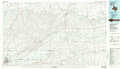
> Back to 36100a1 at 1:250,000 scale
> Back to U.S. Topo Maps home

1:24,000 Topo Quads covered by the spatial extent of this 100k map (Spearman)

Stevens
Stevens USGS topographic map 36101d8
Texhoma South
Texhoma South USGS topographic map 36101d7
Sunray 1 Nw
Sunray 1 Nw USGS topographic map 36101d6
Sunray 1 Ne
Sunray 1 Ne USGS topographic map 36101d5
Phillips Camp
Phillips Camp USGS topographic map 36101d4
Bernstein
Bernstein USGS topographic map 36101d3
Hansford Camp
Hansford Camp USGS topographic map 36101d2
Horseshoe Hill
Horseshoe Hill USGS topographic map 36101d1
Stevens Sw
Stevens Sw USGS topographic map 36101c8
Stevens Se
Stevens Se USGS topographic map 36101c7
Sunray 1 Sw
Sunray 1 Sw USGS topographic map 36101c6
Sunray 1 Se
Sunray 1 Se USGS topographic map 36101c5
Gruver
Gruver USGS topographic map 36101c4
Kimball
Kimball USGS topographic map 36101c3
Waka Sw
Waka Sw USGS topographic map 36101c2
Waka
Waka USGS topographic map 36101c1
Spurlock Chapel
Spurlock Chapel USGS topographic map 36101b8
Pleasure Pond
Pleasure Pond USGS topographic map 36101b7
Capps Switch Nw
Capps Switch Nw USGS topographic map 36101b6
Hannas Draw West
Hannas Draw West USGS topographic map 36101b5
Hannas Draw East
Hannas Draw East USGS topographic map 36101b4
Hansford
Hansford USGS topographic map 36101b3
Spearman
Spearman USGS topographic map 36101b2
Spearman Ne
Spearman Ne USGS topographic map 36101b1
Cactus East
Cactus East USGS topographic map 36101a8
Sunray
Sunray USGS topographic map 36101a7
Capps Switch
Capps Switch USGS topographic map 36101a6
Capps Switch Se
Capps Switch Se USGS topographic map 36101a5
Morse
Morse USGS topographic map 36101a4
Morse Se
Morse Se USGS topographic map 36101a3
Holt
Holt USGS topographic map 36101a2
Spearman Se
Spearman Se USGS topographic map 36101a1
Spearman topographical map