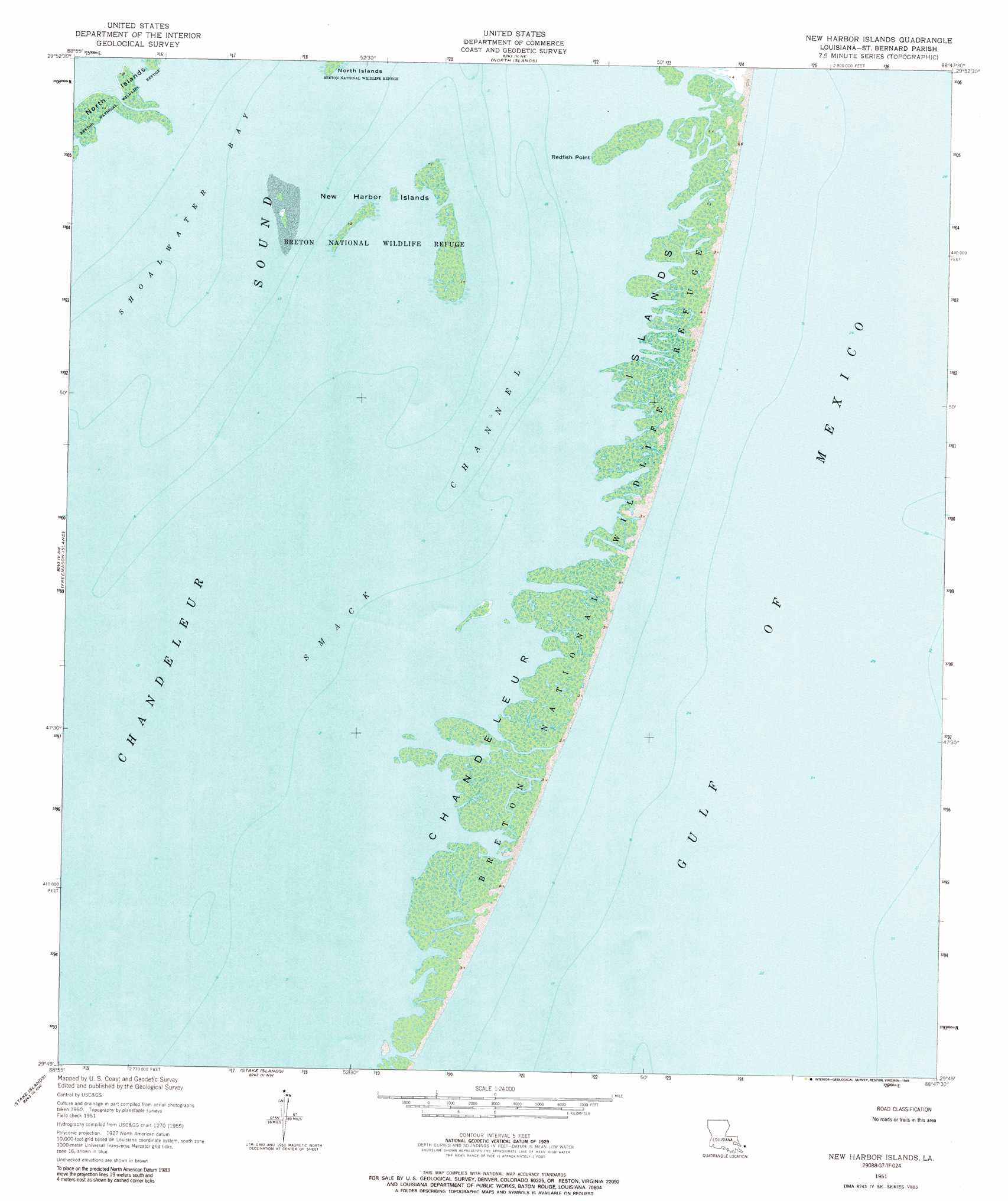
New Harbor Islands Topo Map Louisiana
To zoom in, hover over the map of New Harbor Islands
USGS Topo Quad 29088g7 - 1:24,000 scale
| Topo Map Name: | New Harbor Islands |
| USGS Topo Quad ID: | 29088g7 |
| Print Size: | ca. 21 1/4" wide x 27" high |
| Southeast Coordinates: | 29.75° N latitude / 88.75° W longitude |
| Map Center Coordinates: | 29.8125° N latitude / 88.8125° W longitude |
| U.S. State: | LA |
| Filename: | o29088g7.jpg |
| Download Map JPG Image: | New Harbor Islands topo map 1:24,000 scale |
| Map Type: | Topographic |
| Topo Series: | 7.5´ |
| Map Scale: | 1:24,000 |
| Source of Map Images: | United States Geological Survey (USGS) |
| Alternate Map Versions: |
New Harbor Islands LA 2012 Download PDF Buy paper map New Harbor Islands LA 2015 Download PDF Buy paper map |
1:24,000 Topo Quads surrounding New Harbor Islands
Chandeleur Light |
||||
North Islands |
||||
Freemason Islands |
New Harbor Islands |
|||
> Back to 29088e1 at 1:100,000 scale
> Back to 29088a1 at 1:250,000 scale
> Back to U.S. Topo Maps home
New Harbor Islands topo map: Gazetteer
New Harbor Islands: Capes
Redfish Point elevation 1m 3′New Harbor Islands: Channels
Smack Channel elevation 0m 0′New Harbor Islands: Islands
Chandeleur Islands elevation 1m 3′New Harbor Islands elevation 0m 0′
New Harbor Islands: Parks
Breton National Wildlife Refuge elevation 1m 3′New Harbor Islands digital topo map on disk
Buy this New Harbor Islands topo map showing relief, roads, GPS coordinates and other geographical features, as a high-resolution digital map file on DVD:
Gulf Coast (LA, MS, AL, FL) & Southwestern Georgia
Buy digital topo maps: Gulf Coast (LA, MS, AL, FL) & Southwestern Georgia
 & Southwestern Georgia map DVD")