Lakeland Topo Map Georgia
To zoom in, hover over the map of Lakeland
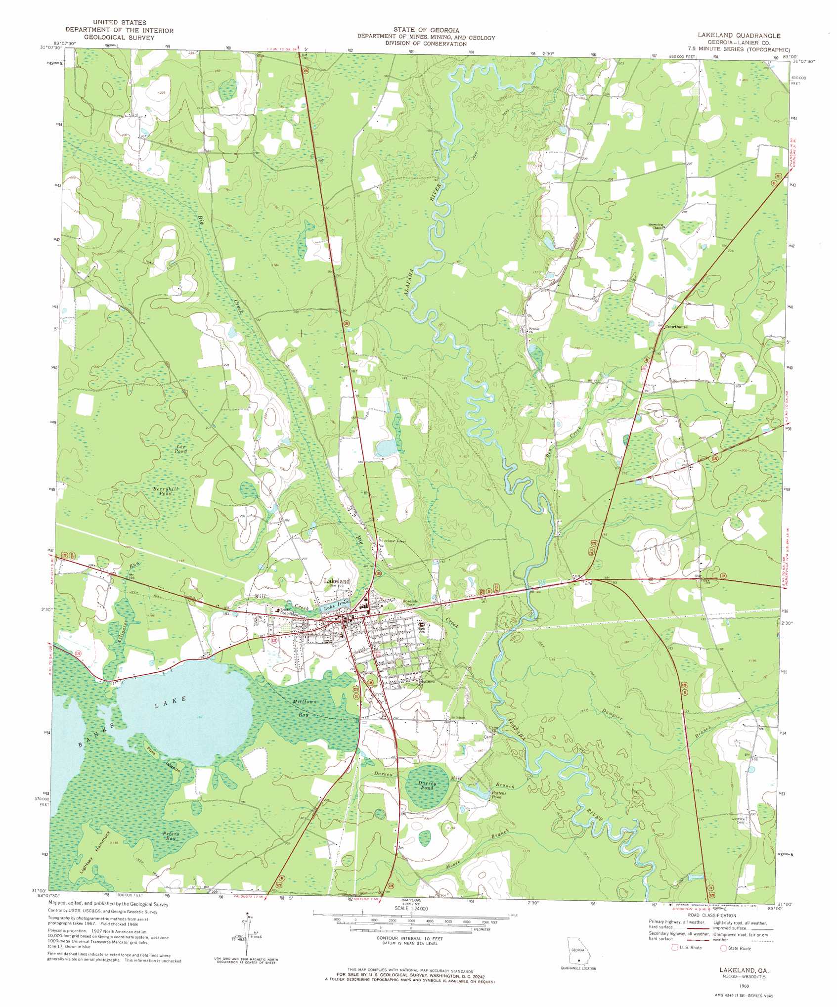
USGS Topo Quad 31083a1 - 1:24,000 scale
| Topo Map Name: | Lakeland |
| USGS Topo Quad ID: | 31083a1 |
| Print Size: | ca. 21 1/4" wide x 27" high |
| Southeast Coordinates: | 31° N latitude / 83° W longitude |
| Map Center Coordinates: | 31.0625° N latitude / 83.0625° W longitude |
| U.S. State: | GA |
| Filename: | o31083a1.jpg |
| Download Map JPG Image: | Lakeland topo map 1:24,000 scale |
| Map Type: | Topographic |
| Topo Series: | 7.5´ |
| Map Scale: | 1:24,000 |
| Source of Map Images: | United States Geological Survey (USGS) |
| Alternate Map Versions: |
Lakeland GA 1968, updated 1971 Download PDF Buy paper map Lakeland GA 2011 Download PDF Buy paper map Lakeland GA 2014 Download PDF Buy paper map |
1:24,000 Topo Quads surrounding Lakeland
Sapps Lake |
Tenmile Bay |
Willacoochee |
Kirkland |
Pearson |
Nashville West |
Nashville East |
Hastings Fish Pond |
Henderson Still |
Sandy Bottom |
New Lois |
Ray City |
Lakeland |
Sirmans |
Homerville West |
Hahira East |
Bemiss |
Naylor |
Stockton |
Du Pont |
Valdosta |
Indianola |
Howell |
Haylow |
Thelma |
> Back to 31083a1 at 1:100,000 scale
> Back to 31082a1 at 1:250,000 scale
> Back to U.S. Topo Maps home
Lakeland topo map: Gazetteer
Lakeland: Dams
Banks Lake Dam elevation 58m 190′Howell Lake Dam elevation 49m 160′
Lake Irma Dam elevation 53m 173′
Lakeland: Islands
Lightsey Hammock elevation 59m 193′Pine Islands elevation 59m 193′
Lakeland: Populated Places
Lakeland elevation 60m 196′Lakeland: Reservoirs
Banks Lake elevation 58m 190′Darsey Pond elevation 56m 183′
Howell Lake elevation 49m 160′
Lake Irma elevation 53m 173′
Pattens Pond elevation 50m 164′
Lakeland: Streams
Alligator Run elevation 58m 190′Ben Creek elevation 45m 147′
Big Creek elevation 45m 147′
Cross Creek elevation 52m 170′
Dampier Branch elevation 45m 147′
Darsey Mill Branch elevation 44m 144′
Mill Creek elevation 48m 157′
Moore Branch elevation 43m 141′
Lakeland: Swamps
Berryhill Pond elevation 60m 196′Lee Pond elevation 61m 200′
Milltown Bay elevation 58m 190′
Peters Bay elevation 58m 190′
Lakeland digital topo map on disk
Buy this Lakeland topo map showing relief, roads, GPS coordinates and other geographical features, as a high-resolution digital map file on DVD: