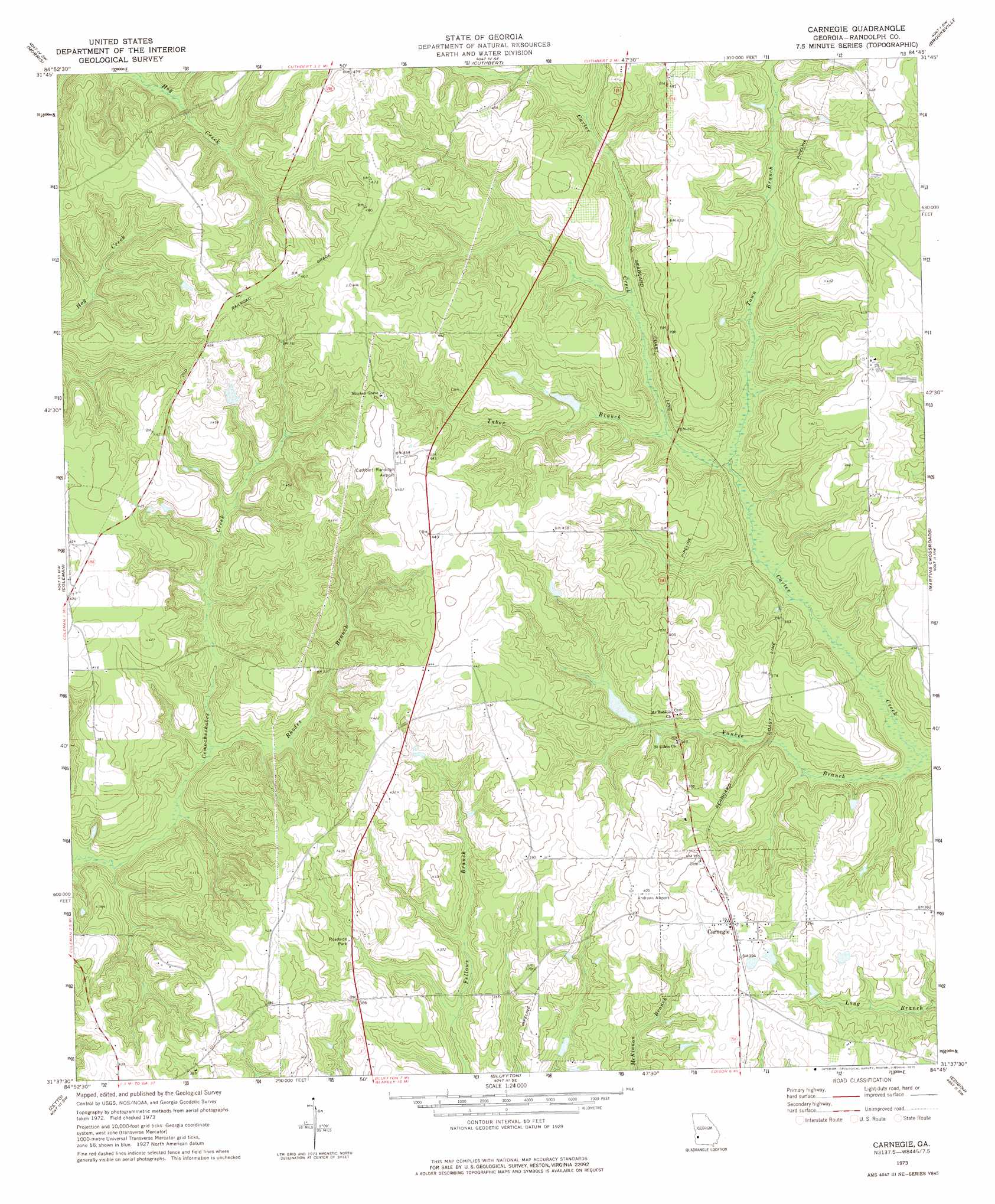
Carnegie Topo Map Georgia
To zoom in, hover over the map of Carnegie
USGS Topo Quad 31084f7 - 1:24,000 scale
| Topo Map Name: | Carnegie |
| USGS Topo Quad ID: | 31084f7 |
| Print Size: | ca. 21 1/4" wide x 27" high |
| Southeast Coordinates: | 31.625° N latitude / 84.75° W longitude |
| Map Center Coordinates: | 31.6875° N latitude / 84.8125° W longitude |
| U.S. State: | GA |
| Filename: | o31084f7.jpg |
| Download Map JPG Image: | Carnegie topo map 1:24,000 scale |
| Map Type: | Topographic |
| Topo Series: | 7.5´ |
| Map Scale: | 1:24,000 |
| Source of Map Images: | United States Geological Survey (USGS) |
| Alternate Map Versions: |
Carnegie GA 1973, updated 1975 Download PDF Buy paper map Carnegie GA 2011 Download PDF Buy paper map Carnegie GA 2014 Download PDF Buy paper map |
1:24,000 Topo Quads surrounding Carnegie
Georgetown |
Sanford |
County Line |
Benevolence |
Parrott |
Hatcher |
Morris |
Cuthbert |
Brooksville |
Shellman |
Fort Gaines Ne |
Coleman |
Carnegie |
Martins Crossroads |
Doverel |
Fort Gaines |
Zetto |
Bluffton |
Edison |
Morgan |
Columbia Ne |
Blakely North |
Bancroft |
Arlington |
Leary |
> Back to 31084e1 at 1:100,000 scale
> Back to 31084a1 at 1:250,000 scale
> Back to U.S. Topo Maps home
Carnegie topo map: Gazetteer
Carnegie: Airports
Andrews Airport elevation 124m 406′Cuthbert-Randolph Airport elevation 137m 449′
Carnegie: Dams
Coffin Lake Dam elevation 107m 351′McDonald Lake Dam elevation 115m 377′
Wohlender Lake Dam elevation 99m 324′
Carnegie: Populated Places
Bass Store elevation 135m 442′Carnegie elevation 120m 393′
Grubb (historical) elevation 109m 357′
Carnegie: Reservoirs
Coffin Lake elevation 107m 351′McDonald Lake elevation 115m 377′
Wohlender Lake elevation 99m 324′
Carnegie: Streams
Rhodes Branch elevation 89m 291′Tabor Branch elevation 94m 308′
Town Branch elevation 92m 301′
Yankee Branch elevation 83m 272′
Carnegie digital topo map on disk
Buy this Carnegie topo map showing relief, roads, GPS coordinates and other geographical features, as a high-resolution digital map file on DVD:
Gulf Coast (LA, MS, AL, FL) & Southwestern Georgia
Buy digital topo maps: Gulf Coast (LA, MS, AL, FL) & Southwestern Georgia
 & Southwestern Georgia map DVD")