Irwin Lake Topo Map Louisiana
To zoom in, hover over the map of Irwin Lake
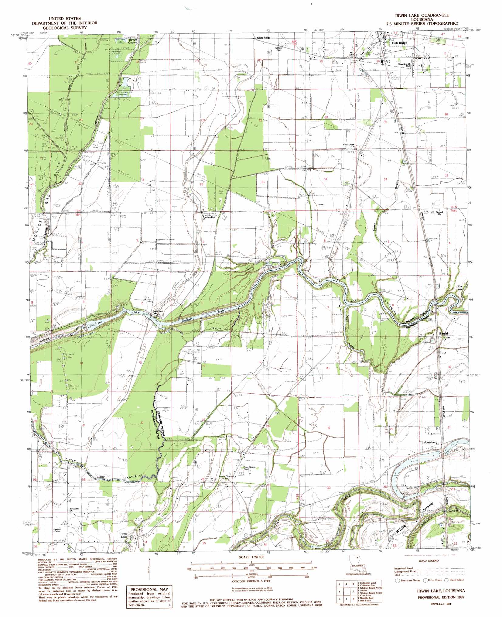
USGS Topo Quad 32091e7 - 1:24,000 scale
| Topo Map Name: | Irwin Lake |
| USGS Topo Quad ID: | 32091e7 |
| Print Size: | ca. 21 1/4" wide x 27" high |
| Southeast Coordinates: | 32.5° N latitude / 91.75° W longitude |
| Map Center Coordinates: | 32.5625° N latitude / 91.8125° W longitude |
| U.S. State: | LA |
| Filename: | o32091e7.jpg |
| Download Map JPG Image: | Irwin Lake topo map 1:24,000 scale |
| Map Type: | Topographic |
| Topo Series: | 7.5´ |
| Map Scale: | 1:24,000 |
| Source of Map Images: | United States Geological Survey (USGS) |
| Alternate Map Versions: |
Irwin Lake LA 1982, updated 1983 Download PDF Buy paper map Irwin Lake LA 2012 Download PDF Buy paper map Irwin Lake LA 2015 Download PDF Buy paper map |
1:24,000 Topo Quads surrounding Irwin Lake
Harrell Lake |
Bastrop |
Mer Rouge |
Bonita Sw |
Goodwill |
Sterlington |
Collinston West |
Collinston East |
Whitney Island North |
Bear Skin |
Monroe North |
Swartz |
Irwin Lake |
Whitney Island South |
Congo Creek |
Monroe South |
Crew Lake |
Rayville |
Bee Bayou |
Dunn |
Bosco |
Gilleyville |
Mangham |
Baskinton |
Lamar |
> Back to 32091e1 at 1:100,000 scale
> Back to 32090a1 at 1:250,000 scale
> Back to U.S. Topo Maps home
Irwin Lake topo map: Gazetteer
Irwin Lake: Areas
Ridges Island elevation 26m 85′Irwin Lake: Bridges
Smith Bridge elevation 18m 59′Irwin Lake: Crossings
Easons Ferry (historical) elevation 19m 62′Jones Ferry (historical) elevation 19m 62′
Lorrlas Ferry (historical) elevation 18m 59′
Irwin Lake: Guts
Cooks Slough elevation 23m 75′Irwin Lake: Islands
White Island elevation 26m 85′Irwin Lake: Lakes
Dead Lake elevation 19m 62′Little Lake Lafourche elevation 18m 59′
Irwin Lake: Populated Places
Bardel elevation 22m 72′Bordenax elevation 26m 85′
Jonesburg elevation 25m 82′
Oak Ridge elevation 27m 88′
Irwin Lake: Reservoirs
Irwin Lake elevation 14m 45′Irwin Lake: Streams
Alligator Bayou elevation 19m 62′Bayou Coulee elevation 20m 65′
Como Bayou elevation 20m 65′
Irwin Lake digital topo map on disk
Buy this Irwin Lake topo map showing relief, roads, GPS coordinates and other geographical features, as a high-resolution digital map file on DVD: