Darco Topo Map Texas
To zoom in, hover over the map of Darco
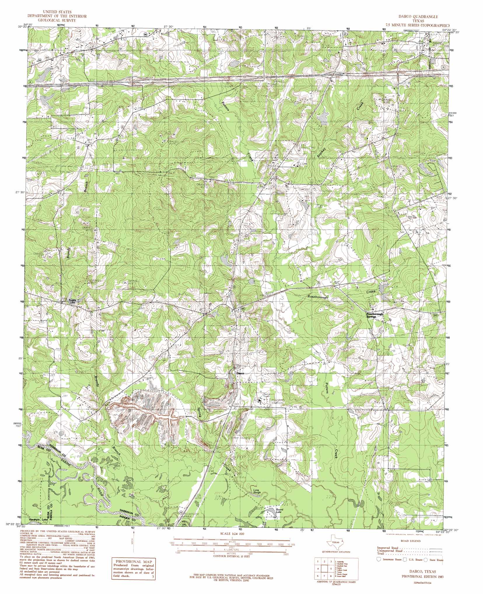
USGS Topo Quad 32094d4 - 1:24,000 scale
| Topo Map Name: | Darco |
| USGS Topo Quad ID: | 32094d4 |
| Print Size: | ca. 21 1/4" wide x 27" high |
| Southeast Coordinates: | 32.375° N latitude / 94.375° W longitude |
| Map Center Coordinates: | 32.4375° N latitude / 94.4375° W longitude |
| U.S. State: | TX |
| Filename: | o32094d4.jpg |
| Download Map JPG Image: | Darco topo map 1:24,000 scale |
| Map Type: | Topographic |
| Topo Series: | 7.5´ |
| Map Scale: | 1:24,000 |
| Source of Map Images: | United States Geological Survey (USGS) |
| Alternate Map Versions: |
Darco TX 1983, updated 1983 Download PDF Buy paper map Darco TX 1983, updated 1987 Download PDF Buy paper map Darco TX 2010 Download PDF Buy paper map Darco TX 2013 Download PDF Buy paper map Darco TX 2016 Download PDF Buy paper map |
1:24,000 Topo Quads surrounding Darco
Ashland |
Harleton |
Marshall Nw |
Woodlawn |
Karnack |
Longview Heights |
Hallsville |
Marshall West |
Marshall East |
Scottsville |
Lakeport |
Easton |
Darco |
Colliers Creek |
Stricklin Springs |
Elderville |
Tatum |
Harris Chapel |
Grand Bluff |
De Berry |
Church Hill |
Fair Play |
Beckville |
Carthage |
River Hill |
> Back to 32094a1 at 1:100,000 scale
> Back to 32094a1 at 1:250,000 scale
> Back to U.S. Topo Maps home
Darco topo map: Gazetteer
Darco: Dams
Lowry Lake Dam elevation 104m 341′White Lake Dam elevation 100m 328′
Darco: Guts
Long Slough elevation 67m 219′Darco: Lakes
Round Lake elevation 67m 219′Darco: Mines
Darco Mine elevation 86m 282′Darco: Populated Places
Darco elevation 91m 298′Darco: Reservoirs
Lowry Lake elevation 104m 341′Rogers Lake elevation 84m 275′
White Lake elevation 100m 328′
Darco: Springs
Roseborough Springs elevation 89m 291′Darco: Streams
Brandy Branch elevation 65m 213′East Potters Creek elevation 83m 272′
Hatley Creek elevation 68m 223′
Roseborough Creek elevation 73m 239′
Starkey Creek elevation 74m 242′
Darco digital topo map on disk
Buy this Darco topo map showing relief, roads, GPS coordinates and other geographical features, as a high-resolution digital map file on DVD: