Mcveigh Hills Topo Map New Mexico
To zoom in, hover over the map of Mcveigh Hills
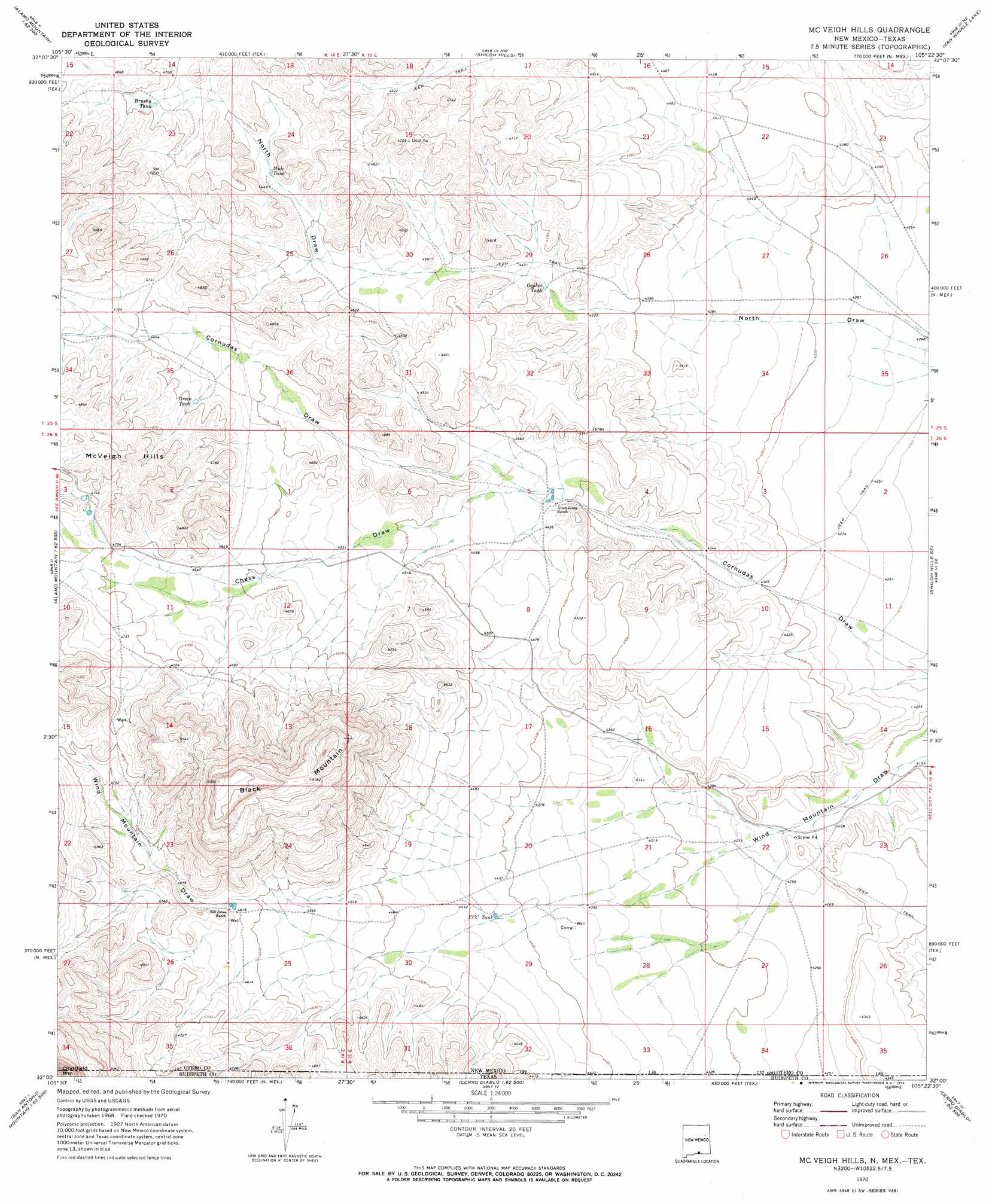
USGS Topo Quad 32105a4 - 1:24,000 scale
| Topo Map Name: | Mcveigh Hills |
| USGS Topo Quad ID: | 32105a4 |
| Print Size: | ca. 21 1/4" wide x 27" high |
| Southeast Coordinates: | 32° N latitude / 105.375° W longitude |
| Map Center Coordinates: | 32.0625° N latitude / 105.4375° W longitude |
| U.S. States: | NM, TX |
| Filename: | o32105a4.jpg |
| Download Map JPG Image: | Mcveigh Hills topo map 1:24,000 scale |
| Map Type: | Topographic |
| Topo Series: | 7.5´ |
| Map Scale: | 1:24,000 |
| Source of Map Images: | United States Geological Survey (USGS) |
| Alternate Map Versions: |
Mc Veigh Hills NM 1970, updated 1973 Download PDF Buy paper map McVeigh Hills NM 2010 Download PDF Buy paper map McVeigh Hills NM 2013 Download PDF Buy paper map McVeigh Hills NM 2017 Download PDF Buy paper map |
1:24,000 Topo Quads surrounding Mcveigh Hills
Stone Well |
Stockard Well |
Cleones Tank |
Cornucopia Ranch Se |
Hackberry Hill |
B T Ranch |
Alamo Mountain Ne |
Shiloh Hills |
Van Winkle Lake |
Lewis Canyon |
Alamo Mountain |
Cornudas Mountain |
Mcveigh Hills |
Shiloh Hills Se |
Culp Draw |
Big Heiser Tank |
Sixteen Mountains |
Cerro Diablo |
C And L Draw |
Dell City |
Buckhorn Draw East |
Molesworth Mesa North |
Cornudas |
Mickey Draw West |
Mickey Draw East |
> Back to 32105a1 at 1:100,000 scale
> Back to 32104a1 at 1:250,000 scale
> Back to U.S. Topo Maps home
Mcveigh Hills topo map: Gazetteer
Mcveigh Hills: Ranges
McVeigh Hills elevation 1499m 4917′Mcveigh Hills: Reservoirs
Brushy Tank elevation 1454m 4770′C C C Tank elevation 1347m 4419′
Gopher Tank elevation 1355m 4445′
Green Tank elevation 1428m 4685′
Mule Tank elevation 1419m 4655′
Mcveigh Hills: Summits
Black Mountain elevation 1629m 5344′McVeigh Hills elevation 1455m 4773′
Mcveigh Hills: Valleys
Chess Draw elevation 1347m 4419′Mcveigh Hills digital topo map on disk
Buy this Mcveigh Hills topo map showing relief, roads, GPS coordinates and other geographical features, as a high-resolution digital map file on DVD: