Knox City Nw Topo Map Texas
To zoom in, hover over the map of Knox City Nw
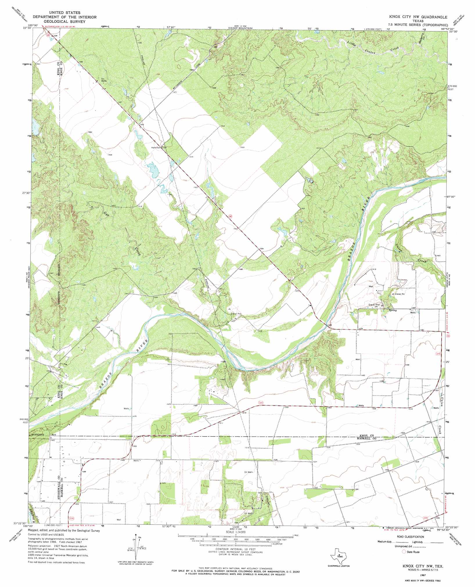
USGS Topo Quad 33099d8 - 1:24,000 scale
| Topo Map Name: | Knox City Nw |
| USGS Topo Quad ID: | 33099d8 |
| Print Size: | ca. 21 1/4" wide x 27" high |
| Southeast Coordinates: | 33.375° N latitude / 99.875° W longitude |
| Map Center Coordinates: | 33.4375° N latitude / 99.9375° W longitude |
| U.S. State: | TX |
| Filename: | o33099d8.jpg |
| Download Map JPG Image: | Knox City Nw topo map 1:24,000 scale |
| Map Type: | Topographic |
| Topo Series: | 7.5´ |
| Map Scale: | 1:24,000 |
| Source of Map Images: | United States Geological Survey (USGS) |
| Alternate Map Versions: |
Knox City NW TX 1967, updated 1970 Download PDF Buy paper map Knox City NW TX 2010 Download PDF Buy paper map Knox City NW TX 2013 Download PDF Buy paper map Knox City NW TX 2016 Download PDF Buy paper map |
1:24,000 Topo Quads surrounding Knox City Nw
J Y Ranch |
Ox Yoke Creek |
Maverick Flat |
Truscott South |
Gilliland |
Dark Canyon |
Buzzard Peak |
Cedar Mountain |
Benjamin |
Rhineland |
Kiowa Peak Nw |
Kiowa Peak Ne |
Knox City Nw |
Knox City |
Munday West |
Kiowa Peak Sw |
Kiowa Peak |
Jud |
Rochester |
Weinert |
Aspermont |
Old Glory |
Rule |
Pinkerton |
Haskell |
> Back to 33099a1 at 1:100,000 scale
> Back to 33098a1 at 1:250,000 scale
> Back to U.S. Topo Maps home
Knox City Nw topo map: Gazetteer
Knox City Nw: Dams
Arnold Ranch Lake Dam elevation 465m 1525′Knox City Nw: Reservoirs
Arnold Ranch Lake elevation 465m 1525′Knox City Nw: Streams
Gyp Creek elevation 435m 1427′Hackberry Creek elevation 430m 1410′
Union Creek elevation 441m 1446′
Knox City Nw digital topo map on disk
Buy this Knox City Nw topo map showing relief, roads, GPS coordinates and other geographical features, as a high-resolution digital map file on DVD: