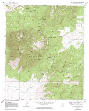
White Oaks South Topo Map New Mexico
To zoom in, hover over the map of White Oaks South
USGS Topo Quad 33105f6 - 1:24,000 scale
| Topo Map Name: | White Oaks South |
| USGS Topo Quad ID: | 33105f6 |
| Print Size: | ca. 21 1/4" wide x 27" high |
| Southeast Coordinates: | 33.625° N latitude / 105.625° W longitude |
| Map Center Coordinates: | 33.6875° N latitude / 105.6875° W longitude |
| U.S. State: | NM |
| Filename: | o33105f6.jpg |
| Download Map JPG Image: | White Oaks South topo map 1:24,000 scale |
| Map Type: | Topographic |
| Topo Series: | 7.5´ |
| Map Scale: | 1:24,000 |
| Source of Map Images: | United States Geological Survey (USGS) |
| Alternate Map Versions: |
White Oaks South NM 1973, updated 1992 Download PDF Buy paper map White Oaks South NM 2004, updated 2006 Download PDF Buy paper map White Oaks South NM 2011 Download PDF Buy paper map White Oaks South NM 2013 Download PDF Buy paper map |
| FStopo: | US Forest Service topo White Oaks South is available: Download FStopo PDF Download FStopo TIF |
1:24,000 Topo Quads surrounding White Oaks South
> Back to 33105e1 at 1:100,000 scale
> Back to 33104a1 at 1:250,000 scale
> Back to U.S. Topo Maps home
White Oaks South topo map: Gazetteer
White Oaks South: Gaps
Benado Gap elevation 2189m 7181′White Oaks South: Mines
Emeline Mine elevation 1930m 6332′In-Situ M and T Corporation of America elevation 1893m 6210′
Lincoln Light and Power Company Mine elevation 2011m 6597′
Martin Mine elevation 1930m 6332′
Old Abe Mine Number 1 Mine elevation 2132m 6994′
Old Abe Mine Number 2 Mine elevation 2132m 6994′
Old Abe Mines elevation 2132m 6994′
Old Price Mine elevation 2150m 7053′
Price elevation 2026m 6646′
Wells and Parker Mine elevation 2226m 7303′
Wildcat elevation 2087m 6847′
Williams elevation 2195m 7201′
White Oaks South: Populated Places
White Oaks elevation 1929m 6328′White Oaks South: Post Offices
White Oaks Post Office (historical) elevation 1929m 6328′White Oaks South: Reservoirs
Cottonwood Tank elevation 2111m 6925′Jims Tank elevation 2132m 6994′
Johnnie Tank elevation 2102m 6896′
Kudner Tank elevation 2043m 6702′
Madden Tank elevation 2609m 8559′
Northwest Tank elevation 2010m 6594′
Roadside Tank elevation 2297m 7536′
Section Thirty-four Tank elevation 2150m 7053′
Section Twenty-six Tank elevation 2209m 7247′
White Oaks South: Springs
Alto Spring elevation 2333m 7654′Barber Spring elevation 2219m 7280′
Benado Spring elevation 2264m 7427′
Bragg Spring elevation 2143m 7030′
Coal Dump Spring elevation 2234m 7329′
Felix Spring elevation 2264m 7427′
Goat Spring elevation 2197m 7208′
Goat Spring elevation 2220m 7283′
Lost Spring elevation 2586m 8484′
Madden Spring elevation 2286m 7500′
Meyer Spring elevation 2300m 7545′
Mud Spring elevation 2239m 7345′
Patos Spring elevation 2156m 7073′
Powder Magazine Spring elevation 1988m 6522′
Powell Spring elevation 2050m 6725′
Wells Spring elevation 2022m 6633′
White Oaks Spring elevation 2039m 6689′
Wilson Spring elevation 2083m 6833′
York Spring elevation 2137m 7011′
White Oaks South: Summits
Carrizo Mountain elevation 2932m 9619′Carrizo Peak elevation 2932m 9619′
Goat Mountain elevation 2455m 8054′
Lake Mountain elevation 2455m 8054′
Patos Mountain elevation 2492m 8175′
Tucson Mountain elevation 2539m 8330′
White Oaks South: Trails
Barber Springs Trail elevation 2217m 7273′Carrizo Peak Trail elevation 2446m 8024′
Patos Mountain Trail elevation 2290m 7513′
Tucson Mountain Trail elevation 2506m 8221′
White Oaks South: Valleys
Benado Canyon elevation 1942m 6371′Bragg Canyon elevation 2106m 6909′
Carrizo Canyon elevation 2058m 6751′
Coal Dump Canyon elevation 2046m 6712′
Dark Canyon elevation 1926m 6318′
Johnnie Canyon elevation 2072m 6797′
Little Bragg Canyon elevation 2091m 6860′
Madden Canyon elevation 2079m 6820′
Outlaw Canyon elevation 2095m 6873′
Powell Canyon elevation 1929m 6328′
Water Canyon elevation 1916m 6286′
White Oaks South digital topo map on disk
Buy this White Oaks South topo map showing relief, roads, GPS coordinates and other geographical features, as a high-resolution digital map file on DVD:


