Buckeye Nw Topo Map Arizona
To zoom in, hover over the map of Buckeye Nw
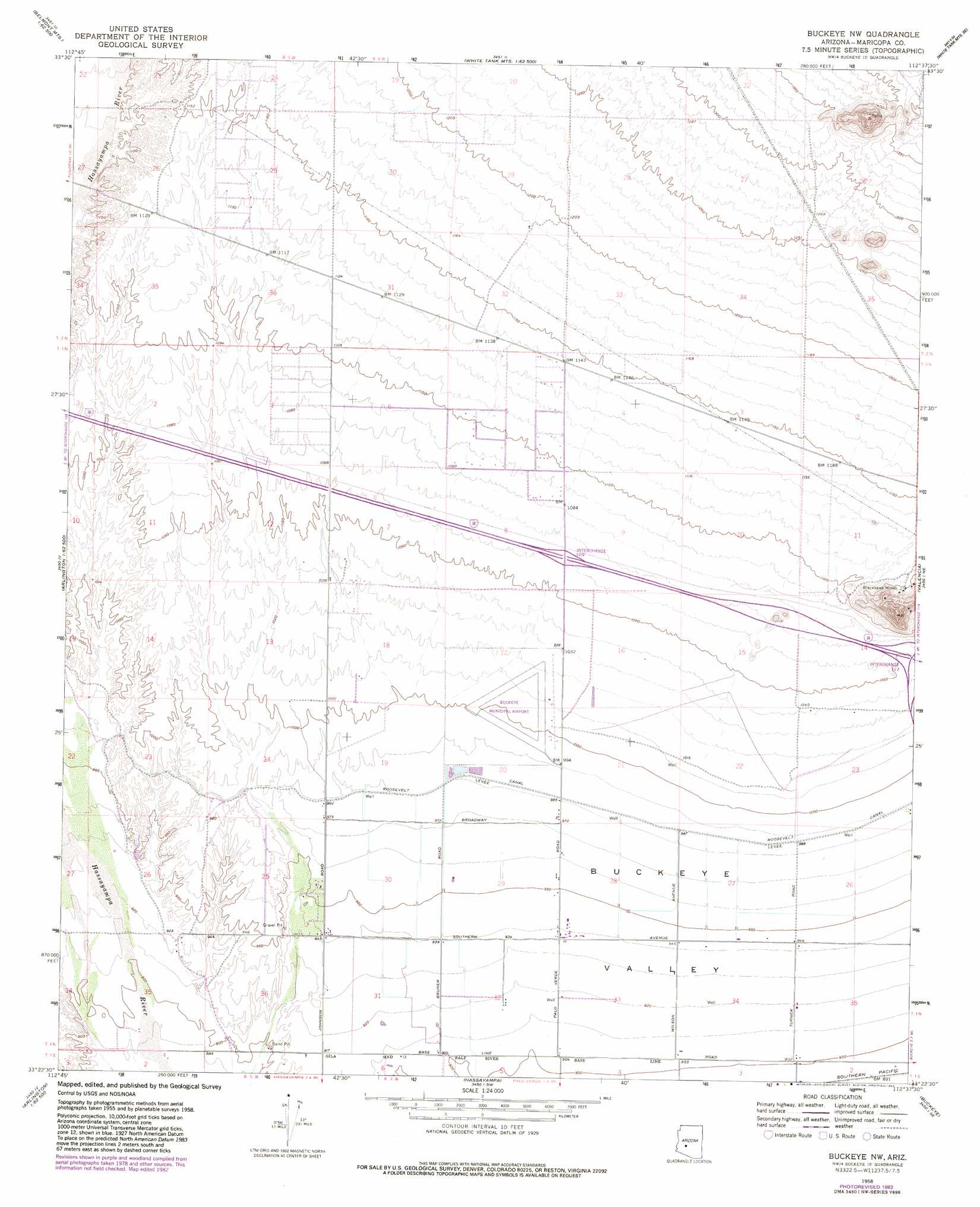
USGS Topo Quad 33112d6 - 1:24,000 scale
| Topo Map Name: | Buckeye Nw |
| USGS Topo Quad ID: | 33112d6 |
| Print Size: | ca. 21 1/4" wide x 27" high |
| Southeast Coordinates: | 33.375° N latitude / 112.625° W longitude |
| Map Center Coordinates: | 33.4375° N latitude / 112.6875° W longitude |
| U.S. State: | AZ |
| Filename: | o33112d6.jpg |
| Download Map JPG Image: | Buckeye Nw topo map 1:24,000 scale |
| Map Type: | Topographic |
| Topo Series: | 7.5´ |
| Map Scale: | 1:24,000 |
| Source of Map Images: | United States Geological Survey (USGS) |
| Alternate Map Versions: |
Buckeye NW AZ 1958, updated 1959 Download PDF Buy paper map Buckeye NW AZ 1958, updated 1972 Download PDF Buy paper map Buckeye NW AZ 1958, updated 1983 Download PDF Buy paper map Buckeye NW AZ 2011 Download PDF Buy paper map Buckeye NW AZ 2014 Download PDF Buy paper map |
1:24,000 Topo Quads surrounding Buckeye Nw
Belmont Mountain |
Star Well |
Daggs Tank |
White Tank Mountains Ne |
Mcmicken Dam |
Hot Rock Mountain |
Flatiron Mountain |
Wagner Wash Well |
White Tank Mountains |
Waddell |
Tonopah |
Wintersburg |
Buckeye Nw |
Valencia |
Perryville |
Gillespie |
Arlington |
Hassayampa |
Buckeye |
Avondale Sw |
Woolsey Peak |
Spring Mountain |
Cotton Center Nw |
Margies Peak |
Mobile Nw |
> Back to 33112a1 at 1:100,000 scale
> Back to 33112a1 at 1:250,000 scale
> Back to U.S. Topo Maps home
Buckeye Nw topo map: Gazetteer
Buckeye Nw: Airports
Buckeye Municipal Airport elevation 311m 1020′Buckeye Nw: Crossings
Interchange One Hundred Nine elevation 325m 1066′Interchange One Hundred Twelve elevation 321m 1053′
Buckeye Nw: Dams
Buckeye FRS Dam Number One elevation 318m 1043′Buckeye Nw: Mines
Blackhawk Mines elevation 358m 1174′Buckeye Nw digital topo map on disk
Buy this Buckeye Nw topo map showing relief, roads, GPS coordinates and other geographical features, as a high-resolution digital map file on DVD: