Kenansville Topo Map North Carolina
To zoom in, hover over the map of Kenansville
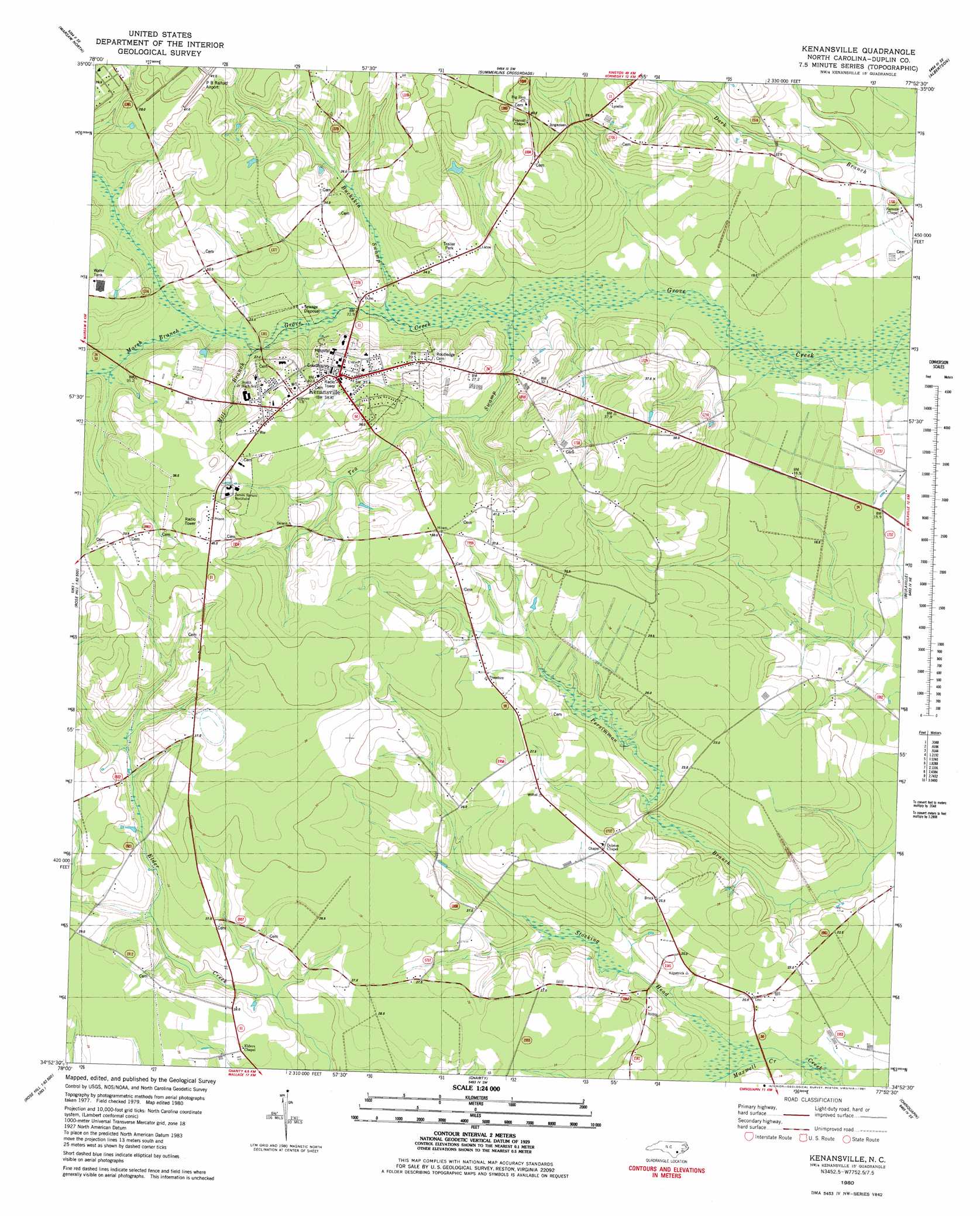
USGS Topo Quad 34077h8 - 1:24,000 scale
| Topo Map Name: | Kenansville |
| USGS Topo Quad ID: | 34077h8 |
| Print Size: | ca. 21 1/4" wide x 27" high |
| Southeast Coordinates: | 34.875° N latitude / 77.875° W longitude |
| Map Center Coordinates: | 34.9375° N latitude / 77.9375° W longitude |
| U.S. State: | NC |
| Filename: | o34077h8.jpg |
| Download Map JPG Image: | Kenansville topo map 1:24,000 scale |
| Map Type: | Topographic |
| Topo Series: | 7.5´ |
| Map Scale: | 1:24,000 |
| Source of Map Images: | United States Geological Survey (USGS) |
| Alternate Map Versions: |
Kenansville NC 1980, updated 1981 Download PDF Buy paper map Kenansville NC 2010 Download PDF Buy paper map Kenansville NC 2013 Download PDF Buy paper map Kenansville NC 2016 Download PDF Buy paper map |
1:24,000 Topo Quads surrounding Kenansville
Dobbersville |
Mount Olive |
Williams |
Seven Springs |
Deep Run |
Faison |
Warsaw North |
Summerlins Crossroads |
Albertson |
Pink Hill |
Turkey |
Warsaw South |
Kenansville |
Beulaville |
Potters Hill |
Delway |
Rose Hill |
Charity |
Chinquapin |
Lyman |
Harrells |
Wallace West |
Wallace East |
Pin Hook |
Maple Hill |
> Back to 34077e1 at 1:100,000 scale
> Back to 34076a1 at 1:250,000 scale
> Back to U.S. Topo Maps home
Kenansville topo map: Gazetteer
Kenansville: Populated Places
Kenansville elevation 38m 124′Pineview Mobile Home Park elevation 37m 121′
Kenansville: Streams
Buckskin Swamp elevation 20m 65′Marsh Branch elevation 22m 72′
Maxwell Creek elevation 13m 42′
Mill Branch elevation 22m 72′
Tea Swamp elevation 19m 62′
Kenansville digital topo map on disk
Buy this Kenansville topo map showing relief, roads, GPS coordinates and other geographical features, as a high-resolution digital map file on DVD:
Atlantic Coast (NY, NJ, PA, DE, MD, VA, NC)
Buy digital topo maps: Atlantic Coast (NY, NJ, PA, DE, MD, VA, NC)
 map DVD")