Curtis Station Topo Map Mississippi
To zoom in, hover over the map of Curtis Station
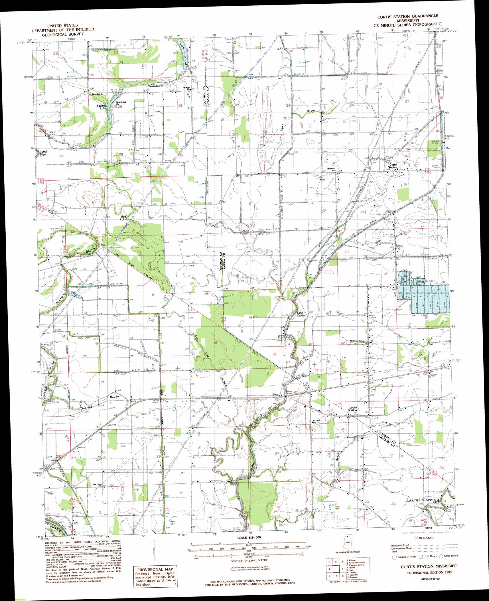
USGS Topo Quad 34090c2 - 1:24,000 scale
| Topo Map Name: | Curtis Station |
| USGS Topo Quad ID: | 34090c2 |
| Print Size: | ca. 21 1/4" wide x 27" high |
| Southeast Coordinates: | 34.25° N latitude / 90.125° W longitude |
| Map Center Coordinates: | 34.3125° N latitude / 90.1875° W longitude |
| U.S. State: | MS |
| Filename: | o34090c2.jpg |
| Download Map JPG Image: | Curtis Station topo map 1:24,000 scale |
| Map Type: | Topographic |
| Topo Series: | 7.5´ |
| Map Scale: | 1:24,000 |
| Source of Map Images: | United States Geological Survey (USGS) |
| Alternate Map Versions: |
Curtis Station MS 1983, updated 1983 Download PDF Buy paper map Curtis Station MS 2012 Download PDF Buy paper map Curtis Station MS 2015 Download PDF Buy paper map |
1:24,000 Topo Quads surrounding Curtis Station
Dundee |
Walnut Lake |
Crenshaw North |
Longtown |
Senatobia |
Lula |
Falcon |
Crenshaw South |
Pleasant Grove |
Sardis |
Jonestown |
Marks |
Curtis Station |
Asa |
Batesville |
Sabino |
Lambert |
Crowder |
Tocowa |
Courtland |
Tutwiler |
Vance |
Fishhook Lake |
Charleston |
Oakland |
> Back to 34090a1 at 1:100,000 scale
> Back to 34090a1 at 1:250,000 scale
> Back to U.S. Topo Maps home
Curtis Station topo map: Gazetteer
Curtis Station: Canals
Quitman Panola Ditch elevation 46m 150′Curtis Station: Dams
Lower Tallahatchie River Y-10-35 Dam elevation 48m 157′M and M Fish Farm Lake Dam elevation 50m 164′
Curtis Station: Flats
Viney Rough elevation 49m 160′Curtis Station: Guts
Ash Log Bayou elevation 47m 154′Sand Bayou elevation 48m 157′
Curtis Station: Lakes
Blue Hole elevation 47m 154′Lake Carrier elevation 44m 144′
Red Lake elevation 48m 157′
Round Hole (historical) elevation 49m 160′
South Lake elevation 46m 150′
Squirrel Lake elevation 46m 150′
Curtis Station: Populated Places
Bobo elevation 44m 144′Curtis Station elevation 48m 157′
Locke Station elevation 49m 160′
Riverview elevation 49m 160′
Curtis Station: Streams
Beech Bayou elevation 46m 150′Onemile Bayou elevation 48m 157′
Curtis Station digital topo map on disk
Buy this Curtis Station topo map showing relief, roads, GPS coordinates and other geographical features, as a high-resolution digital map file on DVD: