Frutosa Lake Topo Map New Mexico
To zoom in, hover over the map of Frutosa Lake
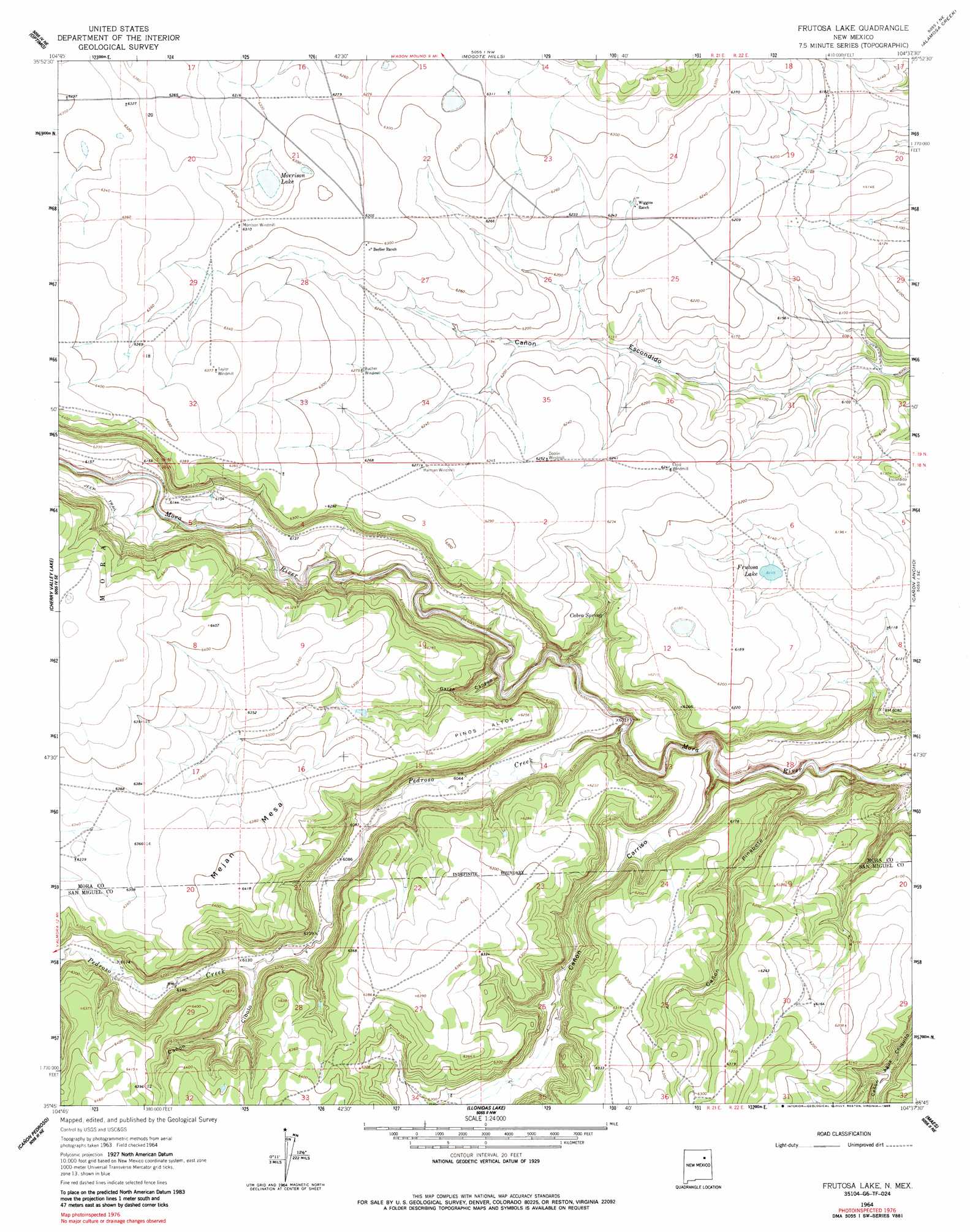
USGS Topo Quad 35104g6 - 1:24,000 scale
| Topo Map Name: | Frutosa Lake |
| USGS Topo Quad ID: | 35104g6 |
| Print Size: | ca. 21 1/4" wide x 27" high |
| Southeast Coordinates: | 35.75° N latitude / 104.625° W longitude |
| Map Center Coordinates: | 35.8125° N latitude / 104.6875° W longitude |
| U.S. State: | NM |
| Filename: | o35104g6.jpg |
| Download Map JPG Image: | Frutosa Lake topo map 1:24,000 scale |
| Map Type: | Topographic |
| Topo Series: | 7.5´ |
| Map Scale: | 1:24,000 |
| Source of Map Images: | United States Geological Survey (USGS) |
| Alternate Map Versions: |
Frutosa Lake NM 1964, updated 1966 Download PDF Buy paper map Frutosa Lake NM 1964, updated 1986 Download PDF Buy paper map Frutosa Lake NM 2010 Download PDF Buy paper map Frutosa Lake NM 2013 Download PDF Buy paper map Frutosa Lake NM 2017 Download PDF Buy paper map |
1:24,000 Topo Quads surrounding Frutosa Lake
Cerro Negro |
La Chata Crater |
Wagon Mound |
Alto De Hormiga |
Canon Colorado |
Maxson Crater |
Optimo |
Mogote Hills |
Alamosa Creek |
Canon Las Cuevas |
Watrous |
Cherry Valley Lake |
Frutosa Lake |
Canon Ancho |
Alamito |
Goetsch Lake |
Canon Pedroso |
Llonidas Lake |
Maes |
Sabinoso |
Laguna La Monia |
Laguna Huerfana |
Trujillo |
Canon Olguin |
San Ramon |
> Back to 35104e1 at 1:100,000 scale
> Back to 35104a1 at 1:250,000 scale
> Back to U.S. Topo Maps home
Frutosa Lake topo map: Gazetteer
Frutosa Lake: Areas
Pinos Altos elevation 1911m 6269′Frutosa Lake: Lakes
Frutosa Lake elevation 1865m 6118′Morrison Lake elevation 1905m 6250′
Frutosa Lake: Mines
Mobil 1 Wiggins elevation 1906m 6253′Frutosa Lake: Springs
Cabra Spring elevation 1864m 6115′Frutosa Lake: Streams
Pedroso Creek elevation 1796m 5892′Frutosa Lake: Summits
Mejan Mesa elevation 1953m 6407′Frutosa Lake: Valleys
Cañon Carriso elevation 1775m 5823′Cañon Cibolo elevation 1796m 5892′
Cañon Pinabete elevation 1767m 5797′
Garza Canyon elevation 1812m 5944′
Frutosa Lake digital topo map on disk
Buy this Frutosa Lake topo map showing relief, roads, GPS coordinates and other geographical features, as a high-resolution digital map file on DVD: