Goetsch Lake Topo Map New Mexico
To zoom in, hover over the map of Goetsch Lake
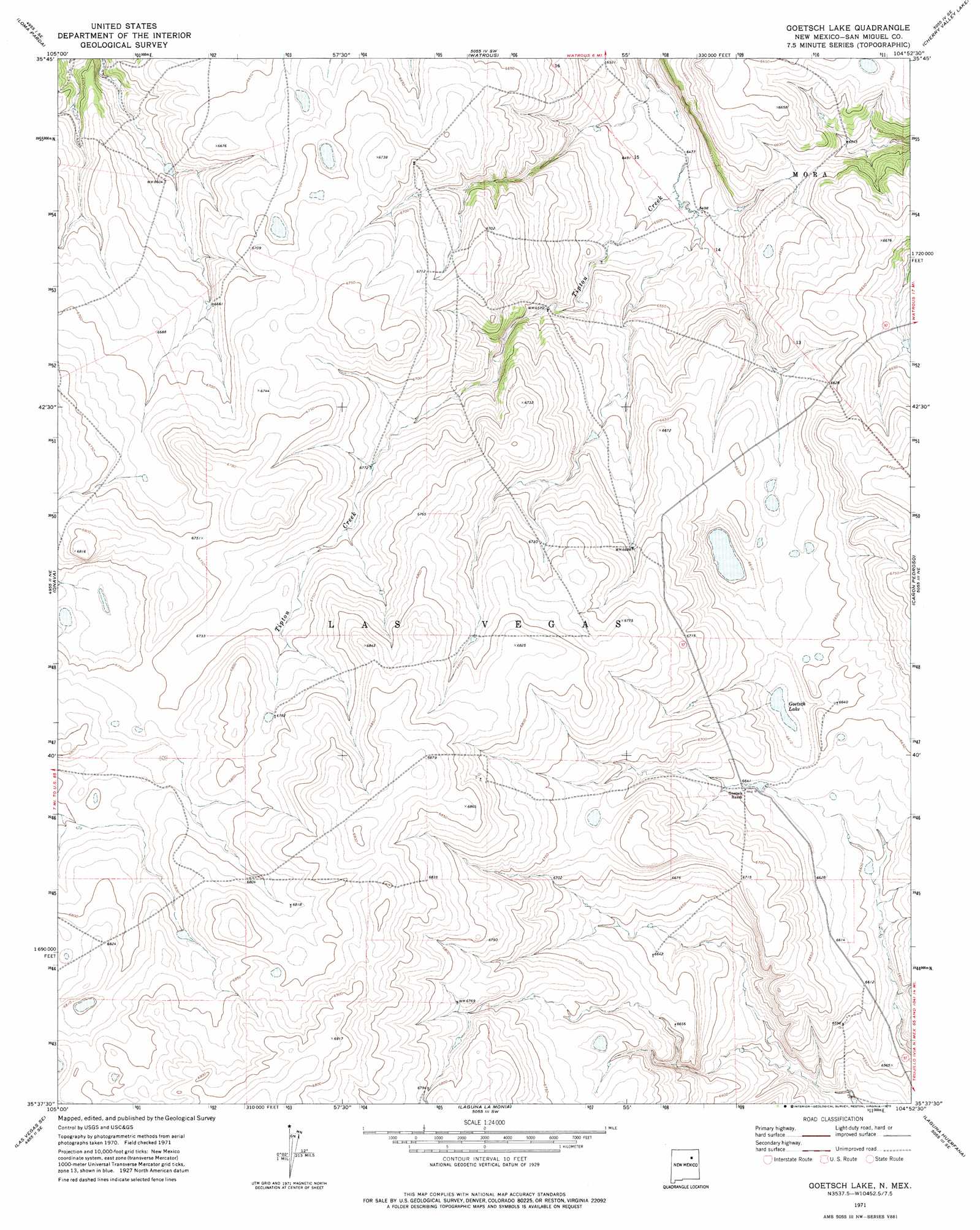
USGS Topo Quad 35104f8 - 1:24,000 scale
| Topo Map Name: | Goetsch Lake |
| USGS Topo Quad ID: | 35104f8 |
| Print Size: | ca. 21 1/4" wide x 27" high |
| Southeast Coordinates: | 35.625° N latitude / 104.875° W longitude |
| Map Center Coordinates: | 35.6875° N latitude / 104.9375° W longitude |
| U.S. State: | NM |
| Filename: | o35104f8.jpg |
| Download Map JPG Image: | Goetsch Lake topo map 1:24,000 scale |
| Map Type: | Topographic |
| Topo Series: | 7.5´ |
| Map Scale: | 1:24,000 |
| Source of Map Images: | United States Geological Survey (USGS) |
| Alternate Map Versions: |
Goetsch Lake NM 1971, updated 1975 Download PDF Buy paper map Goetsch Lake NM 2010 Download PDF Buy paper map Goetsch Lake NM 2013 Download PDF Buy paper map Goetsch Lake NM 2017 Download PDF Buy paper map |
1:24,000 Topo Quads surrounding Goetsch Lake
Rainsville |
Fort Union |
Maxson Crater |
Optimo |
Mogote Hills |
Lake Isabel |
Loma Parda |
Watrous |
Cherry Valley Lake |
Frutosa Lake |
Las Vegas Nw |
Onava |
Goetsch Lake |
Canon Pedroso |
Llonidas Lake |
Las Vegas |
Las Vegas Se |
Laguna La Monia |
Laguna Huerfana |
Trujillo |
Los Montoyas |
La Liendre |
Mesa Lauriano |
Flagstone Mountain |
Punta Del Chorro |
> Back to 35104e1 at 1:100,000 scale
> Back to 35104a1 at 1:250,000 scale
> Back to U.S. Topo Maps home
Goetsch Lake digital topo map on disk
Buy this Goetsch Lake topo map showing relief, roads, GPS coordinates and other geographical features, as a high-resolution digital map file on DVD: