Sky Village Se Topo Map New Mexico
To zoom in, hover over the map of Sky Village Se
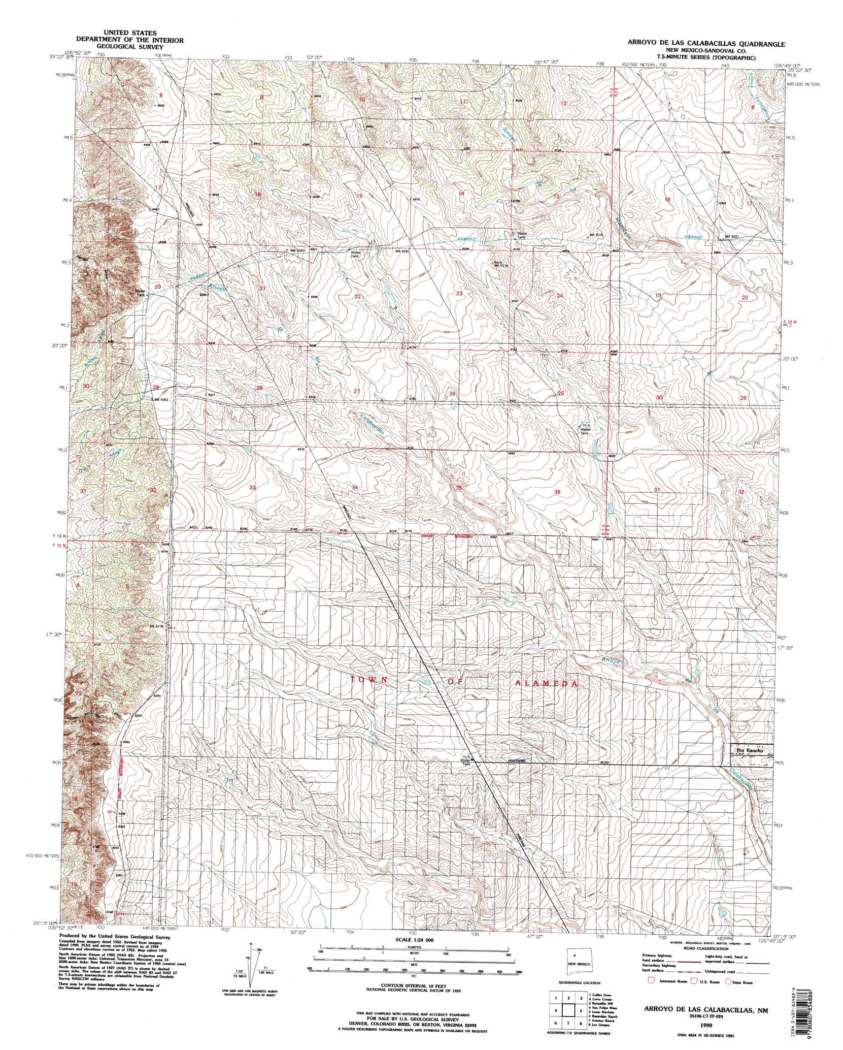
USGS Topo Quad 35106c7 - 1:24,000 scale
| Topo Map Name: | Sky Village Se |
| USGS Topo Quad ID: | 35106c7 |
| Print Size: | ca. 21 1/4" wide x 27" high |
| Southeast Coordinates: | 35.25° N latitude / 106.75° W longitude |
| Map Center Coordinates: | 35.3125° N latitude / 106.8125° W longitude |
| U.S. State: | NM |
| Filename: | o35106c7.jpg |
| Download Map JPG Image: | Sky Village Se topo map 1:24,000 scale |
| Map Type: | Topographic |
| Topo Series: | 7.5´ |
| Map Scale: | 1:24,000 |
| Source of Map Images: | United States Geological Survey (USGS) |
| Alternate Map Versions: |
Sky Village SE NM 1954, updated 1955 Download PDF Buy paper map Sky Village SE NM 1954, updated 1975 Download PDF Buy paper map Arroyo De Las Calabacillas NM 1990, updated 1996 Download PDF Buy paper map Arroyo de las Calabacillas NM 2010 Download PDF Buy paper map Arroyo de las Calabacillas NM 2013 Download PDF Buy paper map Arroyo de las Calabacillas NM 2017 Download PDF Buy paper map |
1:24,000 Topo Quads surrounding Sky Village Se
Cabezon Peak |
Ojito Spring |
San Ysidro |
Jemez Pueblo |
Loma Creston |
Casa Salazar |
Sky Village Nw |
Sky Village Ne |
Bernalillo Nw |
Santa Ana Pueblo |
Puerco Dam |
Sky Village |
Sky Village Se |
Loma Machete |
Bernalillo |
Herrera |
Benavidez Ranch |
Volcano Ranch |
Los Griegos |
Alameda |
Canoncito School |
La Mesita Negra |
La Mesita Negra Se |
Albuquerque West |
Albuquerque East |
> Back to 35106a1 at 1:100,000 scale
> Back to 35106a1 at 1:250,000 scale
> Back to U.S. Topo Maps home
Sky Village Se topo map: Gazetteer
Sky Village Se: Wells
Centipede Well elevation 1827m 5994′Number 9 Water Well elevation 1846m 6056′
Pete Otero Water Well elevation 1810m 5938′
Sky Village Se digital topo map on disk
Buy this Sky Village Se topo map showing relief, roads, GPS coordinates and other geographical features, as a high-resolution digital map file on DVD: