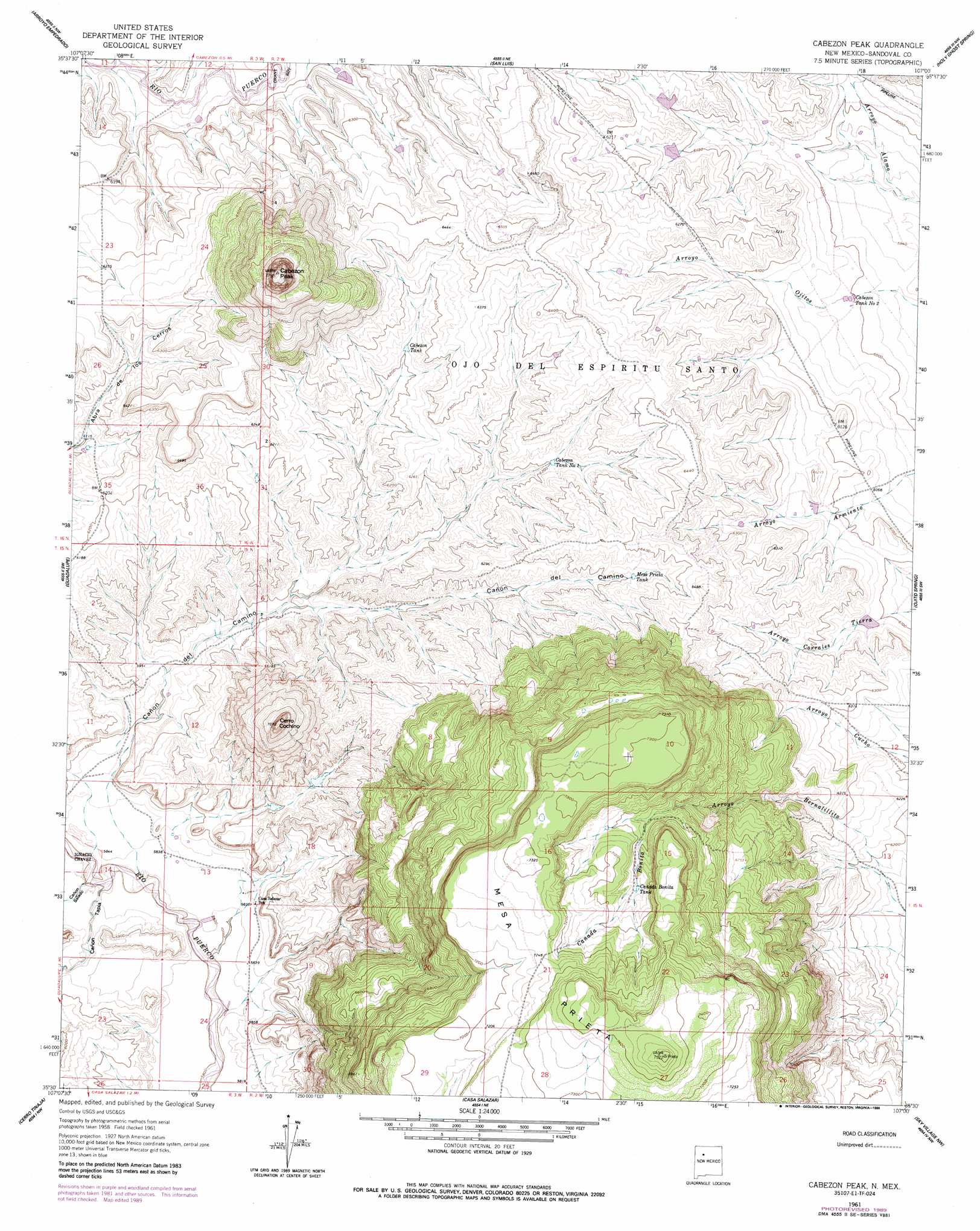
Cabezon Peak Topo Map New Mexico
To zoom in, hover over the map of Cabezon Peak
USGS Topo Quad 35107e1 - 1:24,000 scale
| Topo Map Name: | Cabezon Peak |
| USGS Topo Quad ID: | 35107e1 |
| Print Size: | ca. 21 1/4" wide x 27" high |
| Southeast Coordinates: | 35.5° N latitude / 107° W longitude |
| Map Center Coordinates: | 35.5625° N latitude / 107.0625° W longitude |
| U.S. State: | NM |
| Filename: | o35107e1.jpg |
| Download Map JPG Image: | Cabezon Peak topo map 1:24,000 scale |
| Map Type: | Topographic |
| Topo Series: | 7.5´ |
| Map Scale: | 1:24,000 |
| Source of Map Images: | United States Geological Survey (USGS) |
| Alternate Map Versions: |
Cabezon Peak NM 1961, updated 1963 Download PDF Buy paper map Cabezon Peak NM 1961, updated 1989 Download PDF Buy paper map Cabezon Peak NM 2010 Download PDF Buy paper map Cabezon Peak NM 2013 Download PDF Buy paper map Cabezon Peak NM 2017 Download PDF Buy paper map |
1:24,000 Topo Quads surrounding Cabezon Peak
Tinian |
Wolf Stand |
Headcut Reservoir |
La Ventana |
San Miguel Mountain |
Canada Calladita |
Arroyo Empedrado |
San Luis |
Holy Ghost Spring |
Gilman |
Cerro Parido |
Guadalupe |
Cabezon Peak |
Ojito Spring |
San Ysidro |
Laguna Seca |
Cerro Tinaja |
Casa Salazar |
Sky Village Nw |
Sky Village Ne |
Marquez |
La Gotera |
Puerco Dam |
Sky Village |
Sky Village Se |
> Back to 35107e1 at 1:100,000 scale
> Back to 35106a1 at 1:250,000 scale
> Back to U.S. Topo Maps home
Cabezon Peak topo map: Gazetteer
Cabezon Peak: Parks
Cabezon Wilderness Study Area elevation 2376m 7795′Cabezon Peak: Reservoirs
Cabezon Tank elevation 1897m 6223′Cabezon Tank Number 1 elevation 1892m 6207′
Cabezon Tank Number 2 elevation 1831m 6007′
Cabezon Tank Number 3 elevation 1836m 6023′
Cañada Bonita Tank elevation 2141m 7024′
Mesa Prieta Tank elevation 1929m 6328′
Cabezon Peak: Streams
Canada Bonita elevation 2121m 6958′Cabezon Peak: Summits
Cabezon Peak elevation 2376m 7795′Cerro Cochino elevation 2148m 7047′
Mesa Prieta elevation 2293m 7522′
Cabezon Peak: Valleys
Cañon de Camino elevation 1789m 5869′Cañon Salado elevation 1765m 5790′
Cañon Tapia elevation 1765m 5790′
Cabezon Peak digital topo map on disk
Buy this Cabezon Peak topo map showing relief, roads, GPS coordinates and other geographical features, as a high-resolution digital map file on DVD: