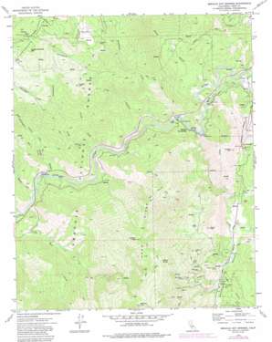
Miracle Hot Springs Topo Map California
To zoom in, hover over the map of Miracle Hot Springs
USGS Topo Quad 35118e5 - 1:24,000 scale
| Topo Map Name: | Miracle Hot Springs |
| USGS Topo Quad ID: | 35118e5 |
| Print Size: | ca. 21 1/4" wide x 27" high |
| Southeast Coordinates: | 35.5° N latitude / 118.5° W longitude |
| Map Center Coordinates: | 35.5625° N latitude / 118.5625° W longitude |
| U.S. State: | CA |
| Filename: | o35118e5.jpg |
| Download Map JPG Image: | Miracle Hot Springs topo map 1:24,000 scale |
| Map Type: | Topographic |
| Topo Series: | 7.5´ |
| Map Scale: | 1:24,000 |
| Source of Map Images: | United States Geological Survey (USGS) |
| Alternate Map Versions: |
Miracle Hot Springs CA 1972, updated 1976 Download PDF Buy paper map Miracle Hot Springs CA 1972, updated 1986 Download PDF Buy paper map Miracle Hot Springs CA 1972, updated 1994 Download PDF Buy paper map Miracle Hot Springs CA 2012 Download PDF Buy paper map Miracle Hot Springs CA 2015 Download PDF Buy paper map |
| FStopo: | US Forest Service topo Miracle Hot Springs is available: Download FStopo PDF Download FStopo TIF |
1:24,000 Topo Quads surrounding Miracle Hot Springs
> Back to 35118e1 at 1:100,000 scale
> Back to 35118a1 at 1:250,000 scale
> Back to U.S. Topo Maps home
Miracle Hot Springs topo map: Gazetteer
Miracle Hot Springs: Flats
Golf Meadow elevation 1103m 3618′Lightners Flat elevation 1784m 5853′
Miracle Hot Springs: Mines
Comet Mine elevation 1515m 4970′Friday Mine elevation 1297m 4255′
Lone Star Mine elevation 1656m 5433′
Mammoth Mine elevation 927m 3041′
Mayflower Mine elevation 1708m 5603′
McKeadney Mine elevation 1364m 4475′
Southern Cross Mine elevation 1032m 3385′
Uncle Sam Mine elevation 1195m 3920′
Miracle Hot Springs: Populated Places
Havilah elevation 956m 3136′Miracle Hot Springs elevation 726m 2381′
Petersburg (historical) elevation 1442m 4730′
Miracle Hot Springs: Ridges
Hobo Ridge elevation 1893m 6210′Miracle Hot Springs: Springs
Delonegha Hot Springs elevation 641m 2103′O'Brien Spring elevation 1706m 5597′
Miracle Hot Springs: Streams
Bradshaw Creek elevation 690m 2263′Clear Creek elevation 688m 2257′
Delonegha Creek elevation 625m 2050′
Freeman Creek elevation 1331m 4366′
Greenhorn Creek elevation 655m 2148′
Little Creek elevation 658m 2158′
Mill Creek elevation 614m 2014′
Sycamore Creek elevation 622m 2040′
Miracle Hot Springs: Summits
Ball Mountain elevation 1247m 4091′Hooper Hill elevation 1354m 4442′
Lightner Peak elevation 1943m 6374′
O'Brien Hill elevation 1391m 4563′
Quartz Mountain elevation 1585m 5200′
Rankin Peak elevation 1298m 4258′
Rough and Ready Mountain elevation 1728m 5669′
White Rock elevation 1063m 3487′
Miracle Hot Springs: Valleys
Bear Canyon elevation 896m 2939′Beaver Canyon elevation 625m 2050′
Black Gulch elevation 699m 2293′
Haight Canyon elevation 940m 3083′
Havilah Canyon elevation 915m 3001′
Jenny Lind Canyon elevation 971m 3185′
Lilly Canyon elevation 690m 2263′
Miracle Hot Springs digital topo map on disk
Buy this Miracle Hot Springs topo map showing relief, roads, GPS coordinates and other geographical features, as a high-resolution digital map file on DVD:
Southern Sierra Nevada, California & Southern Nevada
Buy digital topo maps: Southern Sierra Nevada, California & Southern Nevada


