Osage Topo Map Tennessee
To zoom in, hover over the map of Osage
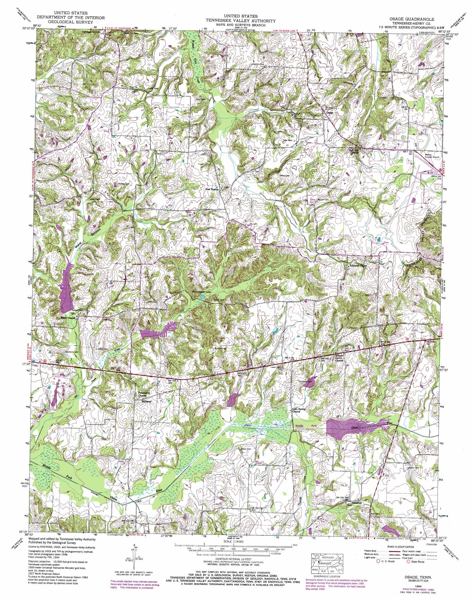
USGS Topo Quad 36088c4 - 1:24,000 scale
| Topo Map Name: | Osage |
| USGS Topo Quad ID: | 36088c4 |
| Print Size: | ca. 21 1/4" wide x 27" high |
| Southeast Coordinates: | 36.25° N latitude / 88.375° W longitude |
| Map Center Coordinates: | 36.3125° N latitude / 88.4375° W longitude |
| U.S. State: | TN |
| Filename: | o36088c4.jpg |
| Download Map JPG Image: | Osage topo map 1:24,000 scale |
| Map Type: | Topographic |
| Topo Series: | 7.5´ |
| Map Scale: | 1:24,000 |
| Source of Map Images: | United States Geological Survey (USGS) |
| Alternate Map Versions: |
Osage TN 1950 Download PDF Buy paper map Osage TN 1950, updated 1974 Download PDF Buy paper map Osage TN 1950, updated 1985 Download PDF Buy paper map Osage TN 2010 Download PDF Buy paper map Osage TN 2013 Download PDF Buy paper map Osage TN 2016 Download PDF Buy paper map |
1:24,000 Topo Quads surrounding Osage
Cuba |
Lynnville |
Lynn Grove |
Murray |
New Concord |
Latham |
Palmersville |
Cottage Grove |
Puryear |
Buchanan |
Dresden |
Como |
Osage |
Paris |
West Sandy Dike |
Pillowville |
Mckenzie |
Henry |
Mansfield |
Manleyville |
Trezevant West |
Trezevant East |
Huntingdon |
Vale |
Bruceton |
> Back to 36088a1 at 1:100,000 scale
> Back to 36088a1 at 1:250,000 scale
> Back to U.S. Topo Maps home
Osage topo map: Gazetteer
Osage: Airports
Henry County Airport elevation 173m 567′Osage: Basins
Ward Bottom elevation 129m 423′Osage: Dams
Flood Water Retarding Dam Number One elevation 126m 413′Middle Fork Obion Dam Five elevation 126m 413′
Middle Fork Obion River Dam Number Four elevation 133m 436′
Middle Fork Obion River Dam Number Six elevation 138m 452′
Middle Fork Obion River Dam Number Three elevation 126m 413′
Middle Fork Obion River Dam Number Two elevation 125m 410′
Osage: Lakes
Briarpatch Lake elevation 129m 423′Osage: Populated Places
Hearndale elevation 125m 410′Midway elevation 151m 495′
New Boston elevation 159m 521′
Osage elevation 177m 580′
Palestine elevation 142m 465′
Osage: Reservoirs
Middle Fork Obion Lake Five elevation 126m 413′Middle Fork Obion River Lake Number Four elevation 133m 436′
Middle Fork Obion River Lake Number Six elevation 138m 452′
Middle Fork Obion River Lake Number Three elevation 126m 413′
Middle Fork Obion River Lake Number Two elevation 125m 410′
Osage: Streams
Trainer Creek elevation 123m 403′Osage digital topo map on disk
Buy this Osage topo map showing relief, roads, GPS coordinates and other geographical features, as a high-resolution digital map file on DVD: