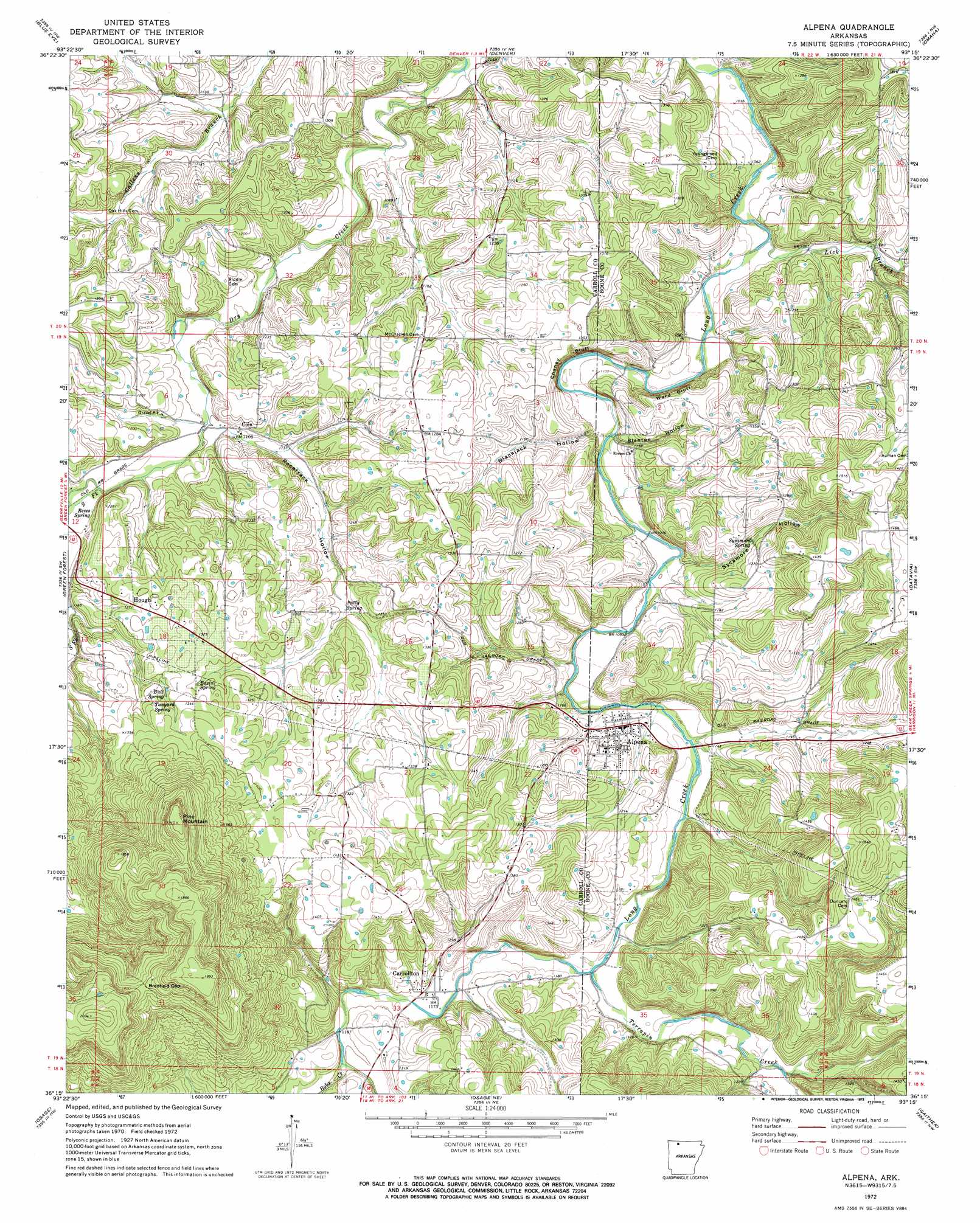
Alpena Topo Map Arkansas
To zoom in, hover over the map of Alpena
USGS Topo Quad 36093c3 - 1:24,000 scale
| Topo Map Name: | Alpena |
| USGS Topo Quad ID: | 36093c3 |
| Print Size: | ca. 21 1/4" wide x 27" high |
| Southeast Coordinates: | 36.25° N latitude / 93.25° W longitude |
| Map Center Coordinates: | 36.3125° N latitude / 93.3125° W longitude |
| U.S. State: | AR |
| Filename: | o36093c3.jpg |
| Download Map JPG Image: | Alpena topo map 1:24,000 scale |
| Map Type: | Topographic |
| Topo Series: | 7.5´ |
| Map Scale: | 1:24,000 |
| Source of Map Images: | United States Geological Survey (USGS) |
| Alternate Map Versions: |
Alpena AR 1972, updated 1973 Download PDF Buy paper map Alpena AR 2011 Download PDF Buy paper map Alpena AR 2014 Download PDF Buy paper map |
1:24,000 Topo Quads surrounding Alpena
Viola |
Lampe |
Table Rock Dam |
Hollister |
Mincy |
Grandview |
Blue Eye |
Denver |
Omaha |
Omaha Ne |
Berryville |
Green Forest |
Alpena |
Batavia |
Bergman |
Marble |
Osage |
Osage Ne |
Gaither |
Harrison |
Kingston |
Osage Sw |
Ponca |
Jasper |
Hasty |
> Back to 36093a1 at 1:100,000 scale
> Back to 36092a1 at 1:250,000 scale
> Back to U.S. Topo Maps home
Alpena topo map: Gazetteer
Alpena: Cliffs
Chaney Bluff elevation 326m 1069′Ward Bluff elevation 382m 1253′
Alpena: Gaps
Bradfield Gap elevation 546m 1791′Alpena: Populated Places
Alpena elevation 344m 1128′Carrollton elevation 358m 1174′
Coin elevation 352m 1154′
Hough elevation 384m 1259′
Nunnally (historical) elevation 390m 1279′
Shaver (historical) elevation 326m 1069′
Alpena: Springs
Basin Spring elevation 392m 1286′Bull Spring elevation 398m 1305′
Patty Spring elevation 358m 1174′
Reves Spring elevation 371m 1217′
Sycamore Spring elevation 360m 1181′
Tanyard Spring elevation 402m 1318′
Alpena: Streams
Bobo Creek elevation 360m 1181′Lick Branch elevation 320m 1049′
South Fork Dry Creek elevation 336m 1102′
Terrapin Creek elevation 345m 1131′
Alpena: Summits
Pine Mountain elevation 547m 1794′Rock Quarry elevation 399m 1309′
Alpena: Valleys
Blackjack Hollow elevation 329m 1079′Blanton Hollow elevation 337m 1105′
Racetrack Hollow elevation 330m 1082′
Sycamore Hollow elevation 339m 1112′
Alpena digital topo map on disk
Buy this Alpena topo map showing relief, roads, GPS coordinates and other geographical features, as a high-resolution digital map file on DVD: