Salina Se Topo Map Oklahoma
To zoom in, hover over the map of Salina Se
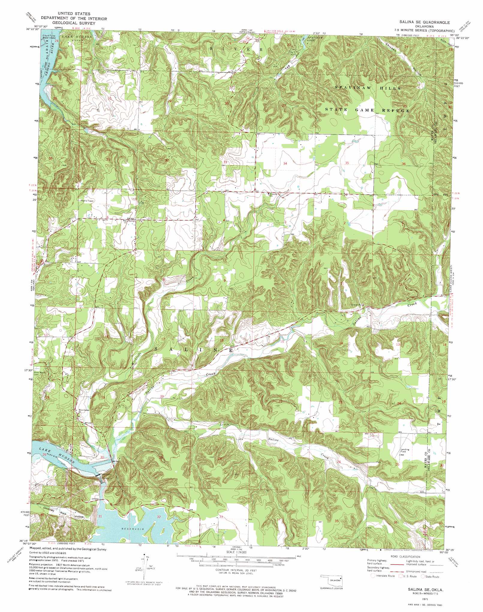
USGS Topo Quad 36095c1 - 1:24,000 scale
| Topo Map Name: | Salina Se |
| USGS Topo Quad ID: | 36095c1 |
| Print Size: | ca. 21 1/4" wide x 27" high |
| Southeast Coordinates: | 36.25° N latitude / 95° W longitude |
| Map Center Coordinates: | 36.3125° N latitude / 95.0625° W longitude |
| U.S. State: | OK |
| Filename: | o36095c1.jpg |
| Download Map JPG Image: | Salina Se topo map 1:24,000 scale |
| Map Type: | Topographic |
| Topo Series: | 7.5´ |
| Map Scale: | 1:24,000 |
| Source of Map Images: | United States Geological Survey (USGS) |
| Alternate Map Versions: |
Salina SE OK 1971, updated 1973 Download PDF Buy paper map Salina SE OK 2010 Download PDF Buy paper map Salina SE OK 2012 Download PDF Buy paper map Salina SE OK 2016 Download PDF Buy paper map |
1:24,000 Topo Quads surrounding Salina Se
White Oak |
Big Cabin |
Ketchum |
Bernice |
Grove |
Adair |
Strang |
Spavinaw |
Chloeta |
Jay |
Pryor |
Salina |
Salina Se |
Lake Eucha West |
Lake Eucha East |
Chouteau |
Locust Grove |
Rose |
Leach |
Kansas |
Rocky Point |
Cedar Crest |
Peggs |
Moodys |
Chewey |
> Back to 36095a1 at 1:100,000 scale
> Back to 36094a1 at 1:250,000 scale
> Back to U.S. Topo Maps home
Salina Se topo map: Gazetteer
Salina Se: Dams
Chimney Rock Dam elevation 267m 875′Salina Se: Populated Places
Hoot Owl elevation 216m 708′Salina Se: Reservoirs
Chimney Rock Reservoir elevation 267m 875′Salina Se: Streams
Little Saline Creek elevation 195m 639′Saline Creek elevation 189m 620′
Wickliffe Creek elevation 189m 620′
Salina Se digital topo map on disk
Buy this Salina Se topo map showing relief, roads, GPS coordinates and other geographical features, as a high-resolution digital map file on DVD: