Sanders Topo Map Oklahoma
To zoom in, hover over the map of Sanders
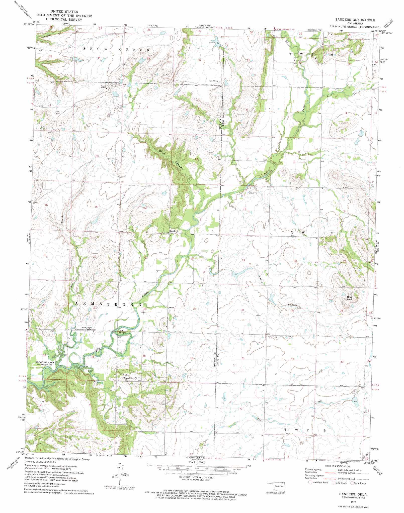
USGS Topo Quad 36095g4 - 1:24,000 scale
| Topo Map Name: | Sanders |
| USGS Topo Quad ID: | 36095g4 |
| Print Size: | ca. 21 1/4" wide x 27" high |
| Southeast Coordinates: | 36.75° N latitude / 95.375° W longitude |
| Map Center Coordinates: | 36.8125° N latitude / 95.4375° W longitude |
| U.S. State: | OK |
| Filename: | o36095g4.jpg |
| Download Map JPG Image: | Sanders topo map 1:24,000 scale |
| Map Type: | Topographic |
| Topo Series: | 7.5´ |
| Map Scale: | 1:24,000 |
| Source of Map Images: | United States Geological Survey (USGS) |
| Alternate Map Versions: |
Sanders OK 1972, updated 1974 Download PDF Buy paper map Sanders OK 2010 Download PDF Buy paper map Sanders OK 2013 Download PDF Buy paper map Sanders OK 2016 Download PDF Buy paper map |
1:24,000 Topo Quads surrounding Sanders
Coffeyville West |
Coffeyville East |
Valeda |
Edna |
Bartlett |
Elliott |
South Coffeyville |
Hayrick Mound |
Hollow |
Welch Nw |
Delaware |
Childers |
Sanders |
Centralia |
Pyramid Corners |
Nowata West |
Nowata East |
Chelsea Nw |
Estella |
Vinita |
Talala |
Winganon |
Chelsea |
White Oak |
Big Cabin |
> Back to 36095e1 at 1:100,000 scale
> Back to 36094a1 at 1:250,000 scale
> Back to U.S. Topo Maps home
Sanders topo map: Gazetteer
Sanders: Populated Places
Sanders elevation 220m 721′Sanders: Streams
Brush Creek elevation 220m 721′Clear Creek elevation 213m 698′
Coal Creek elevation 197m 646′
Looney Branch elevation 207m 679′
Sanders: Summits
Blue Mound elevation 278m 912′Sanders: Valleys
Blue Canyon elevation 207m 679′Sanders digital topo map on disk
Buy this Sanders topo map showing relief, roads, GPS coordinates and other geographical features, as a high-resolution digital map file on DVD: