Valeda Topo Map Kansas
To zoom in, hover over the map of Valeda
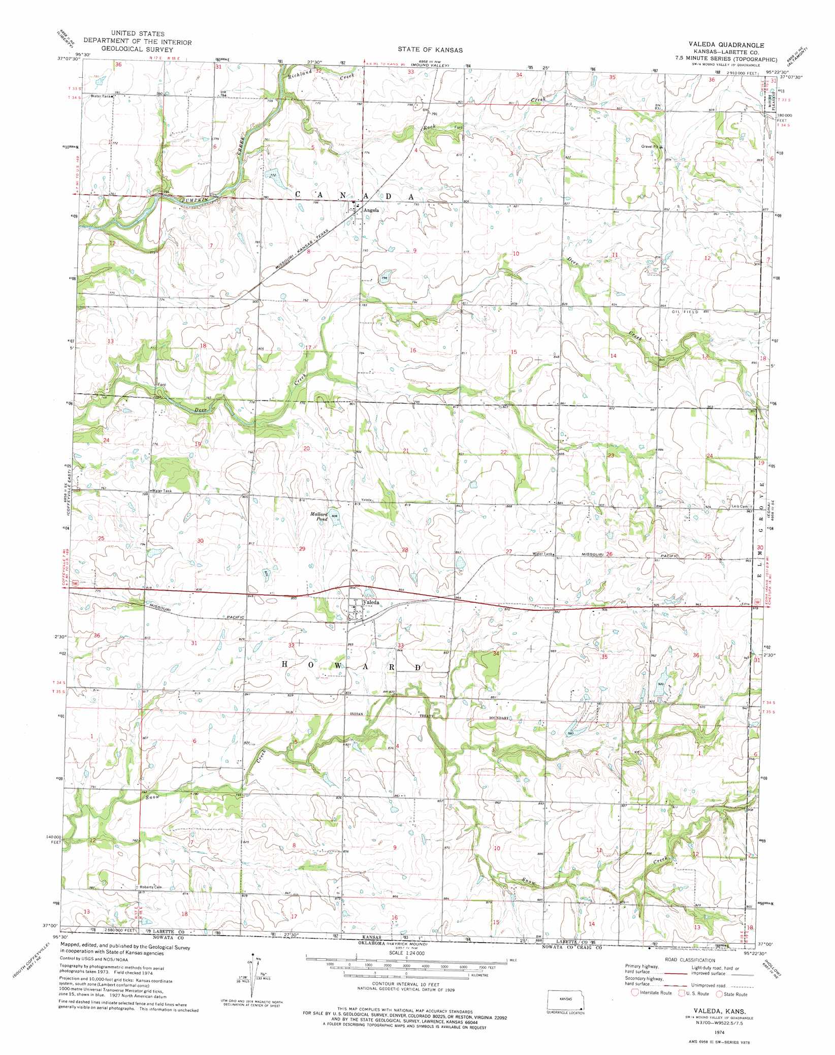
USGS Topo Quad 37095a4 - 1:24,000 scale
| Topo Map Name: | Valeda |
| USGS Topo Quad ID: | 37095a4 |
| Print Size: | ca. 21 1/4" wide x 27" high |
| Southeast Coordinates: | 37° N latitude / 95.375° W longitude |
| Map Center Coordinates: | 37.0625° N latitude / 95.4375° W longitude |
| U.S. State: | KS |
| Filename: | o37095a4.jpg |
| Download Map JPG Image: | Valeda topo map 1:24,000 scale |
| Map Type: | Topographic |
| Topo Series: | 7.5´ |
| Map Scale: | 1:24,000 |
| Source of Map Images: | United States Geological Survey (USGS) |
| Alternate Map Versions: |
Valeda KS 1974, updated 1976 Download PDF Buy paper map Valeda KS 2009 Download PDF Buy paper map Valeda KS 2012 Download PDF Buy paper map Valeda KS 2015 Download PDF Buy paper map |
1:24,000 Topo Quads surrounding Valeda
Sycamore |
Cherryvale |
Dennis |
Parsons West |
Parsons East |
Independence |
Liberty |
Mound Valley |
Altamont |
Labette |
Coffeyville West |
Coffeyville East |
Valeda |
Edna |
Bartlett |
Elliott |
South Coffeyville |
Hayrick Mound |
Hollow |
Welch Nw |
Delaware |
Childers |
Sanders |
Centralia |
Pyramid Corners |
> Back to 37095a1 at 1:100,000 scale
> Back to 37094a1 at 1:250,000 scale
> Back to U.S. Topo Maps home
Valeda topo map: Gazetteer
Valeda: Dams
Edna City Dam elevation 281m 921′Valeda: Lakes
Mallard Pond elevation 245m 803′Valeda: Populated Places
Angola elevation 240m 787′Valeda elevation 260m 853′
Valeda: Streams
Richland Creek elevation 225m 738′Rock Creek elevation 225m 738′
Valeda digital topo map on disk
Buy this Valeda topo map showing relief, roads, GPS coordinates and other geographical features, as a high-resolution digital map file on DVD: