Newkirk Sw Topo Map Oklahoma
To zoom in, hover over the map of Newkirk Sw
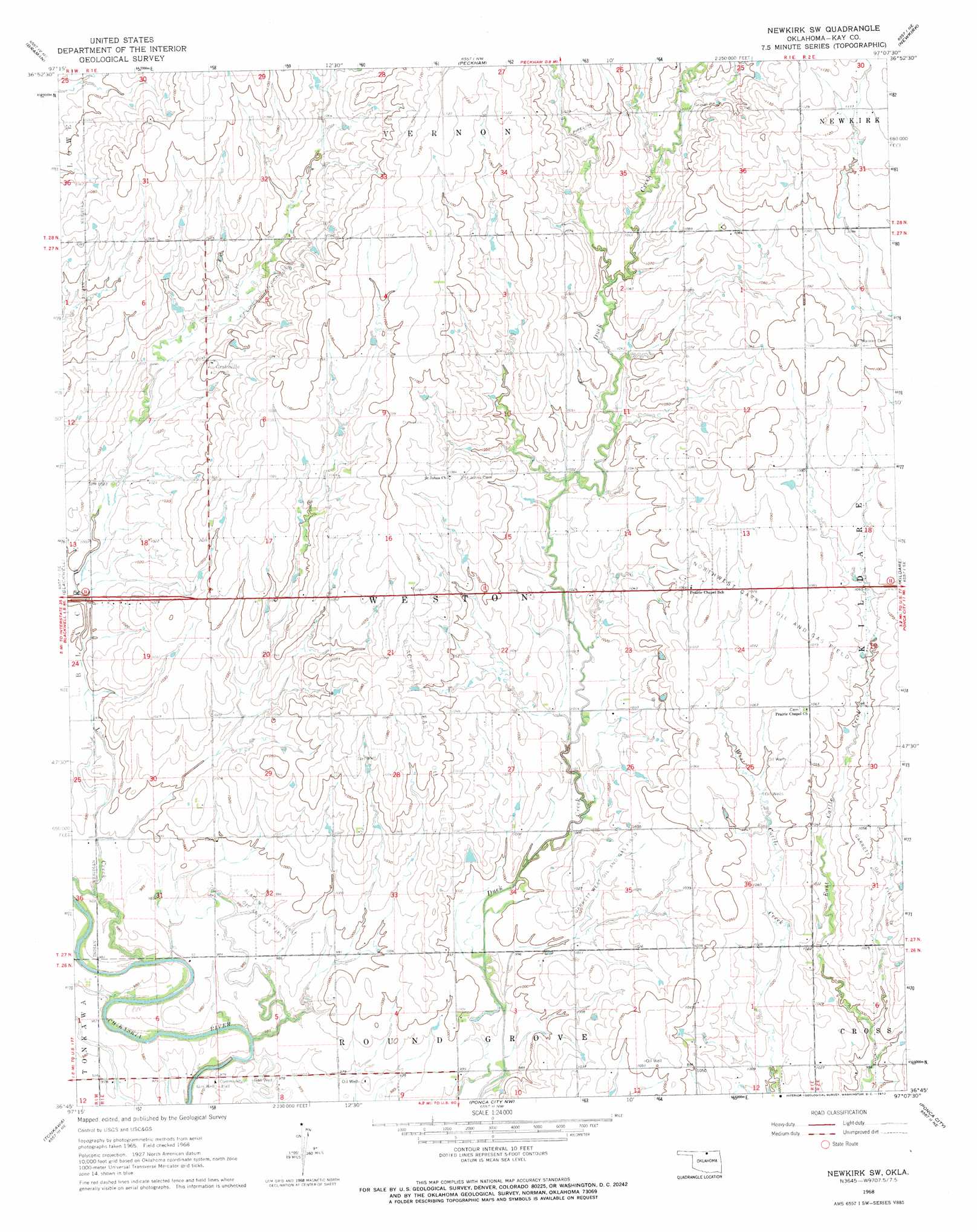
USGS Topo Quad 36097g2 - 1:24,000 scale
| Topo Map Name: | Newkirk Sw |
| USGS Topo Quad ID: | 36097g2 |
| Print Size: | ca. 21 1/4" wide x 27" high |
| Southeast Coordinates: | 36.75° N latitude / 97.125° W longitude |
| Map Center Coordinates: | 36.8125° N latitude / 97.1875° W longitude |
| U.S. State: | OK |
| Filename: | o36097g2.jpg |
| Download Map JPG Image: | Newkirk Sw topo map 1:24,000 scale |
| Map Type: | Topographic |
| Topo Series: | 7.5´ |
| Map Scale: | 1:24,000 |
| Source of Map Images: | United States Geological Survey (USGS) |
| Alternate Map Versions: |
Newkirk SW OK 1968, updated 1970 Download PDF Buy paper map Newkirk SW OK 2009 Download PDF Buy paper map Newkirk SW OK 2012 Download PDF Buy paper map Newkirk SW OK 2016 Download PDF Buy paper map |
1:24,000 Topo Quads surrounding Newkirk Sw
South Haven |
Portland |
Geuda Springs |
Arkansas City |
Silverdale |
Blackwell Nw |
Braman |
Peckham |
Newkirk |
Kaw City Nw |
Nardin |
Blackwell |
Newkirk Sw |
Kildare |
Uncas |
Eddy |
Tonkawa |
Ponca City Nw |
Ponca City |
Charley Creek East |
Billings |
Tonkawa Se |
Marland |
Ponca City Se |
Prettyhair Creek |
> Back to 36097e1 at 1:100,000 scale
> Back to 36096a1 at 1:250,000 scale
> Back to U.S. Topo Maps home
Newkirk Sw topo map: Gazetteer
Newkirk Sw: Dams
Lost Duck Creeks Site D-1 Dam elevation 311m 1020′Newkirk Sw: Oilfields
Blackwell East Oil Field elevation 328m 1076′Blackwell Southeast Oil and Gas Field elevation 302m 990′
Garrett Oil Field elevation 319m 1046′
Garrett West Oil and Gas Field elevation 311m 1020′
Northwest Garrett Oil and Gas Field elevation 329m 1079′
Newkirk Sw: Populated Places
Grainville elevation 321m 1053′Newkirk Sw: Reservoirs
Lost Duck Creeks Site D-1 Reservoir elevation 311m 1020′Newkirk Sw: Streams
Lost Creek elevation 296m 971′Newkirk Sw digital topo map on disk
Buy this Newkirk Sw topo map showing relief, roads, GPS coordinates and other geographical features, as a high-resolution digital map file on DVD: