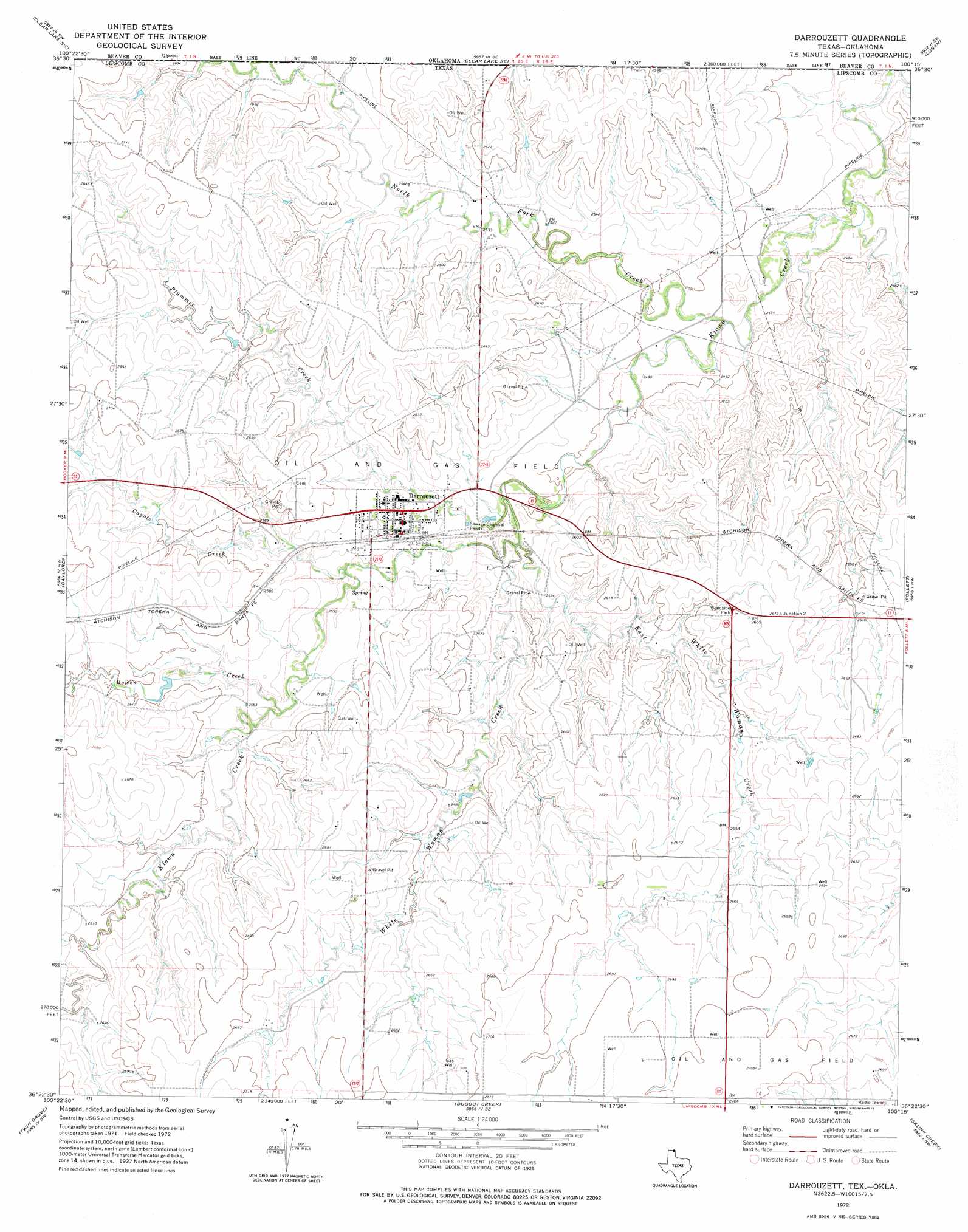
Darrouzett Topo Map Texas
To zoom in, hover over the map of Darrouzett
USGS Topo Quad 36100d3 - 1:24,000 scale
| Topo Map Name: | Darrouzett |
| USGS Topo Quad ID: | 36100d3 |
| Print Size: | ca. 21 1/4" wide x 27" high |
| Southeast Coordinates: | 36.375° N latitude / 100.25° W longitude |
| Map Center Coordinates: | 36.4375° N latitude / 100.3125° W longitude |
| U.S. States: | TX, OK |
| Filename: | o36100d3.jpg |
| Download Map JPG Image: | Darrouzett topo map 1:24,000 scale |
| Map Type: | Topographic |
| Topo Series: | 7.5´ |
| Map Scale: | 1:24,000 |
| Source of Map Images: | United States Geological Survey (USGS) |
| Alternate Map Versions: |
Darrouzett TX 1972, updated 1975 Download PDF Buy paper map Darrouzett TX 2010 Download PDF Buy paper map Darrouzett TX 2012 Download PDF Buy paper map Darrouzett TX 2016 Download PDF Buy paper map |
1:24,000 Topo Quads surrounding Darrouzett
Balko Ne |
Clear Lake Nw |
Clear Lake |
Logan Nw |
Logan Ne |
Elmwood |
Clear Lake Sw |
Clear Lake Se |
Logan |
Slapout |
Booker |
Gaylord |
Darrouzett |
Follett |
Magoun |
Booker Se |
Twin Grove |
Dugout Creek |
Skunk Creek |
Follett Se |
Lake Fryer Ne |
Barton Corners |
Lipscomb |
Willow Creek |
Higgins North |
> Back to 36100a1 at 1:100,000 scale
> Back to 36100a1 at 1:250,000 scale
> Back to U.S. Topo Maps home
Darrouzett topo map: Gazetteer
Darrouzett: Airports
Duke Ranch Airport elevation 819m 2687′Darrouzett: Populated Places
Darrouzett elevation 779m 2555′Darrouzett: Streams
Bowen Creek elevation 773m 2536′Coyote Creek elevation 766m 2513′
East White Woman Creek elevation 765m 2509′
North Fork Creek elevation 749m 2457′
North Fork Kiowa Creek elevation 751m 2463′
North Fork Kiowa Creek elevation 751m 2463′
Plummer Creek elevation 762m 2500′
White Woman Creek elevation 762m 2500′
Darrouzett digital topo map on disk
Buy this Darrouzett topo map showing relief, roads, GPS coordinates and other geographical features, as a high-resolution digital map file on DVD: