Sedan Topo Map New Mexico
To zoom in, hover over the map of Sedan
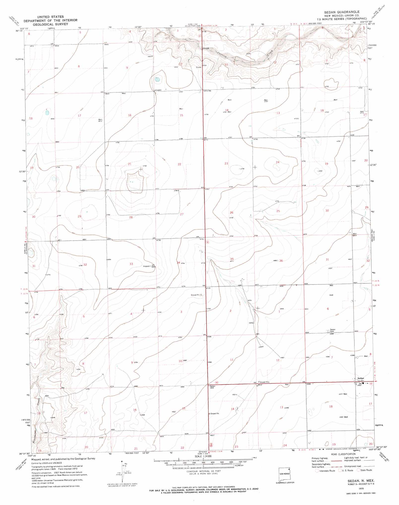
USGS Topo Quad 36103b2 - 1:24,000 scale
| Topo Map Name: | Sedan |
| USGS Topo Quad ID: | 36103b2 |
| Print Size: | ca. 21 1/4" wide x 27" high |
| Southeast Coordinates: | 36.125° N latitude / 103.125° W longitude |
| Map Center Coordinates: | 36.1875° N latitude / 103.1875° W longitude |
| U.S. State: | NM |
| Filename: | o36103b2.jpg |
| Download Map JPG Image: | Sedan topo map 1:24,000 scale |
| Map Type: | Topographic |
| Topo Series: | 7.5´ |
| Map Scale: | 1:24,000 |
| Source of Map Images: | United States Geological Survey (USGS) |
| Alternate Map Versions: |
Sedan NM 1970, updated 1973 Download PDF Buy paper map Sedan NM 2010 Download PDF Buy paper map Sedan NM 2013 Download PDF Buy paper map Sedan NM 2017 Download PDF Buy paper map |
1:24,000 Topo Quads surrounding Sedan
Black Canyon |
Royce |
Clayton |
Texline North |
Corlena Nw |
Tate School |
Sand Hill |
Clayton Sw |
Texline South |
Corlena |
Car Top Butte |
Clapham |
Sedan |
Sedan Ne |
Windy Hill Nw |
Pedernal Creek |
Skull Mesa |
Stead |
Sedan Se |
Windy Hill |
Cottonwood Springs |
Hayden |
Amistad |
Koger Ranch |
Beck Ranch |
> Back to 36103a1 at 1:100,000 scale
> Back to 36102a1 at 1:250,000 scale
> Back to U.S. Topo Maps home
Sedan topo map: Gazetteer
Sedan: Populated Places
Sedan elevation 1399m 4589′Sedan: Post Offices
Sedan Post Office elevation 1399m 4589′Sedan digital topo map on disk
Buy this Sedan topo map showing relief, roads, GPS coordinates and other geographical features, as a high-resolution digital map file on DVD: