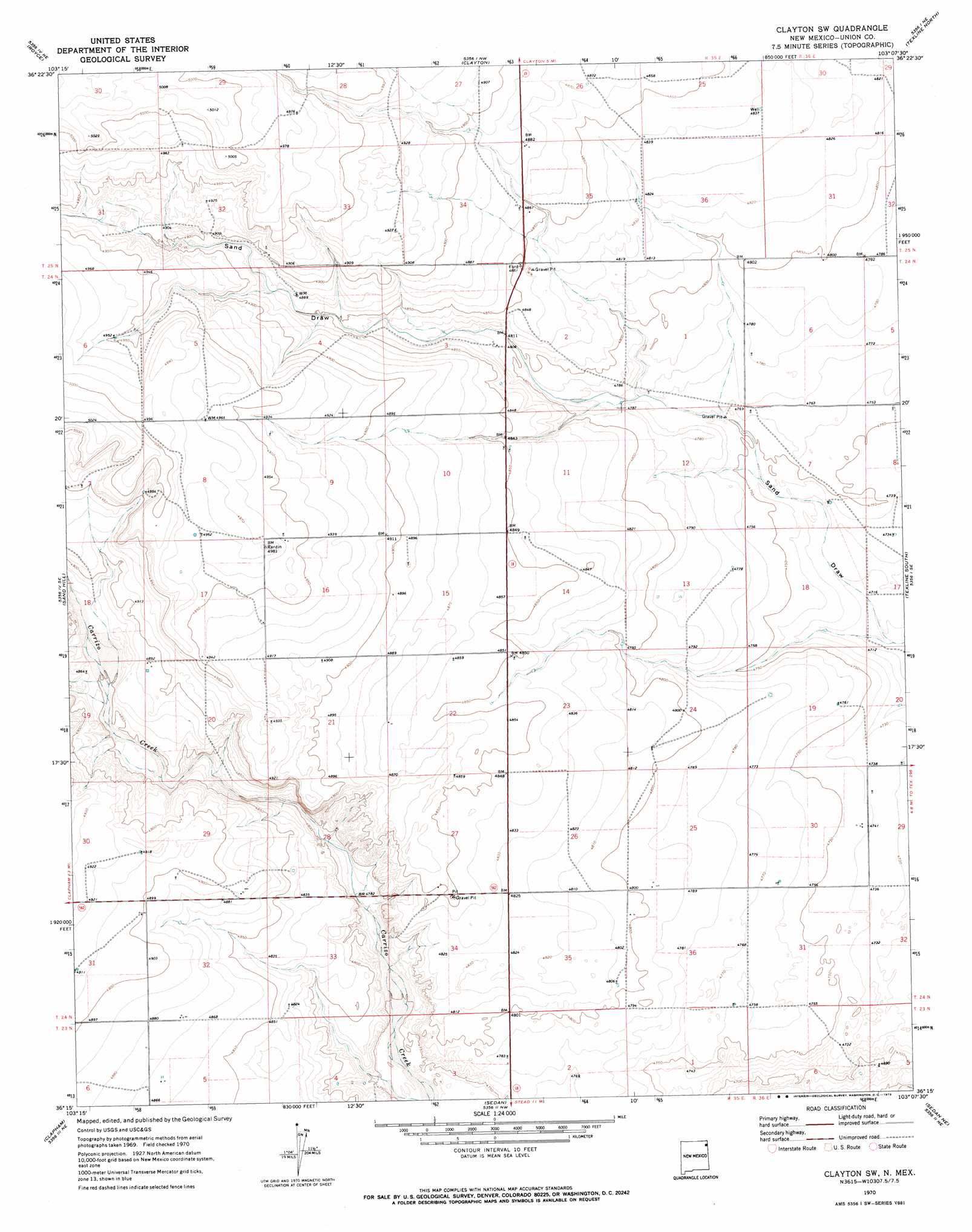
Clayton Sw Topo Map New Mexico
To zoom in, hover over the map of Clayton Sw
USGS Topo Quad 36103c2 - 1:24,000 scale
| Topo Map Name: | Clayton Sw |
| USGS Topo Quad ID: | 36103c2 |
| Print Size: | ca. 21 1/4" wide x 27" high |
| Southeast Coordinates: | 36.25° N latitude / 103.125° W longitude |
| Map Center Coordinates: | 36.3125° N latitude / 103.1875° W longitude |
| U.S. State: | NM |
| Filename: | o36103c2.jpg |
| Download Map JPG Image: | Clayton Sw topo map 1:24,000 scale |
| Map Type: | Topographic |
| Topo Series: | 7.5´ |
| Map Scale: | 1:24,000 |
| Source of Map Images: | United States Geological Survey (USGS) |
| Alternate Map Versions: |
Clayton SW NM 1970, updated 1973 Download PDF Buy paper map Clayton SW NM 1998, updated 2001 Download PDF Buy paper map Clayton SW NM 2011 Download PDF Buy paper map Clayton SW NM 2013 Download PDF Buy paper map Clayton SW NM 2017 Download PDF Buy paper map |
| FStopo: | US Forest Service topo Clayton SW is available: Download FStopo PDF Download FStopo TIF |
1:24,000 Topo Quads surrounding Clayton Sw
Mount Dora |
Bible Top Butte |
Rabbit Ear Mountain |
Rardin Hill |
Felt Sw |
Black Canyon |
Royce |
Clayton |
Texline North |
Corlena Nw |
Tate School |
Sand Hill |
Clayton Sw |
Texline South |
Corlena |
Car Top Butte |
Clapham |
Sedan |
Sedan Ne |
Windy Hill Nw |
Pedernal Creek |
Skull Mesa |
Stead |
Sedan Se |
Windy Hill |
> Back to 36103a1 at 1:100,000 scale
> Back to 36102a1 at 1:250,000 scale
> Back to U.S. Topo Maps home
Clayton Sw topo map: Gazetteer
Clayton Sw: Mines
Atkinson Cattle Pit elevation 1480m 4855′Clayton Sw: Populated Places
Bates elevation 1485m 4872′Clayton Sw digital topo map on disk
Buy this Clayton Sw topo map showing relief, roads, GPS coordinates and other geographical features, as a high-resolution digital map file on DVD: