Capulin Topo Map New Mexico
To zoom in, hover over the map of Capulin
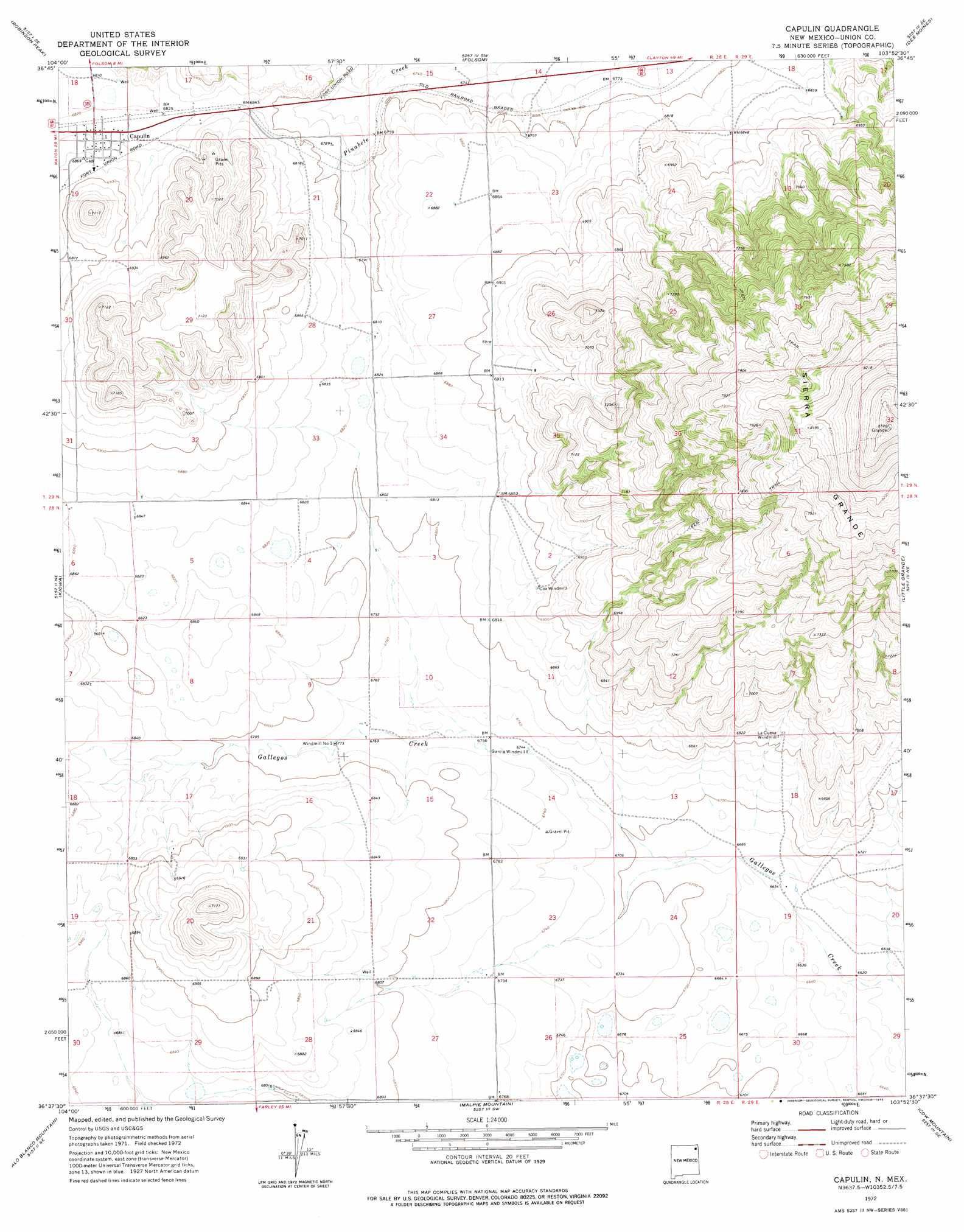
USGS Topo Quad 36103f8 - 1:24,000 scale
| Topo Map Name: | Capulin |
| USGS Topo Quad ID: | 36103f8 |
| Print Size: | ca. 21 1/4" wide x 27" high |
| Southeast Coordinates: | 36.625° N latitude / 103.875° W longitude |
| Map Center Coordinates: | 36.6875° N latitude / 103.9375° W longitude |
| U.S. State: | NM |
| Filename: | o36103f8.jpg |
| Download Map JPG Image: | Capulin topo map 1:24,000 scale |
| Map Type: | Topographic |
| Topo Series: | 7.5´ |
| Map Scale: | 1:24,000 |
| Source of Map Images: | United States Geological Survey (USGS) |
| Alternate Map Versions: |
Capulin NM 1972, updated 1975 Download PDF Buy paper map Capulin NM 2010 Download PDF Buy paper map Capulin NM 2013 Download PDF Buy paper map Capulin NM 2017 Download PDF Buy paper map |
1:24,000 Topo Quads surrounding Capulin
Dale Mountain |
Trinchera Pass |
Alps Mesa |
Emery Peak |
Cross L Ranch |
Johnson Park |
Robinson Peak |
Folsom |
Des Moines |
Cross L Ranch Sw |
Mesa Larga |
Kiowa |
Capulin |
Little Grande |
Wetherly Lake |
Pine Buttes |
Palo Blanco Mountain |
Malpie Mountain |
Cow Mountain |
Grenville Sw |
Point Of Rocks Mesa |
Lawrence Arroyo |
Gladstone Nw |
Sofia |
Tripod Mountain |
> Back to 36103e1 at 1:100,000 scale
> Back to 36102a1 at 1:250,000 scale
> Back to U.S. Topo Maps home
Capulin topo map: Gazetteer
Capulin: Parks
Goodnight-Loving Trail Historical Marker elevation 2086m 6843′Sierra Grande Historical Marker elevation 2655m 8710′
Capulin: Populated Places
Capulin elevation 2086m 6843′Capulin: Summits
Sierra Grande elevation 2655m 8710′Capulin digital topo map on disk
Buy this Capulin topo map showing relief, roads, GPS coordinates and other geographical features, as a high-resolution digital map file on DVD: