Thompson Mesa Topo Map New Mexico
To zoom in, hover over the map of Thompson Mesa
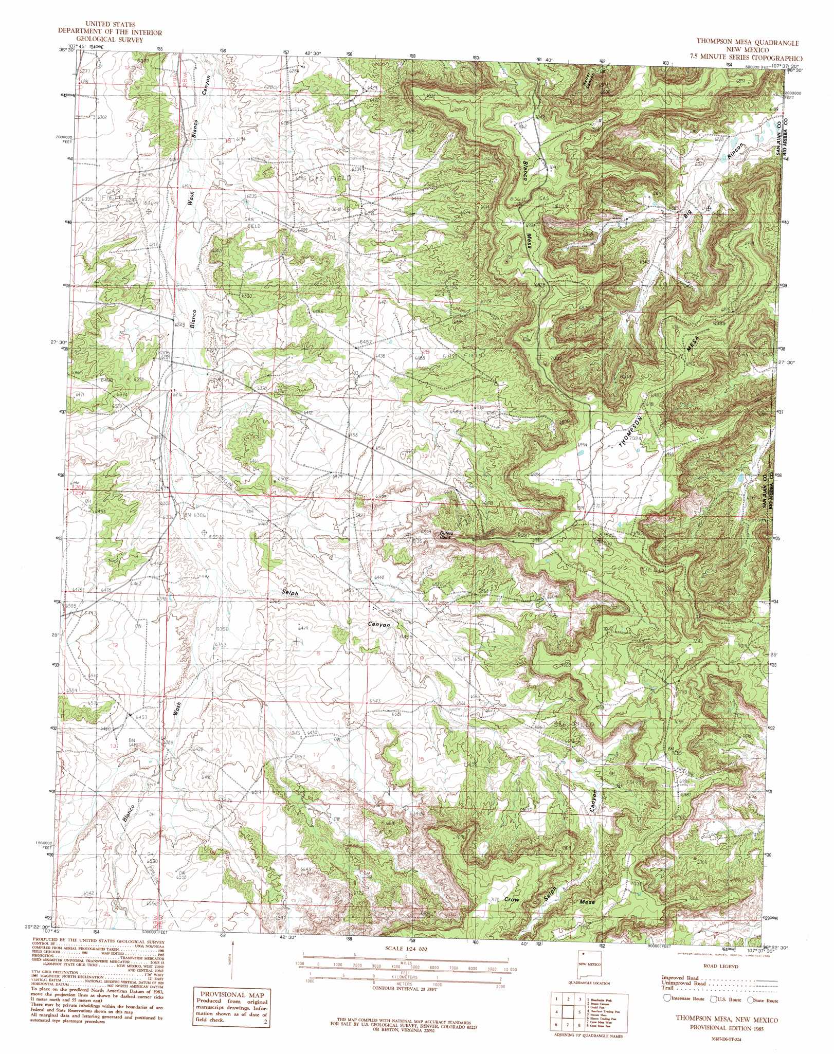
USGS Topo Quad 36107d6 - 1:24,000 scale
| Topo Map Name: | Thompson Mesa |
| USGS Topo Quad ID: | 36107d6 |
| Print Size: | ca. 21 1/4" wide x 27" high |
| Southeast Coordinates: | 36.375° N latitude / 107.625° W longitude |
| Map Center Coordinates: | 36.4375° N latitude / 107.6875° W longitude |
| U.S. State: | NM |
| Filename: | o36107d6.jpg |
| Download Map JPG Image: | Thompson Mesa topo map 1:24,000 scale |
| Map Type: | Topographic |
| Topo Series: | 7.5´ |
| Map Scale: | 1:24,000 |
| Source of Map Images: | United States Geological Survey (USGS) |
| Alternate Map Versions: |
Thompson Mesa NM 1985, updated 1985 Download PDF Buy paper map Thompson Mesa NM 2010 Download PDF Buy paper map Thompson Mesa NM 2013 Download PDF Buy paper map Thompson Mesa NM 2017 Download PDF Buy paper map |
1:24,000 Topo Quads surrounding Thompson Mesa
Bloomfield |
Blanco |
Cutter Canyon |
Delgadito Mesa |
Fourmile Canyon |
East Fork Kutz Canyon |
Huerfanito Peak |
Fresno Canyon |
Gould Pass |
Santos Peak |
Huerfano Trading Post Nw |
Huerfano Trading Post |
Thompson Mesa |
Smouse Mesa |
Gonzales Mesa |
Huerfano Trading Post Sw |
Blanco Trading Post |
Crow Mesa West |
Crow Mesa East |
Tafoya Canyon |
Pueblo Bonito Nw |
Kimbeto |
Lybrook Nw |
Lybrook |
Counselor |
> Back to 36107a1 at 1:100,000 scale
> Back to 36106a1 at 1:250,000 scale
> Back to U.S. Topo Maps home
Thompson Mesa topo map: Gazetteer
Thompson Mesa: Cliffs
Dufers Point elevation 2100m 6889′Thompson Mesa: Summits
Dufers Point elevation 1988m 6522′Thompson Mesa elevation 2113m 6932′
Thompson Mesa: Valleys
Selph Canyon elevation 1932m 6338′Thompson Mesa: Wells
Hodges Number 4 Water Well elevation 2093m 6866′Thompson Mesa digital topo map on disk
Buy this Thompson Mesa topo map showing relief, roads, GPS coordinates and other geographical features, as a high-resolution digital map file on DVD: